|
|

|

|

|
COMAL SPRINGS
"Boating and fishing on Lake in Landa Park, in the heart of New Braunfels, Texas, where Nature did its masterpiece of beauty."
— Author Unknown
— Author Unknown

2013: The First Time In Decades, Comal Springs Is Dry
2023 Critical Management Systems (CMS) keeping Comal Springs flowing
Texas Public Radio | By Eileen Pace
September 3, 2013
Hear the recording.
The Comal Springs feed the Comal River, and people usually come to see and take pictures of the springs that bubble up at the edge of Landa Park just below Panther Canyon in New Braunfels, but New Braunfels Utilities spokeswoman Gretchen Reuwer said that spring is no longer visible.
"This is one of those visual impacts of the drought," Reuwer said.
The springs have not dried up to this extent for many years, at least since the mid-80s, and before that not since the 1950s.
Ruewer said there are hundreds of springs feeding the river and Landa Park Lake, but the dry springs at the head of the river signal a need for serious cutbacks, not just by the local area, but by the whole region.
"This isn’t all about New Braunfels or San Marcos or Seguin or Cibolo or San Antonio," Reuwer said. "This is about the entire region, and obviously we’re in a drought situation that has continued and there’s no guarantee that it won’t continue into the first of the year."
The City of New Braunfels has been on Stage 3 watering restrictions for about three weeks, meaning watering with a sprinkler only, one day every two weeks, and with a hand-held hose any day except between the hours of 10:00 AM to 8:00 PM.
Reuwer said whatever rain occurs over the next few months will impact the level of drought management plans that will be implemented for the next year.
Comal Springs and Landa Park
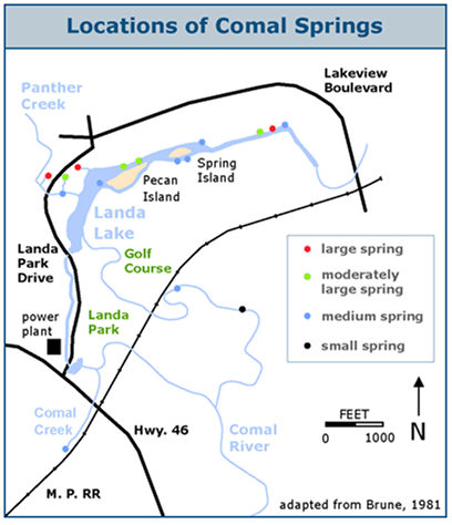
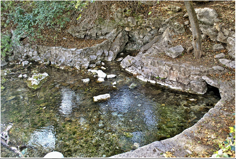
The Comal Springs are the largest in Texas and the American southwest. Seven major springs and dozens of smaller ones occur over a distance of about 4,300 feet at the base of a steep limestone bluff in New Braunfels' Landa Park. The Springs and the Comal River below are home for a federally endangered species, the Fountain Darter. In Spanish, comal is a flat griddle used for cooking tortillas, so the name probably refers to the flat area below the bluff where the springs issue forth. The largest and most easily visited is the one shown at left, just west of Landa Park drive.
These springs were a favorite camping place for native Indian tribes for thousands of years, and many artifacts and burial mounds have been found. In the language of the Indians the Comal Springs were called Conaqueyadesta, which means "where the river has its source" (Ximenes, 1963). The Comal River arises entirely, except after major rains, from springs in this vicinity and flows for just over two miles through Landa Park and New Braunfels before confluencing with the Guadalupe River. It is said to be the shortest river in the United States.
When Spanish missionaries arrived in 1691, they found a huge concentration of Indians at Comal Springs, some from as far away as New Mexico (Brune, 1981). In 1716, Juan Espinoza encountered the beauty of the springs and more than a few ticks:
Soon we reached the passage of the Guadalupe which is made of gravel and is very wide. Groves of inexpressible beauty are found in this vicinity. We stopped at the other bank of the river in a little clearing surrounded by trees, and contiguous to said river. The waters of the Guadalupe are clear, crystal and so abundant that it seemed almost incredible to us that its source arose so near. Composing this river are three principal springs of water which, together with other smaller ones, unite as soon as they begin to flow. There the growth of the walnut trees competes with the poplars. All are crowned by the wild grapevines, which climb up their trunks. Willow trees beautified the region of this river with their luxuriant foliage and there was a great variety of plants. It makes a delightful grove for recreation, and the enjoyment of the melodious songs of different birds. Ticks molested us, attaching themselves to our skin (Tous, 1930).
The "three principal springs" described by Espinoza were probably the two large and one moderately large spring on the west end of Landa Lake. The Spanish never established a permanent presence here, although it was the location of an early Spanish mission, Nuestra Señora de Guadalupe, from 1756 to 1758. In 1827 the league containing the headwaters and Springs was granted to Juan Martín de Veramendi, Mexican Governor of Coahuila and Texas.
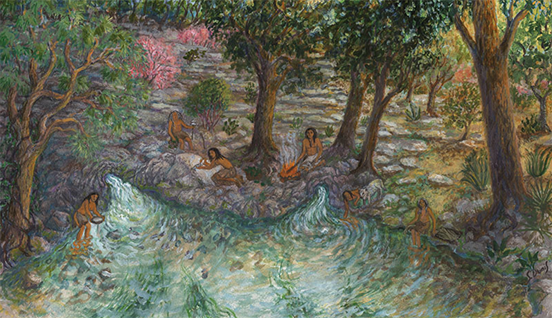
In 2014, artist Susan Dunis created a series of paintings for these pages that depict a family of Lower Pecos natives on a sacred pilgrimage to the Edwards springs sites about 4,000 years ago. Each painting illustrates a different aspect of cultural importance of the Edwards springs.
In this painting, the third in the series, the theme is the use of the springs for everyday activity - cooking dinner. The site is still largely recognizable today, and the rock being used for cleaning a fish is still there, with traces of animal residue from thousands of cooking events still visible.
See the other paintings in the series on these pages:
Barton Springs, San Marcos, Springs, San Antonio Springs, San Pedro Springs
EARLY USES AND DEVELOPMENT OF LANDA PARK
In 1844, German settlers arriving in Texas under the auspices of an emigration society, the Adelsverein, discovered they had been grievously deceived regarding the suitability and ownership of a tract in the Hill Country intended for their settlement. In San Antonio, society organizer Prince Carl Solms was told by John Rahm, an old Texan, about "Las Fontanas" - a place where huge natural springs formed the headwaters of a perpetually flowing river. With his first immigrants living in deadly conditions at the coast, and with waves of thousands more expected, Solms was desperate to establish an inland way station. Dan Murchison, a scout belonging to Captain Jack Hays famous company of Texas Rangers, piloted him to Las Fontanas. In March of 1845 he purchased the site from Veramendi's heirs for $1,111 (Harby, 1888). In 1847 William H. Merriweather bought the Comal Springs tract. Merriweather built a saw and grist mill and a cotton gin on the property. His slaves dug a millrace to divert water for power. The Springs were dynamited to increase their discharge and eventually harnessed for many commercial purposes.
THE SPRINGS AND PARK TODAY
Today, Landa Park is still a mecca for local residents and tourists. Attractions include nature trails, paddle boats, a large spring-fed swimming pool, a miniature train, a golf course, and lots of sites for picnicking and celebrations. Swimming is no longer allowed in a large portion of Landa Lake because of the presence of the endangered species. Fountain darters can be easily observed at the paddle-boat landing. Landa Lake is very shallow and lined with gravel washed in by floods from upstream Blieders Creek. Many small springs issue forth through the gravel, their locations marked by bubbles and schools of fish that congregate around them. When habitat restoration efforts were undertaken in 2013 that involved removing this accumulated gravel and sediments, more than 450 springs were identified. The freshwater zone is very narrow here and the "bad water" line is less than a mile from Comal Springs.
Flows at Comal Springs become intermittent when the level of the J-17 index well drops below 620 feet. Almost all flow at Comal ceases at an elevation of 618 feet. It is often said that Comal Springs went dry during the drought of record in the 1950s, but gage records reveal that was not really the case. The Springs were almost dry from June to November of 1956 and the river was reduced to isolated pools of water. The minimum springflow recorded during that period was 41 gallons per second. In any case, flows were not enough to support the Comal River population of the fountain darter - it was completely eliminated by the drought and was reintroduced using individuals from another population in San Marcos, where springflow was still sufficient to support the species. Models suggest that in a repeat of the 1950's drought, given current levels of pumping, Comal Springs would be dry for a number of years.
Only a small portion of total springflow comes from the largest springs shown in the graphic above. Special springflow measurements made by the U.S. Fish and Wildlife Service and the U.S. Geological Survey determined that most of the spring flows (about 78%) come from the many small springs and seeps under and around the shores of Landa Lake (McKinney and Sharp, 1995). Most of the water that becomes Comal springflow originates with recharge far to the west of the Springs and moves through major flow zones in Medina and Bexar counties on its way toward New Braunfels (see Flowpath Map). In five ground-water trace tests performed by Ogden, Quick, and Rothermel (1986) around Comal Springs, none of the dye appeared at any of the spring orifices. This supported earlier hypotheses that very little recent, locally derived recharge waters emerge from Comal Springs.
Data from dye-tracer studies also suggests there are some separate flowpaths that feed the individual spring orifices. Ogden, Quick, and Rothermel (1986) discussed their conversation with a scientist (Rettman) who injected dye into a well in Panther Creek about 500 feet from the nearest spring orifice. The dye emerged from one orifice but not another nearby. The trace was repeated and the results were the same. In March 2002 these results were duplicated by scientists from the Edwards Aquifer Authority, who injected green dye in the shallow well in Panther Creek. In less than three hours the dye started showing up in surprisingly strong concentrations in one spring, while no dye was seen in another spring only 10 feet away.
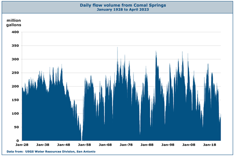
Official flow records for Comal Springs begin in 1928 and have been uninterrupted since then, giving Comal the longest period of record for any of the Edwards springs. The data is from USGS gage 08168710, which applies a calculation that attempts to separate flow that can be attributed to local stormwater runoff at gage 08169000 on the Comal River. Once runoff is removed, the rest is attributed to springflow. For the latest Comal springflows see the USGS Real-Time data page.
By the spring of 2013, New Braunfels had begun implementing a number of management and restoration efforts listed in the newly approved Habitat Conservation Plan to protect the endangered species in the Springs and the Comal River. An island was removed in the Comal River to increase fountain darter habitat, and other measures in the plan include flow management, restoring and maintaining native aquatic vegetation, managing public recreational use, and controlling harmful non-native species such as Asian gill parasites (see the New Braunfels section of the HCP). Over 75,000 snails were removed, along with 2,300 pounds of non-natives such as nutria and talapia, erosion control mats were installed, and more than 10,000 aquatic plants were planted. There were plans to consider a ban on certain types of non-native live bait and develop an education program for fishermen regarding what types of bait are appropriate in such a sensitive area.
By June of 2016 a second phase of improvement and restoration efforts had begun under the Habitat Conservation Plan to protect habitat for four endangered species Comal Springs. New retaining walls, re-contouring, and native plantings will restore about 1,000 linear feet of steep and eroding bank alongside the first hole of the Landa Park Golf Course. This will minimize erosion from that slope and protect the instream habitat for fountain darters, the Comal Springs riffle beetle, the Comal Springs dryopid beetle, and a small crustacean known as Peck's cave amphipod. The project cost is $870,000.
In August of 2016 New Braunfels Utilities broke ground on Phase One of their project to transform the Klingemann wastewater station into a site that will highlight the hydrological, environmental, and cultural history of the region and become a living demonstration of sustainable practices. Radio New Braunfels reported that landscape design of the property will include restoration of the Comal Springs headwaters and the transformation of more than 16 acres of asphalt into immersive native landscape. A new $23 million facility will include display gardens, walking trails, outdoor classrooms, natural spring overlooks, wastewater treatment wetlands, and composting facilities.
STINKY FALLS AND THE COMAL RIVER
Though it winds for only two short miles through New Braunfels before confluencing with the Guadalupe River, the Comal River's importance as a recreational destination is long and legendary. In the mid 20th century, Stinky Falls, Camp Warnecke, Camp Ulbricht, Camp Giesecke, and Camp Placid were all popular sites. In 1979, the Schlitterbahn Waterpark first opened on the site where Camp Warnecke was, and today it is one of the country's premiere water parks.
Stinky Falls was located at Clemens Dam, the site of an earlier dam and mill built by John F. Torrey in 1850. Mr. Torrey operated a grist mill, a cotton factory, and a wool factory, and he rebuilt his facilities several times after partial destruction by floods until all were finally washed away. In 1882 banker William Clemens acquired the property and built a new cut limestone dam to supply water under contract to the city of New Braunfels, but it soon became idle when the city built its own waterworks operation next to Landa Park. In 1907 a well was drilled nearby for the purpose of acquiring pure artesian water, but it produced only hot and smelly sulfur water. The well was left flowing, and the site became a popular swimming spot for kids long before anyone invented water parks. It became known as "Stinky Falls" (Sophienberg, 2006).
Comal River, circa 1915
The M. K. & T. train known as The Katy Limited over the Comal River in New Braunfels around 1915. The card incorrectly identifies it as the "Camel" River, which might explain why this card is rare.
By the 1960s, Stinky Falls was drawing mostly unsupervised teenagers and hippies from all over the state. Though popular, the site was entirely unsafe. In the early 1970s I witnessed a lot of dangerous diving and risky swimming through the dam's outlet. The name "Stinky Falls" could just as easily have referred to all the weed. In 1976, the city built the New Braunfels Tube Chute at the site and capped the well. It is still an extremely popular summertime cooling-off spot.
By 2011, crowds on the Comal River had begun to grow so large that one could barely get a tube in the water. That summer, police concerned about public safety were forced to turn some visitors away, and city officials began looking at ways to control the number of people getting on the River. One of these might be an admission fee, but opponents insist that since the river is public property, it shouldn’t cost anything to get wet.
Another controversy erupted in the summer of 2011 over a container ban passed by the city of New Braunfels. On August 22, the city banned disposable food and beverage containers on the Comal River and a small portion of the Guadalupe River that passes through the city. Opponents promised a lawsuit and a petition drive to overturn the measure. The issue was placed on the November 8 ballot and voters approved the ban by 58%. It remained to be seen whether the ban would stick, however, because a 1993 state law prohibits cities from banning disposable containers. A lawsuit was filed by a group of local business owners and residents in state district court. In February of 2012, that suit was dropped and another was filed in Austin, also naming two state officials as defendants, Land Commissioner Jerry Patterson and TCEQ Executive Director Mark Vickery. Attorney Jim Ewbank said that as Land Commissioner, Patterson was responsible for state owned waterways, and Vickery is charged with managing municipal solid waste.
Over the Memorial Day weekend in 2012, a noticeable reduction in the amount of trash in the Comal River was attributed to the new ban on disposable containers, but not everyone was pleased. Commercial river outfitters who rent inner tubes claimed that trash was down simply because crowds were smaller. They noticed that rentals were down, even though weather and tubing conditons were excellent. Apparently some tubers simply went to stretches of the Guadalupe River outside the New Braunfels city limits, where beer cans were not banned.
In January of 2014, state District Judge Don Burgess ruled the New Braunfels can ban is unconstitutional and unenforceable. Jim Ewbank, lawyer for the water recreation interests that sued the city, said "We hope that, now that the court has spoken, declaring these ordinances unconstitutional, we can sit down with the city and try to work out a solution that addresses everybody's goals and purposes." New Braunfels said it would appeal the ruling. The first major holiday after the ruling was Memorial Day in May of 2014, and tubers hit the river with cans in hand. The city was providing free mesh bags through the tube outfitters for people to collect their trash in, and everything seemed under control. Anybody who finds themsef in Texas is at least part Texan, and Texans know you don't trash the river by "sinking your empties." If any Texans witness such behavior, it is expected they will put a stop to it and send the offender back to New York.
In November of 2013, an ownership squabble developed over a scenic little spot in the Comal River called Spring Island. For many decades, the general public has been excluded from the one-acre island - the only persons allowed were those residing within the Comal County Water Recreational District No. 1 in the Landa Park Highlands and Landa Park Estates subdivisions. The District was created in 1937 for mosquito and trash control and is the state's only Water Recreational District. The legislation that established it said its purpose was to "protect the health of those residing in such district and keep such waters in good condition for the recreational purposes of swimmers and fishing therein and boating thereon by those entitled to do so." This was interpreted to mean the only "entitled" persons are those in subdivisions with deed provisions that grant them access. After a spate of trespassing complaints in 2013, the District was asked to produce a deed, which it couldn't. Board chairman Cecil Eager said "The district was given authority over the island by the Legislature. I believe it's owned by the residents of the subdivisions." Mike Reynolds, publisher of the Texas Citizen weekly newspaper said "They're basically squatting on public property and claiming it for themselves," and he offered to fund the defense of the first person arrested for trespassing. "We want to see this ownership claim test in court. It's not going to pass muster," he said.
Eventually, a title search revealed the Island was actually owned by the Lower Colorado River Authority, which acquired it in 1972. In 2015 the LCRA transferred title of the Island to the Colorado River Land Trust, a nonprofit created by the LCRA in 2013 to preserve the natural beauty and history of the Colorado River basin. The site is not in the Colorado River basin, it's in the Guadalupe River basin, but the LCRA Trust and the Water Recreational District have similar goals, so they began negotiations to sell the Island to the District. In April 2016 the Trust sold to the District 9.46 acres of river property between Houston and Landa Streets, including Spring Island and other small islands, for $300,000. The District assessed a special one-time charge to each of the 311 residential property owners in the district to fund the purchase.
So the title issue was solved, and the District defended its practice of restricting public access to the land even when it didn't own the land. Property owners have deeds which give them rights to build structures, swim, fish, and enjoy the place, and the District's lawyer Leonard Dougal said "We've always believed those were exclusive rights, otherwise there would be no need to include them in the deed. Because they were exclusive rights, the district that manages the property had grounds to exclude people from the property."
In May of 2017, a state appeals court overturned the 2014 decision by Judge Don Burgess in favor of river businesses on New Braunfels' "can ban" and the city was considering how to resume enforcement of the ordinance. The Third Court of Appeals ruled the plaintiffs in the case had no legal standing challenge the ban in the first place and therefore Judge Burgess did not have subject-matter jurisdiction over the case. Although the plaintiffs had evidence they'd lost business, the court found no harm occurred to a vested property right, because the ordinance does not prohibit the businesses from selling disposable containers. In October of 2017 the Texas Supreme Court refused to bar the city from enforcing the ban, but also requested a full briefing, so the issue was not quite settled yet. New Braunfels announced that it would resume enforcement of the ban on November 1 and erected signs informing tubers. Parties to the lawsuit were required to file briefs by late November, and the Court would then decide if it would hear the whole case. In October of 2018, the Court declined to review the case, and the issue was finally settled. The can ban stood.
CAMP WARNECKE
Just below Stinky Falls and Clemens Dam, Camp Warnecke was one of the top family summer resort areas in South Texas for most of the 20th century.
Camp Warnecke was created by A&M professor F. E. Giesecke, who purchased a 60 acre site in 1910 for the purpose of establishing a summer school for students. A generator attached to a waterwheel provided electricity the first year, however, the contraption was unreliable because the paddles of the wheel were warped on one side, causing an irregular turn and sudden dimming and flaring of the lights. The second year the electricity was provided by Harry Landa.
By the 1940s, Camp Warnecke was a large and popular attraction. Long trains of swimmers hooked tubes together by locking feet under the armpits of the one in front of them, forming a train to “shoot the rapids”. Another favorite pastime was “catching the ledges”, which involved diving into the rapids and hanging on to the limestone rocks. If you were “shooting the rapids”, the trick was to avoid being tumped over by young local boys catching the ledges. After tumping you over, they would help you get back into your tube. (Sophienberg, 2006).


The cover of “Native American Artifacts: Comal Springs in Landa Park” is shown in a photo by John Moler.
Comal Springs sites teach us about who lived here thousands of years ago
Listen to the interview with:
Tim Barker| Friends for the Preservation of Historic Landa Park
Laura McKenzie | New Braunfels Herald-Zeitung
Tim Barker| Friends for the Preservation of Historic Landa Park
Laura McKenzie | New Braunfels Herald-Zeitung

An image of Tonkawa by local artist Channe Felton.
Landa Park/Comal Springs sites are consistent with some of the earliest human habitation in North America. Artifacts and features reveal that Paleo-Indians occupied the site more than 13,000 years ago. Indians of this period hunted the last of the big mammals of the Ice Age, including the Columbian Mammoth, a member of the elephant species which stood more than 12 feet high at the shoulders and had curved tusks and little hair on its body.
Paleo-Indians used regular handheld spears in addition to atlatl-thrown spears. The atlatl was four to six feet in length and provided leverage so that the spear could be thrown more forceful and farther. Stone tools were used for chopping and scraping. Other tools were made from wood, bones and antlers.
Eight thousand years ago, the Archaic Indians hunted bison, deer, rabbits, turkeys, lizards, rodents and snakes in this area. Wild plants and fish completed their diet.
As some large animals like bison and deer became extinct or smaller in size, plants became a more important food source. Among the tools used to grind wild seeds and nuts were a large stone slab called a metate and a handheld grinder called a mano. The bow and arrow appeared 1,500 years ago, signaling the end of the Archaic Period and the beginning of the Late Prehistoric time.
In 1936, while excavating a sewer ditch along Old Klappenbach Road (Fredericksburg Road) adjacent to Landa Park, laborers unearthed what appeared to be an ancient Indian burial ground.
The University of Texas was notified and an attempt to learn more about the prehistoric peoples was undertaken by A.M. Woolsey of Austin, field foreman for the Department of Anthropology of the University of Texas.
This archeological site became known as 41CM25, the Locke Farm Site. Woolsey, a professional archeologist, commented that all relics were well preserved for the length of time they were underground, which was considered to be more than 2,000 years.
Shell beads were found indicative of trade with the coastal Native Americans. There also were tools and weapons identified. A race of people having similar characteristics was traced throughout their nomadic wandering through what is now Peru in South America through Central America and Mexico to a section of East Texas. They were known as the Mound Builders.
In 1926, a private utility company from San Antonio constructed the Comal Power Plant on the initial land sold from the Landa estate. In 1947, the Lower Colorado River Authority (LCRA) leased the plant before purchasing it in 1971 and shuttering the plant in 1973.
Because a portion of the grounds was within a known archaeologist evaluated site-41CM25, the Locke Farm site-LCRA archeologist evaluated the potential impacts of the project.
More than 13,000 artifacts were recovered. At the conclusion of the field work, a profile drawing was made of one wall of the excavation area. Different soil zones were recognized and data within them used to understand human reactions to various past environments.
The site was rich in artifacts from 4,000 to 6,000 years ago, a time referred by archeologist as the middle Archaic Period.
Archaeologists learned a great deal about the past inhabitants of what is now Landa Park.
It is known that Native Americans in Central Texas were nomadic hunter-gatherers. They never settled in permanent homes, nor grew crops. Snails revealed the best information about temperature and rainfall. About 4,000 years ago the temperature became drier, warmer, and more extreme than any time in human occupation of North America. During this time an area that formerly had few inhabitants became filled with humans because of its vital resource — water.
The Tonkawa people were a designated tribe in this area. They lived off the land, hunting and eating most of the same small animals — rattlesnake was considered a delicacy. Pecans, acorns, beans from the mesquite tree, prickly pear fruit, Mexican plums, Texas persimmon, and mustang grapes were found near the Springs.
After shelling, acorns were ground into a meal, soaked to remove the tannins, then eaten as a kind of bread, mush or soup. Mesquite beans were ground into flour. The prickly pear fruit was eaten fresh or squeezed for juice and the pulp was dried and stored. Small thorns from the young prickly pear pads were removed and the pads were eaten.
Venison and other meats were made into jerky and pemmican to preserve them.
The Tonkawa tribe made simple, functional pottery. They traded frequently with other tribes, and eventually with Europeans. The Karankawa, Waco, Coahuiltecan, Lipan, Apache and Kickapoo tribes also traded in the Comal Springs area. The warlike Comanche made their first appearance in the mid-1700s. The Comanche made a more recent appearance in 1946 when descendants of the German emigrants who permanently settled the area celebrated the centennial of their arrival. To add to the festivities, Comanche descendants set up camp in the area known today as Landa Park.
Source Acknowledgment: “New Braunfels Historic Landa Park, Its Springs and Its People” by Rosemarie Leissner Gregory and Arlene Krueger Seales, with illustrations by Elizabeth Felton and Channe Felton. This book includes two supplements: “Native American Artifacts- Comal Springs in Landa Park” and “The Comal Springs of Historic Landa Park.


Comal Springs
WHY IT'S A GREAT PLACE
The Edwards (Balcones Fault Zone) Aquifer is the largest and most prolific groundwater source in Texas. It provides water for agriculture in the Uvalde, Hondo, and Castroville area; city water for metropolitan San Antonio; and spring flow to the Guadalupe and San Marcos Rivers. A separate segment of the aquifer provides spring flow to Barton Springs in Austin.
The main natural outlets for the water in the Edwards Group carbonate rocks are Comal and San Marcos Springs. Fresh water flows generally south from the Edwards outcrop area into the confined zone (where younger, impervious rocks overlie the porous Edwards rocks). The water then moves eastward from the Uvalde and Hondo area beneath San Antonio and turns northeast toward New Braunfels and San Marcos. The flow is focused within a narrow zone on the southeast side of two large faults of the Balcones Fault Zone. The water rises along the fault planes to the two major springs. Comal Springs, in the valley of the Guadalupe River, is the larger spring, and its flow is nearly entirely from the deep confined aquifer. Some of the confined water continues northeast in the upthrown Edwards Aquifer to the San Marcos Spring (in the Blanco River Valley), where it mixes with more locally recharged waters.
EXPLORE COMAL SPRINGS
View in a larger map
Springs are located in Landa Park, a large city park. From Austin, take IH 35 south and head west on TX 46/Loop 337. Turn left onto California Street and continue until you reach the park.
Ownership: City park at and around springs
Comal Springs29°42'47"N 98°08'15"W (Comal Springs; Spring #1)
Access level: 1
(short walk to viewpoint or exposure, less than 0.2 miles; handicapped accessible; may have small steps or curbs)
Comal Springs are the largest spring complex in Texas. The seven major and many smaller spring outlets occur for a distance of 4300 feet along the Comal Springs Fault, the main southeast-down Balcones normal fault in the area. Many of the springs lie beneath Landa Lake or along its edge. Upthrown to the fault, Edwards carbonate rocks are exposed in Panther Canyon along the nature trail. The same rock layers are over 800 feet below the surface of Landa Lake.
The largest and most conspicuous spring is Spring #1, which lies just south of Landa Park Road (California Street) at the mouth of Panther Canyon. The spring discharge here averages 180 cubic feet per second, a bit over half of the total spring discharge. Other springs can be found across the road along the line of hills (which is the fault line) toward Landa Lake. A historic marker indicates the location of the short-lived Spanish mission "Nuestra Señora de Guadalupe" from 1756 to 1758.
The springs give rise to the Comal River, which runs only five miles before joining the Guadalupe River—it's known as the shortest significant river in the United States. The steady flow of water was developed for water power beginning before 1860. Mills were built downstream of the springs, where the natural spring lake was enlarged by a low dam. A large millrace runs along Landa Park Road to the hydroelectric plant. The old mill buildings now host the annual Wurstfest celebration.
NEARBY GEOLOGIC ATTRACTIONS
San Marcos Springs
29°53'39"N 97°55'47"W
The second large spring outlet for the aquifer lies in the city of San Marcos, on the campus of Texas State University. The springs discharge into Spring Lake and give rise to the San Marcos River. The springs were developed as an amusement park and hotel complex (Aquarena Springs) that were a Texas institution for many decades.
Wasserfall der Guadalupe
29°41'50"N 98°06'26"W
This riverside exposure of Austin limestone (about 12 feet of section) was the first geologic exposure studied in Texas, described by Ferdinand Roemer in 1846. A low dam has been built across the middle of the old outcrop, which fed textile mills to the north. The limestone lies beneath about 40 ft of gravel, sand, and silt deposited by streams in geologically recent time. The fractured limestone pavement is best viewed from the old Mill Street Bridge, now a foot and bicycle bridge. This Austin limestone lies some 300 feet below Landa Lake, showing that the springs occur in a graben (faulted low).
Natural Bridge Caverns
29°41'32.1"N 98°20'33.9"W
This privately owned cavern is the most extensive in the San Antonio area and one of the largest in the state. The Caverns, which lie in the Balcones Fault Zone, were carved into Glen Rose and Edwards limestone by water traveling through joints and faults deep underground, eroding them into huge passages over time. Many levels of caverns were formed by a descending water table, which eventually drained out of the caves all together causing multiple levels to collapse in on themselves. For more information visit www.naturalbridgecaverns.com.
Canyon Lake Dam: see Great Place #43
- Largest springs in Texas, outlet for Edwards (Balcones) Aquifer
- Balcones Fault Zones
- The springs and surrounding area were once home to the indigenous Tonkawa people before being discovered by Spanish explorers
- The town of New Braunfels began to take shape with the arrival of German settlers in 1845, and by the 1860's the springs were powering local grist- and sawmills
- Comal Springs consists of seven major springs and dozens of smaller springs occurring over a distance of approximately 4,300 feet at the base of a limestone bluff in Landa Park
- Comal Springs and the Comal River are home to the federally endangered fountain darter—a small, reddish-brown fish
The Edwards (Balcones Fault Zone) Aquifer is the largest and most prolific groundwater source in Texas. It provides water for agriculture in the Uvalde, Hondo, and Castroville area; city water for metropolitan San Antonio; and spring flow to the Guadalupe and San Marcos Rivers. A separate segment of the aquifer provides spring flow to Barton Springs in Austin.
The main natural outlets for the water in the Edwards Group carbonate rocks are Comal and San Marcos Springs. Fresh water flows generally south from the Edwards outcrop area into the confined zone (where younger, impervious rocks overlie the porous Edwards rocks). The water then moves eastward from the Uvalde and Hondo area beneath San Antonio and turns northeast toward New Braunfels and San Marcos. The flow is focused within a narrow zone on the southeast side of two large faults of the Balcones Fault Zone. The water rises along the fault planes to the two major springs. Comal Springs, in the valley of the Guadalupe River, is the larger spring, and its flow is nearly entirely from the deep confined aquifer. Some of the confined water continues northeast in the upthrown Edwards Aquifer to the San Marcos Spring (in the Blanco River Valley), where it mixes with more locally recharged waters.
EXPLORE COMAL SPRINGS
View in a larger map
Springs are located in Landa Park, a large city park. From Austin, take IH 35 south and head west on TX 46/Loop 337. Turn left onto California Street and continue until you reach the park.
Ownership: City park at and around springs
Comal Springs29°42'47"N 98°08'15"W (Comal Springs; Spring #1)
Access level: 1
(short walk to viewpoint or exposure, less than 0.2 miles; handicapped accessible; may have small steps or curbs)
Comal Springs are the largest spring complex in Texas. The seven major and many smaller spring outlets occur for a distance of 4300 feet along the Comal Springs Fault, the main southeast-down Balcones normal fault in the area. Many of the springs lie beneath Landa Lake or along its edge. Upthrown to the fault, Edwards carbonate rocks are exposed in Panther Canyon along the nature trail. The same rock layers are over 800 feet below the surface of Landa Lake.
The largest and most conspicuous spring is Spring #1, which lies just south of Landa Park Road (California Street) at the mouth of Panther Canyon. The spring discharge here averages 180 cubic feet per second, a bit over half of the total spring discharge. Other springs can be found across the road along the line of hills (which is the fault line) toward Landa Lake. A historic marker indicates the location of the short-lived Spanish mission "Nuestra Señora de Guadalupe" from 1756 to 1758.
The springs give rise to the Comal River, which runs only five miles before joining the Guadalupe River—it's known as the shortest significant river in the United States. The steady flow of water was developed for water power beginning before 1860. Mills were built downstream of the springs, where the natural spring lake was enlarged by a low dam. A large millrace runs along Landa Park Road to the hydroelectric plant. The old mill buildings now host the annual Wurstfest celebration.
NEARBY GEOLOGIC ATTRACTIONS
San Marcos Springs
29°53'39"N 97°55'47"W
The second large spring outlet for the aquifer lies in the city of San Marcos, on the campus of Texas State University. The springs discharge into Spring Lake and give rise to the San Marcos River. The springs were developed as an amusement park and hotel complex (Aquarena Springs) that were a Texas institution for many decades.
Wasserfall der Guadalupe
29°41'50"N 98°06'26"W
This riverside exposure of Austin limestone (about 12 feet of section) was the first geologic exposure studied in Texas, described by Ferdinand Roemer in 1846. A low dam has been built across the middle of the old outcrop, which fed textile mills to the north. The limestone lies beneath about 40 ft of gravel, sand, and silt deposited by streams in geologically recent time. The fractured limestone pavement is best viewed from the old Mill Street Bridge, now a foot and bicycle bridge. This Austin limestone lies some 300 feet below Landa Lake, showing that the springs occur in a graben (faulted low).
Natural Bridge Caverns
29°41'32.1"N 98°20'33.9"W
This privately owned cavern is the most extensive in the San Antonio area and one of the largest in the state. The Caverns, which lie in the Balcones Fault Zone, were carved into Glen Rose and Edwards limestone by water traveling through joints and faults deep underground, eroding them into huge passages over time. Many levels of caverns were formed by a descending water table, which eventually drained out of the caves all together causing multiple levels to collapse in on themselves. For more information visit www.naturalbridgecaverns.com.
Canyon Lake Dam: see Great Place #43


HCP To Protect Unique Species Found In San Marcos & Comal Springs & River Systems
The Edwards Aquifer in south-central Texas is an important water resource that also provides critical habitat for threatened and endangered species in the San Marcos and Comal spring and river systems. The unique habitat afforded by these spring-fed rivers has led to the evolution of species found in no other locations on Earth. Because of the potential for variations in spring flow due to both human and natural causes, the Edwards Aquifer Authority (EAA) and stakeholders have developed a Habitat Conservation Plan (HCP) to protect these unique species. The HCP seeks to effectively manage the river-aquifer system to ensure the viability of the endangered species in the face of future water quantity concerns, such as drought and increased demand from population growth, as well as water quality threats to the system.
The EAHCP partnered with environmental consulting firm BIO-WEST, Inc. to track biota and habitat conditions of the river-aquifer ecosystem, with sampling efforts specifically targeting species such as the Fountain Darter (Etheostoma fonticola), Texas wild-rice (Zizania texana), Comal Springs riffle beetle (Heterelmis comalensis) and the San Marcos salamander (Eurycea nana). Additional community level monitoring data was also collected on aquatic vegetation, fish, and benthic macroinvertebrates. The results provide valuable data to be able to further assess temporospatial shifts among aquatic floral and faunal communities of the upper San Marcos system.
PROJECT DESCRIPTION & HISTORY
Under the Edwards Aquifer Habitat Conservation Plan administered by the Edwards Aquifer Authority, the City of New Braunfels, and BIO-WEST Inc., the purpose of the Comal River Aquatic Habitat Restoration Project is to improve habitat along the upper 2.5 km of the Comal River, including Landa Lake.
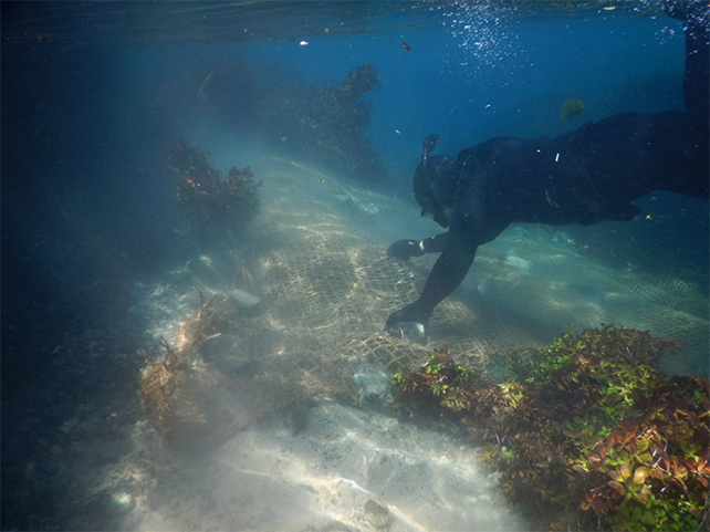
The project consists of removing non-native aquatic plants that have taken over parts of the Comal River and re-establishing native aquatic plants that were known to exist before invasion. Native aquatic plants have benefits to water quality, including nutrient uptake, and act as water filters that improve water quality and stabilize the river system. To undertake aquatic restoration, the group has developed a protocol to effectively remove the aquatic invasive plants using zero chemical herbicides that will cause very little disturbance to the environment. On top of this, a protocol was developed to grow sufficient quantities of native aquatic plants to provide restoration.
The primary goal of this action is to improve aquatic habitat for the endangered Fountain Darter (Etheostoma fonticola) as well as other endangered native aquatic species. Improved habitat leads to improved population numbers and survival through environmental hardships such as drought, flooding, and habitat disturbance.
The primary goal of this action is to improve aquatic habitat for the endangered Fountain Darter (Etheostoma fonticola) as well as other endangered native aquatic species. Improved habitat leads to improved population numbers and survival through environmental hardships such as drought, flooding, and habitat disturbance.
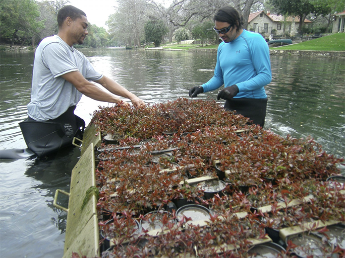
Native aquatic plants, such as Ludwigia repens, are propagated at a field nursery using Mobile Underwater Plant Propagation Trays. When the plants are mature they are harvested and transported to the final planting location. Native plants are planted by hand using snorkel or SCUBA equipment. Coconut matting is used to hold the plants in place until they root and establish.
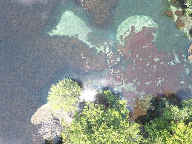
Below is an aerial view of restored Ludwigia repens (red color) in Landa Lake. This area was once occupied by the non-native aquatic plant Hygrophila polysperma.
COMMUNITY IMPACT
The Comal River Aquatic Habitat Restoration Project is projected to impact 35,000-75,000 people, from employees to local residents and tourists visiting the area. Ecosystem services, such as erosion control and and clean water, will help promote recreational activities and tourism in and around Comal and Hays County, and provides viable habitat for endangered species that are only found in this small part of the world. A healthy and stable population of aquatic flora and fauna leads to a healthy and stable ecosystem, which benefits the surrounding communities and people traveling from near and far to witness the beauty that is the Comal River and its springs.
The Comal River Aquatic Habitat Restoration Project is projected to impact 35,000-75,000 people, from employees to local residents and tourists visiting the area. Ecosystem services, such as erosion control and and clean water, will help promote recreational activities and tourism in and around Comal and Hays County, and provides viable habitat for endangered species that are only found in this small part of the world. A healthy and stable population of aquatic flora and fauna leads to a healthy and stable ecosystem, which benefits the surrounding communities and people traveling from near and far to witness the beauty that is the Comal River and its springs.

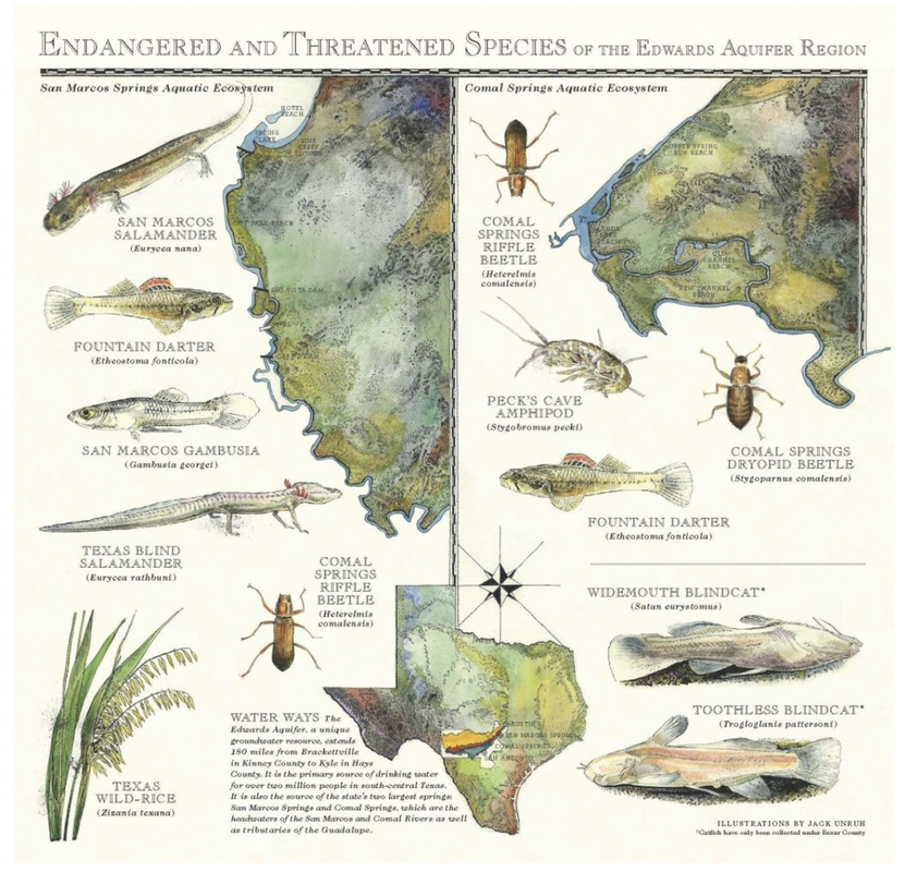
Endangered Species of the Edwards Aquifer
AQUATIC SPECIES
Over 40 species of highly adapted, aquatic, subterranean species are known to live in the Edwards Aquifer. These include amphipod crustaceans, gastropod snails, and interesting vertebrates like blind catfish (Longley, 1986). Seven aquatic species are listed as endangered in the Edwards Aquifer system, and one is listed as threatened. The main problems for all the species are reduced springflows caused by increased pumping, elimination of habitat, and degradation of water quality caused by urban expansion.
The World Wildlife Fund has produced a must-have, authoritative reference work for anyone interested in endangered species. It describes 540 endangered or threatened species, including their habitat, behavior, and recovery. Excerpts from their Guide to Endangered Species and other sources were used to prepare this section. Information on the aquatic invertebrates was prepared using the US Fish and Wildlife's published final rule on listing the species.
The seven endangered species of the Edwards Aquifer system are:
The threatened species is:
San Marcos Salamander (Eurycea nana)
KARST-DWELLING SPECIES
In addition to the aquatic species that depend on Aquifer water itself, nine cave-dwelling invertebrates that live in the Aquifer's karst formations were listed by the US Fish & Wildlife Service as endangered in December 2000. There are three beetles, one daddy long-legs, and five spiders. In May of 2008 the Service released a Draft Recovery Plan (download it). For a general discussion on all these creatures see the section below on the cave-dwelling invertebrates.Rhadine exilis (no common name)
Over 40 species of highly adapted, aquatic, subterranean species are known to live in the Edwards Aquifer. These include amphipod crustaceans, gastropod snails, and interesting vertebrates like blind catfish (Longley, 1986). Seven aquatic species are listed as endangered in the Edwards Aquifer system, and one is listed as threatened. The main problems for all the species are reduced springflows caused by increased pumping, elimination of habitat, and degradation of water quality caused by urban expansion.
The World Wildlife Fund has produced a must-have, authoritative reference work for anyone interested in endangered species. It describes 540 endangered or threatened species, including their habitat, behavior, and recovery. Excerpts from their Guide to Endangered Species and other sources were used to prepare this section. Information on the aquatic invertebrates was prepared using the US Fish and Wildlife's published final rule on listing the species.
The seven endangered species of the Edwards Aquifer system are:
- Fountain Darter (Etheostoma fonticola)
- Texas Blind Salamander (Typhlomolge rathbuni)
- San Marcos Gambusia (Gambusia georgei)
- Texas Wild Rice (Zizania texana)
- Comal Springs Riffle Beetle (Heterelmis comalensis)
- Comal Springs Dryopid Beetle (Stygoparnus comalensis)
- Peck's Cave Amphipod (Stygobromus pecki)
The threatened species is:
San Marcos Salamander (Eurycea nana)
KARST-DWELLING SPECIES
In addition to the aquatic species that depend on Aquifer water itself, nine cave-dwelling invertebrates that live in the Aquifer's karst formations were listed by the US Fish & Wildlife Service as endangered in December 2000. There are three beetles, one daddy long-legs, and five spiders. In May of 2008 the Service released a Draft Recovery Plan (download it). For a general discussion on all these creatures see the section below on the cave-dwelling invertebrates.Rhadine exilis (no common name)
- Rhadine infernalis (no common name)
- Helotes mold beetle (Batrisodes venyivi)
- Cokendolpher cave harvestman (Texella cokendolpheri)
- Robber Baron Cave spider (Cicurina baronia)
- Braken Bat Cave meshweaver (Cicurina venii)
- Madla Cave meshweaver (Cicurina madla)
- Government Canyon Bat Cave meshweaver (Cicurina vespera)
- Government Canyon Bat Cave spider (neoleptoneta microps)
TEXAS BLIND SALAMANDER (Typhlomolge rathbuni)
A blind salamander stopping for a moment on a rock underwater. These are very difficult to photograph!
Description:
The Texas blind salamander is a sightless, cave-dwelling salamander that reaches a mature length of about 13 centimeters (5 inches). It is a slender, frail-legged amphibian, white or pinkish in color with a fringe of blood-red, external gills. The head and snout are flattened. Two small black eyespots mark the location of vestigial eyes.
Behavior:
This totally aquatic species feeds on insects and other small invertebrates that live in subterranean waters and are nourished by the droppings of bats in caves. Little else of its natural history is known.
Reproduction:
Little is known, but gravid females have been observed throughout the year. The larvae do not transform.
Habitat/Historic Range:
The Texas blind salamander is endemic to the underground water system of the limestone caverns of the Edwards plateau. It spends its life in complete darkness. It is sensitive to changes of water quality and thus susceptible to groundwater pollutants.
Current Distribution:
Biologists know of only one population of the Texas blind salamander, which occurs in the Edwards Aquifer around San Marcos. The current population is apparently stable, although of limited numbers. It is possible that other populations may exist in unexplored underground caverns.
Conservation and Recovery:
Survival of this salamander depends upon the stability and continued purity of the Edwards Aquifer springflows. As with the other endangered species in the Edwards region, threats are from diminished springflows and pollution of groundwater and runoff caused by increasing demand for water and burgeoning development over recharge areas.
FOUNTAIN DARTER (Etheostoma fonticola)
Breeding males such as this one develop colorful stripes along the dorsal fin.
Description:
The fountain darter is a reddish brown darter with an average length of 2.5 centimeters (1 inch). It displays a series of dark, horizontal, stitch-like lines along its sides and three dark spots at the base of the tail. Dark bars appear below, behind, and in front of the eyes. Breeding males develop black, red, and clear stripes along the dorsal fin.
Behavior:
The fountain darter feeds primarily in daylight on aquatic insect larvae and small crustaceans. It is a selective feeder and prefers moving prey, remaining stationary until prey passes within striking distance. The fountain darter spawns year round, with peaks in early spring and August. After attaching eggs to mosses and algae, the female abandons the site, providing no care to eggs or fry.
Habitat:
The fountain darter prefers clear, quiet backwaters with a profuse bottom growth of aquatic plants and matted algae. It is found in the San Marcos and Comal rivers.
Historic Range:
The historic range of the fountain darter included the sources, headwaters, and sections of the San Marcos and Comal rivers.
Current Distribution:
The fountain darter is found in Spring Lake at the headwaters of the San Marcos River, in the main channel of the river to the confluence of the Blanco River, and in the Comal River. The Comal River population of fountain darters was completely eliminated when its habitat was reduced to isolated pools by a major drought in the 1950's, but the river was restocked with 457 darters taken from the San Marcos River (USFWS, 1984).
Schenck and Whiteside (1976) estimated the population in the San Marcos River between Spring Lake Dam and the San Marcos Wastewater Treatment Plant outfall to be 102,966 individuals. Until recently, no population estimates had been made for the Comal River. Linam, Mayes, and Saunders (1993) conducted a study to determine habitat utilization, the amount of habitat available, and an estimate of population size. Fountain darters were found in greatest densities in filamentous algae, and the mean population estimate for the Comal River upstream of Torrey Mill Dam was 168,078 with 95% confidence limits of 114,178 and 254,110.
Conservation and Recovery:
Actions that threaten the fountain darter include the destruction of aquatic vegetation in Spring Lake and the San Marcos River, recreational use of the San Marcos River, and long-term water depletion from the Edwards Aquifer. Swimmers and divers disturb the algae mats used by the darter for spawning. As with the San Marcos gambusia, recovery is considered a remote possibility without the cooperation of all state and local agencies that manage use of the Aquifer. Linam, Mayes, and Saunders (1993) concluded that despite the successful reintroduction effort after the 1950's drought, other factors might preclude it being replicated if the Springs should cease to flow again. Back then, enduring pools of water sustained some segments of the aquatic community, providing a base for reestablishment. However, the assumption that enduring pools will once again provide a remnant habitat for aquatic plants may no longer be valid. Since the introduction of giant rams-horn snails (Marisa cornuarietis) around 1983, plants in many areas of Landa Lake have been denuded of leaves or even grazed to the bottom (Horne, et al., 1992). These snails thrive in low flow conditions, and during a drought grazing could eliminate the fountain darter habitat. In a repeat of the 1950's drought, the Springs are also likely to be dry for a much longer period of time, and there may be changes in water quality that could limit another successful reintroduction
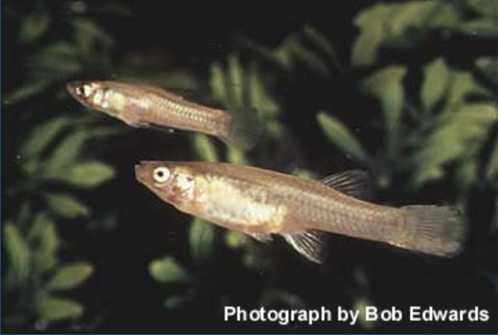
SAN MARCOS GAMBUSIA (Gambusia georgei)
SAN MARCOS GAMBUSIA (Gambusia georgei)
The gambusia had not been seen since 1982 and was declared to be extinct in 2021.
Description:
The San Marcos Gambusia ranged in length from 2.5 to 4 centimeters (1 to 1.6 inches), had lemon yellow median fins and a diffuse midlateral stripe along the length of its body. The dark body displayed a bluish sheen, and scales tended to be strongly cross-hatched.
Behavior:
This fish was a livebearer - eggs hatched inside the female's body and emerge alive. The female was capable of bearing up to 60 young in a single brood. It fed on insect larvae and other invertebrates in slow-moving waters shaded by overhanging trees or bridges.
Habitat:
The San Marcos gambusia preferred quiet backwaters, adjacent to the main thrust of the river current. Its primary habitat requirements appeared to be clean and clear water of a constant temperature. Temperatures in the river vary by only a few degrees throughout the year, averaging about 23 degrees C (73 F). The bottom is muddy but generally unsilted. This species was restricted to a limited portion of the San Marcos River springrun a few kilometers below the headsprings. It was always rare.
Historic Range:
The gambusia's entire known range was restricted to a 1-kilometer (0.6 miles) section of the San Marcos River near the city of San Marcos. Most specimens were found between the Interstate Highway 35 crossing and Thompson's Island. This gambusia was always extremely rare as determined by surveys conducted in 1978 and 1979 in the San Marcos River. Biologists netted more than 20,000 Gambusia specimens but counted only 18 San Marcos gambusia among them.
San Marcos gambusia were captured alive and an artificial culture established in Austin and in Dexter, New Mexico, in 1979 and 1980, respectively. Both of these cultures were contaminated by Gambusia affinis in the early 1980s and the last individual taken from the wild was captured in 1982. Despite considerable efforts to secure this species after 1982, none were found.
Conservation and Recovery:
The species' very restricted known distribution in the River and its absence from the headwaters at Spring Lake indicate very specific habitat requirements. It was apparently extremely sensitive to any alteration of its habitat. Changes in water turbidity caused by runoff from land clearing and construction, an increase in water temperatures caused by lowered water flows, and pumping of groundwater from the Edwards Aquifer could have easily eliminated the species. Even if additional specimens had been found, recovery of the San Marcos gambusia was considered a remote possibility.
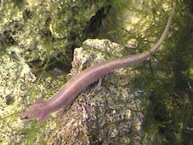
SAN MARCOS SALAMANDER (Eurycea nana)
Photograph by Joe N. Fries
SAN MARCOS SALAMANDER (Eurycea nana)
Photograph by Joe N. Fries
Description:
The slender-bodied San Marcos salamander is about 6 centimeters (2.4 inches) long and displays a prominent gill fringe behind the head. It is light brown above with a row of pale flecks on either side of the midline and yellowish white below. The large eyes have a dark ring around the lens. Limbs are short and slender with four toes on the forefeet and five on the hind feet. At first glance, it is similar to a lizard but lacks scales and claws. The specific name nana is from the Greek nanos, meaning "dwarf." This voiceless salamander is also earless. It was listed as endangered on July 14, 1980.
Behavior:
Salamanders lay jelly-covered eggs from which tiny fishlike larvae emerge and develop in the manner of tadpoles. The San Marcos salamander breeds and lays eggs in standing pools amid thick mats of aquatic vegetation. Eggs hatch in about 24 days. This species is carnivorous and feeds on amphipods, midge fly larvae, and aquatic snails. It remains stationary until prey pass closely and then abruptly snaps its head, taking the prey.
Habitat:
The San Marcos salamander is found in shallow alkaline springs carved out of limestone with sand and gravel substrates. Pools and streambeds are often punctuated with large limestone boulders. Aquatic vegetation is profuse, and the pool surfaces are covered with moss (Amblystegium riparium) and thick mats of coarse, blue-green algae.
Historic Range:
The species appears to be endemic to the sources and upper portions of the San Marcos River.
Current Distribution:
The limited range of the San Marcos salamander comprises the San Marcos Springs, Spring Lake, and a few hundred feet of the San Marcos River. The most recent estimates of population size indicate there are probably around 50,000 individuals. Tupa and Davis (1976) estimated there about 23,000 in algal mats, and Nelson (1993) estimated about 25,000 in rocks in Spring Lake and about 5,200 below the Lake.
Conservation and Recovery:
Although the population appears relatively stable for the moment, the salamander is threatened by potential degradation or modification of its very limited habitat. Increasing residential and agricultural development along with rising demand for water for human and agricultural uses may cause the spring sources become dry intermittently. The key to preserving the San Marcos salamander is controlling the amount of water pumped out of the Edwards Aquifer.
TEXAS WILD RICE (Zizania texana)
A canoer glides past submerged streamers of Texas Wild Rice in the San Marcos River.
At left, tubers co-exist with Wild Rice in Sewell Park, just below Aquarena Springs. At right, drooping stalks above the surface produce grain-like seeds.
Description:
Texas wildrice is an aquatic grass with thin, flat, elongated leaves that are typically immersed and long-streaming in river currents. Leaves often grow as long as 1.5 meters (57 inches). Flower stalks, when present, extend above the surface of the water, sometimes to a height of 1 meter (40 inches), and produce drooping heads of profuse grain-like seeds. The plant flowers and sets seed at irregular intervals from April to November. Seeding plants have become increasingly rare in the wild. It was listed as federally endangered on April 26, 1978 and state endangered on April 29, 1983. It was the first Texas plant to be placed on the endangered species list.
The leaves are linear, elongate, green, to 45 in. long, 1/4 to 1 in. wide. Flowers are arranged in a narrow panicle, 6-13 in. long, 1/2 to 4 in. wide, spreading male branches below, tighter female branches above; pikelet with one flower without glumes; male spikelets 1/4-1/2 in. long. 1/16-1/8 in. wide; female spikelets 5/16-1/2 in. long 1/16-1/8 in. wide, tipped by rough bristles 3/8-1 3/8 in. long; flowering spring and autumn.
Habitat:
Texas wildrice forms large clones or masses of clones that firmly root in gravel shallows near the middle of the river. This plant is adapted to fast-flowing water of high quality and constant year-round temperatures as provided by adequate spring flows. Silting, disturbance of the bottom, or stagnant water will kill off plants.
Historic Range:
This wildrice was once abundant in the San Marcos River, in contiguous irrigation ditches with constant flows, and in Spring Lake at the River's headwaters. In the 1930's it was so abundant that a local irrigation company considered it a difficult task to keep plants from clogging its ditches.
Current Distribution:
Texas wildrice is currently distributed along the upper four miles of the River in and near the city of San Marcos. In August of 2011, the Texas Parks and Wildlife Department proposed designating this stretch of the River a State Scientific Area, which is allowable under state law for the purposes of education, research, and preservation of plant and animal life.
Conservation and Recovery:
The major reason for decline of the San Marcos River habitat has been increased pumping and diversion of Edwards Aquifer groundwater. Decreased spring outflow lowers the water level of the River and exposes the shallows where Texas wildrice typically would grow. River dredging and damming, riverside construction, and bottomland cultivation have destroyed plants, altered stream flows and temperature, or increased siltation. In the past, intensive harvesting of the seed crop inhibited successful reproduction.
Because most of the remaining population is in the urban area of San Marcos, botanists have suggested that transplanting wildrice to some other location is the species only hope of survival. However, the Fish and Wildlife Service stresses that every effort must be made to preserve the species in its native habitat.
Efforts to grow Texas wildrice in cultivation and to transplant it have met with limited success. In the 1970's, botanists attempted to establish a new population in Salado Creek with cultivated plants, but recreational activities continually disturbed transplanted clones. From 1976 to 1982, nursery grown plants were transplanted to various sites in central Texas. No new populations resulted.
The Fish and Wildlife Service Recovery Plan recommends that a public education program be established, aimed at minimizing recreational disturbance of wildrice in the San Marcos River. Ultimately, long term protection will require a management program to balance the water needs of the human population with the requirements of a healthy San Marcos River ecosystem.
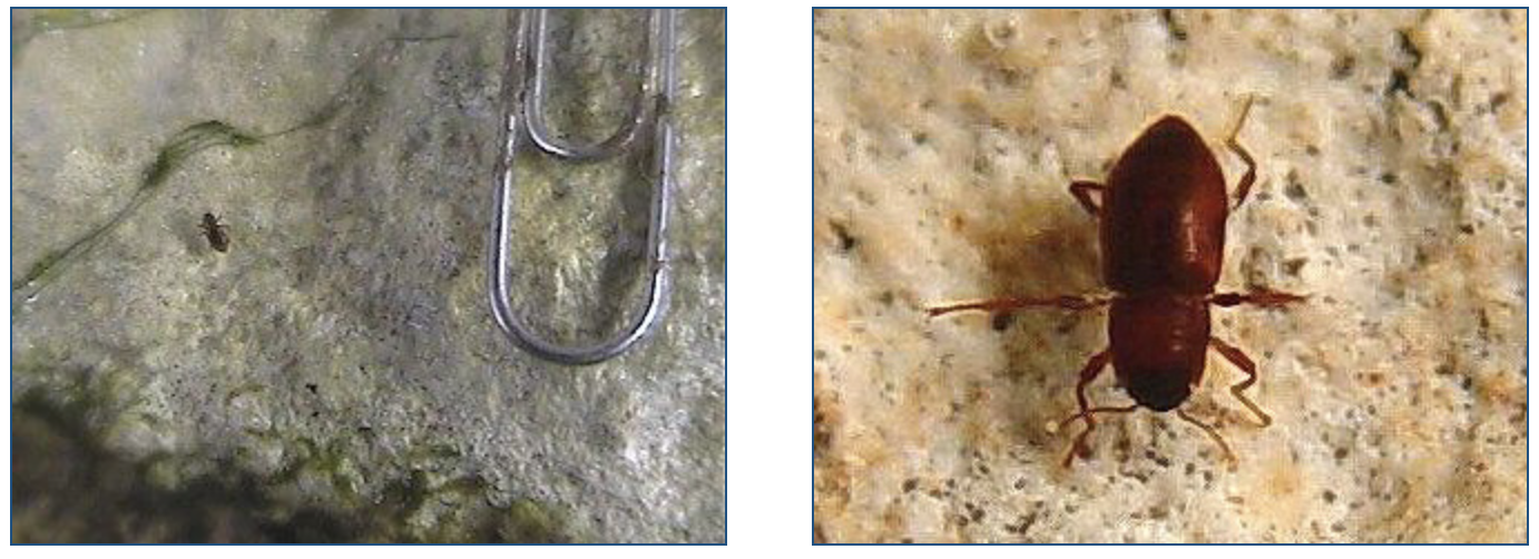
COMAL SPRINGS RIFFLE BEETLE (Heterelmis comalensis)
Photographs by Joe N. Fries
COMAL SPRINGS RIFFLE BEETLE (Heterelmis comalensis)
Photographs by Joe N. Fries
Description:
The Comal Springs riffle beetle is a small aquatic, surface-dwelling species in the family Elmidae. Adult Comal Springs riffle beetles are about 1/8 inch long, with females slightly larger than males. The closest relative of H. comalensis appears to be H. glabra, a species that occurs farther to the west in the Big Bend region (Bosse, et al., 1988). Some riffle beetle species can fly (Brown, 1987), but the hind wings of H. comalensis are short and almost certainly non-functional, making the species incapable of this mode of dispersal (Bosse, et al., 1988).
Habitat:
Unlike the other two aquatic invertebrate organisms listed here, the Comal Springs riffle beetle is not a subterranean species. It occurs in the gravel substrate and shallow riffles in spring runs. Larvae have been collected with adults in the gravel substrate of the Spring headwaters and not on submerged wood as is typical of most Heterelmis species (Brown & Barr, 1988). Usual water depth in occupied habitat is 2 to 10 centimeters (1 to 4 in) although the beetle may also occur in slightly deeper areas within the Spring runs. Populations have been reported to reach their greatest densities from February to April (Bosse, et al., 1988). The Comal Springs riffle beetle has been collected from Spring runs 1, 2, and 3 at Comal Springs in Landa Park (springs j, k, and l in Brune, 1981) and a single specimen was collected from San Marcos Springs 32 km (20 mi) to the northeast.
Historic Range:
It was first collected by Bosse in 1976 and was described by Bosse, et al., in 1988. Nothing is known about whether this species may have historically ranged in other springs that are now dry almost all the time, such as San Pedro Springs and San Antonio Springs.
Current Distribution:
The Comal Springs riffle beetle is known from Comal Springs and San Marcos Springs.
Conservation and Recovery:
Because conservation and recovery of the three listed aquatic invertebrate species are very similar, they are discussed together at the end of this page.

COMAL SPRINGS DRYOPID BEETLE (Stygoparnus comalensis)
Photograph by Joe N. Fries
COMAL SPRINGS DRYOPID BEETLE (Stygoparnus comalensis)
Photograph by Joe N. Fries
Description:
The Comal Springs dryopid beetle is the only known subterranean member of the beetle family Dryopidae. Adult Comal Springs dryopid beetles are about 1/8 inch long. They have vestigial (non-functional) eyes, are weakly pigmented, translucent, and thin-skinned.
Habitat:
Elmid and dryopid beetles live primarily in flowing, uncontaminated waters. Collection records for the Comal Springs dryopid beetle are primarily from Spring run 2 at Comal Springs, but they have also been collected from runs 3 and 4 at Comal and from Fern Bank Springs about 20 miles to the northeast in Hays County. Collections have been from April through August. Most of the specimens have been taken from drift nets or from inside the Spring orifices. Although the larvae of the Comal Springs dryopid beetle have been collected in drift nets positioned over the Spring openings, they are presumed to be associated with air-filled voids inside the spring orifices since all other known dryopid beetle larvae are terrestrial. Unlike Peck's cave amphipod, the Comal Springs dryopid beetle does not swim, and it may have a smaller range within the Aquifer.
Historic Range:
The Comal Springs dryopid beetle is a recently discovered species. It was first collected in 1987 and described as a new genus and species by Barr & Spangler, 1992. Nothing is known about whether this species may have historically ranged in other springs that are now dry almost all the time, such as San Pedro Springs and San Antonio Springs.
Current Distribution:
The Comal Springs dryopid beetle is known from Comal Springs and Fern Bank Springs (Hays County). The exact depth and subterranean extent of the range of the Comal Springs dryopid beetle is not precisely known because of a lack of methodologies available for studying karst aquifer systems and the organisms that inhabit such systems. Presumably an interconnected area, the subterranean portion of this habitat, provides for feeding, growth, survival, and reproduction of the Comal Springs dryopid beetle. However, no specimens have appeared in collections from 22 artesian and pumped wells flowing from the Edwards Aquifer, suggesting this species may be confined to small areas surrounding the Spring openings and is not distributed throughout the Aquifer (Barr, 1993). Barr (1993) also surveyed nine springs in Bexar, Comal, and Hays counties considered most likely to provide habitat for endemic invertebrates and found Stygoparnus comalensis only at Comal and Fern Bank Springs.
Conservation and Recovery:
Because conservation and recovery of the three listed aquatic invertebrate species are very similar, they are discussed together at the end of this page.
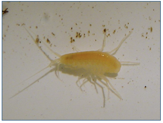
PECKS'S CAVE AMPHIPOD (Stygobromus pecki)
Photograph by Joe N. Fries
PECKS'S CAVE AMPHIPOD (Stygobromus pecki)
Photograph by Joe N. Fries
Description:
Peck's cave amphipod is a subterranean, aquatic crustacean in the family Crangonyctidae. Like all members of the exclusively subterranean genus Stygobromus, this species is eyeless and unpigmented. The Fish and Wildlife Service has used "cave amphipod" as a generic common name for members of this genus, and this name was simply transliterated as "Peck's cave amphipod" without reference to a particular cave.
Habitat:
Over 300 specimens of Peck's cave amphipod have been collected since its description. Most specimens were netted from crevices in rock and gravel near the three largest orifices of Comal Springs on the west side of Landa Park in Comal County (Arsuffi, 1993) and (Barr, 1993). Barr collected one specimen from a fourth Comal Spring run on private property adjacent to Landa Park and one specimen from Hueco Springs, about four miles north of Comal Springs (Barr, 1993). Despite extensive collecting efforts, no specimens have been found in other areas of the Edwards Aquifer, indicating that its primary habitat is a zone of permanent darkness in the underground Aquifer feeding the springs. Above ground, individuals are easy prey for predators, but they usually take shelter in the rock and gravel crevices and may succeed in reentering the Spring orifice. In 1993 Barr got most specimens in drift nets at Spring orifices and found them less often as she moved downstream, supporting the notion they may be easy prey and do not likely survive for long outside the Aquifer.
Historic Range:
Nothing is known about whether this species may have historically ranged in other springs that are now dry almost all the time, such as San Pedro Springs and San Antonio Springs. The first recorded specimen was collected by Peck at Comal Springs in June 1964. Reddell collected a second specimen at the same place in May 1965. In 1967, Holsinger named the species Stygonectes pecki, in Peck's honor, selecting the 1965 specimen as the type specimen. Later he included all the nominal Stygonectes species in the synonymy of the large genus Stygobromus.
Current Distribution:
Peck's cave amphipod is known from Comal Springs and Hueco Springs, both in Comal County. The exact depth and subterranean extent of the ranges of this species is not precisely known because of a lack of methodologies available for studying karst aquifer systems and the organisms that inhabit such systems. Presumably an interconnected area, the subterranean portion of this habitat, provides for feeding, growth, survival, and reproduction of the Peck's cave amphipod. However, no specimens have appeared in collections from 22 artesian and pumped wells flowing from the Edwards Aquifer (Barr, 1993), suggesting this species may be confined to small areas surrounding the Spring openings and is not distributed throughout the Aquifer. Barr also surveyed nine springs in Bexar, Comal, and Hays counties considered most likely to provide habitat for endemic invertebrates and found Stygobromus pecki only at Comal and Hueco springs.
CONSERVATION AND RECOVERY OF THE AQUATIC INVERTEBRATE
Conservation and management of the Peck's cave amphipod, Comal Springs riffle beetle, and Comal Springs dryopid beetle are likely to involve protection and conservation of the Edwards Aquifer and springflow at Comal, Hueco, San Marcos, and Fern Bank Springs. These species' very limited habitat is likely to be lost through drying or decreased volume of springflow during minor or severe drought. It is likely the effect of natural droughts in south central Texas will increase in severity because of the large increase in human groundwater withdrawals. Many possible effects of reduced springflow exist. These include changes in the chemical composition of the water in the Aquifer and at the Springs, a decrease in current velocity and corresponding increase in siltation, and an increase in temperature and temperature fluctuations in the aquatic habitat (McKinney & Watkins, 1993).
Another threat to the habitat of these species is the potential for groundwater contamination. Pollutants of concern include those associated with human sewage, leaking underground storage tanks, animal/feedlot waste, agricultural chemicals (especially insecticides, herbicides, and fertilizers) and urban runoff (including pesticides, fertilizers, and detergents).
Pipeline, highway, and railway transportation of hydrocarbons and other potentially harmful materials in the Edwards Aquifer recharge zone and its watershed, with the attendant possibility of accidents, present a particular risk to water quality in Comal and San Marcos Springs. Comal and San Marcos Springs are both located in urbanized areas. Hueco Springs is located alongside River Road, which is heavily traveled for recreation on the Guadalupe River, and may be susceptible to road runoff and spills related to traffic. Fern Bank Springs is in a relatively remote, rural location and its principal vulnerability is probably to contaminants associated with leaking septic tanks, animal/feedlot wastes, and agricultural chemicals.
Although these species are fully aquatic and two of the three require flowing water for respiration, the absolute low water limits for survival are not known. They survived the drought of the middle 1950's, which resulted in cessation of flow at Comal Springs from June 13 through November 3, 1956. Hueco Springs is documented to have gone dry in the past (Brune, 1981), (Barr, 1993).
These invertebrates were not extirpated by the only recorded temporary cessation of springflow. However, given that they are fully aquatic and that no water was present in the Springs for a period of several months, they were probably negatively impacted. These species are not likely adapted to surviving long periods of drying (up to several years in duration) that may occur in the absence of a water management plan for the Edwards Aquifer that accommodates the needs of these invertebrates.
Stagnation of water may be a limiting condition, particularly for the Comal Springs dryopid beetle and Peck's cave amphipod. Stagnation of water and/or drying within the Spring runs and the photic (lighted) zone of the Spring orifices would probably be limiting for the Comal Springs riffle beetle because natural water flow is considered important to the respiration and therefore survival of this invertebrate species. Elmid and dryopid beetles have a mass of tiny, hydrophobic (unwettable) hairs on their underside where they maintain a thin bubble of air through which gas exchange occurs (Chapman, 1982). This method of respiration loses its effectiveness as the level of dissolved oxygen in the water decreases. A number of aquatic insects that use dissolved oxygen rely on flowing water to obtain oxygen.
At present, competition is not known to be a significant threat to these species. However, two exotic snail species, Thiara granifera and Thiara tuberculata, are common in the Spring runs and, as grazers, may compete for food. Another exotic species, the giant ramshorn snail (Marisa cornuarietis), is present in two of the Spring runs and may colonize the other runs at low flow levels. Marisa can have a tremendous impact on vegetation, that in turn may affect the habitat for surface-dwelling grazers like the riffle beetle.
In July of 2007, the U.S. Fish and Wildlife Service designated about 50 acres around four Edwards springs as critical habitat for aquatic invertebrate species. Although they were listed in 1997, the U.S. Fish & Wildlife Service did not designate any critical habitat, leading to a 2003 lawsuit by the Center for Biological Diversity. Under the Bush administration, Fish & Wildlife Service officials contended that designating critical habitat has little effect on protecting species. The Center for Biological Diversity disagreed, and the Wildlife Service made the designation as part of a settlement. Such a designation requires federal agencies to analyze activities they undertake, fund, or permit to determine if there may be any harm to the species' habitat. If so, they must consult with the Fish & Wildlife Service to determine how to eliminate or reduce the impacts to an acceptable level.
The initial designation of 50 acres as critical habitat was deemed insufficient by scientists because it included only surface water and not the underground orifices critical to the species’ survival. So the Center for Biological Diversity and its allies filed suit again, resulting in a new proposal that was announced in October 2012.
The new proposal expands the critical habitat and includes new subsurface areas for the dryopid beetle and the Peck’s Cave amphipod. In all, 169 acres of critical habitat are being proposed. The habitat areas overlap and consist of 39 acres of surface habitat and 139 acres of subsurface habitat for the Comal Springs dryopid beetle; 38 surface acres and 138 subsurface acres for the Peck’s cave amphipod; and 54 acres of protected surface habitat for the Comal Springs riffle beetle.
THE CAVE-DWELLING INVERTEBRATES
In 1992, several local groups, (the Alamo Group of the Sierra Club, the Balcones Canyonlands Conservation Coalition, the Helotes Creek Association, the Texas Cave Management Association, and Texas Speleological Association) petitioned the US Fish and Wildlife Service to add the nine species of karst invertebrates to the List of Threatened and Endangered Wildlife. The nine species of invertebrates are known only from caves in the northern and northwest parts of Bexar county. In December 2000 the Fish and Wildlife Service designated the nine species as endangered under the Endangered Species Act.
Invertebrates are animals without internal skeletons or backbones such as butterflies, beetles, grasshoppers and spiders. The nine Bexar county species listed as endangered include three beetles, five spiders, and one harvestman, a relative of the common household daddy-longlegs. Although small, ranging from less than 2 millimeters to 9 millimeters long, and generally overlooked because they spend their entire lives underground, these invertebrates are biologically and ecologically unique. They resemble creatures out of Tim Burton's animation, with eyes that are either very small or entirely absent, and bodies that are long and thin, with no coloration, appearing white but actually being transparent.
Four of the species are currently only known from one cave and three others are only known from two to eight caves. It is likely these species also exist in other caves on private property which the Fish & Wildlife Service were not allowed to inspect. Although these species are known only from caves, they may also use karst passages that are too small for people or that have no known entrance at the surface. The number of caves known to contain these species is likely to increase in the future as more caves are discovered and inspected. The listing of these species was not based on a known decline in the number of individuals or the known locations, but rather on evidence that all these species are subject to threats to their continued existence throughout all or most of their range.
These species are currently being threatened by the rapid pace of development around San Antonio and northern Bexar county. Development can degrade the cave environment through increased vandalism, contamination from sewer or septic tank leaks, storm water run-off, pesticides, or chemical spills. Development can also destroy the cave outright through digging or filling. These species are also threatened by the invasion of non-native fire ants which can prey upon them as well as compete with them for their limited sources of food.
A number of the caves where these species are found are located on the Texas Parks and Wildlife Department's Government Canyon State Natural Area and the U.S. Army's Camp Bullis, both of which have developed and implemented protective management plans.
The invertebrates are highly adapted to their underground home, an environment which has a very stable temperature; very high, constant humidity; and little food. The lack of food and stability of their environment leads to an ecosystem with very few species. This makes cave environments valuable areas for ecological research. It also means that a sudden change in the environment or loss of a species could quickly wipe out the entire ecosystem.
Ecologically, cave invertebrates can be described as more similar to large mammals like elephants than to their invertebrate cousins which live on the surface. Like elephants, they have few offspring and live relatively long lives (for invertebrates), a characteristic ecologists call "K-selected". This also means their populations are more sensitive to losing even fairly small numbers of individuals, and that it takes a long time for their population sizes to recover from any catastrophe.
The surface environment of karst areas is also an integral part of the habitat needed by the animals inhabiting the underground areas. Because plants cannot grow in the blackness of caves, the cave ecosystem is entirely dependent on input from the outside. Food in a cave can come either through animals that cave biologists call "trogloxenes", which roost in the cave but forage for food on the outside, like bats, mice, or cave crickets, or through organic material like leaves being washed into the cave entrance or filtered in through the ground above the cave. Mammal feces provide a medium for the growth of fungi and, subsequently, localized population blooms of several species of tiny, hopping insects. These insects reproduce rapidly on rich food sources and may become prey for some predatory cave invertebrates. The nine listed invertebrates are probably predaceous and eat the eggs, larvae, or adults of other cave invertebrates.
Cave invertebrates typically also have very low metabolisms, an adaptation to the sparse amounts of food found in their environment. Some biologists have hypothesized that the stereotypical characteristics of cave-dwelling species, such as the lack of pigment (white color) and reduced or absent eyes (blind), have evolved as a measure to conserve energy and channel their limited resources to more useful features like antennae and chemical and touch receptors, which are typically highly developed in cave species. In fact, because they are adapted to an environment with little food, pollution by the addition of large amounts of nutrients to the cave can actually be harmful to the species, because it allows invertebrates that are not cave adapted, such as cockroaches and a variety of flies to survive in the cave and even out-compete the cave species. The healthy cave ecosystem lies in a delicate balance between too little food and too much.
Conservation and Recovery of the karst invertebrate species:In general, conservation measures for species listed as endangered or threatened under the Endangered Species Act include recognition, recovery actions, requirements for Federal protection, and prohibitions against certain practices. Recognition through listing encourages and results in conservation actions by Federal, State, and local agencies, private organizations, and individuals. The Act provides for possible land acquisition and cooperation with the States and requires that recovery actions be carried out for all listed species.
In 2002, shortly after the specis were first listed in 2000, the US Fish and Wildlife Service proposed designating 9,516 acres as critical habitat for the species, but under the Bush administration only 1,063 acres were designated.
On May 23 2008 the US Fish and Wildlife Service released a Draft Recovery Plan that suggests reducing threats to the species by securing an adequate quantity and quality of caves, including their drainage basins and the natural surface plant and animal communities. Conservation of endangered species also involves protection of the ecosystems that support them. For these nine invertebrates, conservation requires maintaining moist, humid conditions in the caves they inhabit and stable temperatures in the air-filled voids; maintaining an adequate nutrient supply; preventing contamination of the water entering the ecosystem; preventing or controlling invasion of nonnative species such as fire ants; and maintaining of a healthy ecosystem surrounding the karst features. Another important component of species recovery is education. Without an educated and concerned public, these species will probably become extinct.
The plan estimates that eventual delisting of the nine species could cost $140 million over 25 years. All the Bexar county karst invertebrates have been assigned a "Recovery Priority Number" of 2c, which means these species face a high degree of threat and a high potential for recovery and there may be conflict between species recovery and economic development.
In 2009 the Service was forced to re-evaluate its process for critical habitat designation in response to a lawsuit filed by local and national environmental groups concerned about construction projects that would threaten the species. In February of 2011, the Fish and Wildlife Service asked for public comment on designation of an additional 6,906 acres as critical habitat. If adopted, the designation could have impacts on many development projects proposed for north and northwest Bexar county. Although critical habitat designations only apply to projects that use federal funding or require a federal permit, the designation would draw focus to TCEQ rules about not filling in or damaging caves and city of San Antonio requirements that developers follow federal laws regarding not harming endangered species.
This section was prepared using Fish and Wildlife Service news releases, the 2008 Draft Recovery Plan, and San Antonio Express-News articles.
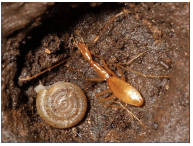
RHADINE EXILIS (no common name)
Photograph by Dr. Jean Krejca
RHADINE EXILIS (no common name)
Photograph by Dr. Jean Krejca
Description:
A small, essentially eyeless ground beetle with a slender body, about 7.4 mm in length. (in the photo, the beetle is at right).
Habitat:
Karstic (cavelike) formations of Bexar county, Texas. Seldom found near cave entrances - prefers the dark zone deeper in caves.
Historic Range:
Historic Range is unknown, but likely similar to Current Distribution, with the exception of caves that have been destroyed or adversely impacted by development, other human activities, and non-native species like fire ants.
Current Distribution:
Known to inhabit 50 caves in north and northwest Bexar county. Many are located on Camp Bullis in the Stone Oak karst region; with others located in the Helotes, UTSA, and Stone Oak karst regions.
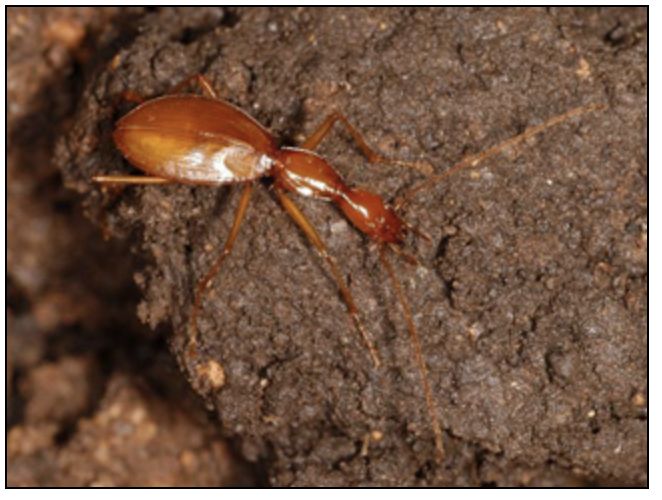
RHADINE INFERNALIS (no common name)
Photograph by Dr. Jean Krejca
RHADINE INFERNALIS (no common name)
Photograph by Dr. Jean Krejca
Description:
A small, essentially eyeless reddish-brown ground beetle with a narrow neck and a body about 8.6 to 8 mm in length. There are two recognized subspecies, and a third possible subspecies. Beetles of this genus are opportunistic feeders but have been most often seen eating dead or dying arthropods. Some species actively seek cave cricket eggs in caves.
Habitat:
Karstic (cavelike) formations of Bexar county, Texas. The species may be occasionally abundant with ten or more individuals seen in a limited area. At other times, however, it appears to be absent or is extremely rare.
Historic Range:
Historic Range is unknown, but likely similar to Current Distribution, with the exception of caves that have been destroyed or adversely impacted by development, other human activities, and non-native species like fire ants.
Current Distribution:
Known to inhabit 36 caves in north and northwest Bexar county.
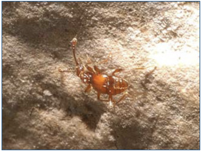
HELOTES MOLD BEETLE (Batrisodes venyivi)
Photograph by Dr. Jean Krejca
HELOTES MOLD BEETLE (Batrisodes venyivi)
Photograph by Dr. Jean Krejca
Description:
A tiny, reddish-brown beetle up to 2.4 mm in length that superficially resembles an ant.
Habitat:
Karstic (cavelike) formations of Bexar county, Texas.
Historic Range:
Historic Range is unknown, but likely similar to Current Distribution, with the exception of caves that have been destroyed or adversely impacted by development, other human activities, and non-native species like fire ants.
Current Distribution:
Known to inhabit eight caves near Helotes. There have been three known collections of adult specimens.
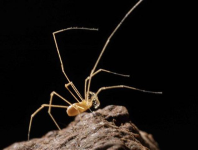
Photograph by Dr. Jean Krejca of Texella tuberculata from a cave in Government Canyon State Natural Area, to illustrate general external morphology.
COKENDOLPHER CAVE HARVESTMAN (Texella cokendolpheri)
Description:
A small, eyeless daddy long-legs. Very long, thin legs and a small body. Pale orange in color. Also known as the Robber Baron cave harvestman.
Habitat:
Karstic (cavelike) formations of Bexar county, Texas.
Historic Range:
Historic Range is unknown, but likely similar to Current Distribution, with the exception of caves that have been destroyed or adversely impacted by development, other human activities, and non-native species like fire ants.
Current Distribution:
Robber Baron Cave in Alamo Heights. The cave is on private property, but the cave entrance has been donated to the Texas Cave Management Association, which actively works to protect and improve the cave habitat. The cave is relatively large and the land over and around the cave is heavily urbanized. The cave has also been subject to extensive commercial and recreational use in the past. No known collections since 1993.
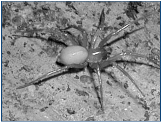
ROBBER BARON CAVE SPIDER (Cicurina baronia)
Photograph by Dr. Jean Krejca
ROBBER BARON CAVE SPIDER (Cicurina baronia)
Photograph by Dr. Jean Krejca
Description:
A small, essentially eyeless spider.
Habitat:
Karstic (cavelike) formations of Bexar county, Texas.
Historic Range:
Historic Range is unknown, but likely similar to Current Distribution, with the exception of caves that have been destroyed or adversely impacted by development, other human activities, and non-native species like fire ants.
Current Distribution:
Robber Baron Cave in Alamo Heights. The cave is on private property, but the cave entrance has been donated to the Texas Cave Management Association, which actively works to protect and improve the cave habitat. The cave is relatively large and the land over and around the cave is heavily urbanized. The cave has also been subject to extensive commercial and recreational use in the past. Last collected in 1983, but has been observed more recently.
BRAKEN BAT CAVE MESHWEAVER (Cicurina venii)
Description:
A small, essentially eyeless spider. Only two specimens have ever been collected.
Habitat:
Karstic (cavelike) formations of Bexar county, Texas.
Historic Range:
Historic Range is unknown, but likely similar to Current Distribution, with the exception of caves that have been destroyed or adversely impacted by development, other human activities, and non-native species like fire ants.
Current Distribution:
Noted hydrogeologist George Veni was the first to identify the spider in 1980 in Braken Bat Cave in northwest Bexar county. The cave entrance was filled during construction of a home in 1990. Without re-excavating the cave, it is difficult to determine what effect this had on the species. There may still be some surface nutrients introduced from a reported small side passage. It should be noted this was not known to be a bat cave and is not the famous Bracken Bat Cave in Comal county.
A second specimen was found in August of 2012 during construction of a highway interchange at Loop 1605 and Texas 151, about five miles from the location of the first specimen. The highway project was placed on hold, while TxDOT and Fish & Wildlife officials tried to work out a construction plan that wouldn't disturb any spiders potentially living in the area or their habitat.
In October of 2014 a solution was found - an overpass will be constructed instead of an underpass that would have required extensive excavation. This will cost about $44 million, almost three times as much as the original plan. TxDOT also agreed to do a genetic study that will determine how to better identify the spider. Fish and Wildlife Service spokesman Darren LeBlanc said that by protecting creates such as the meshweaver, the Service isn't intentionally trying to stop projects, it just wants to ensure those populations can be increased so one day they can be removed from the endangered species list. "Every creature has its place in the ecosystem," he said
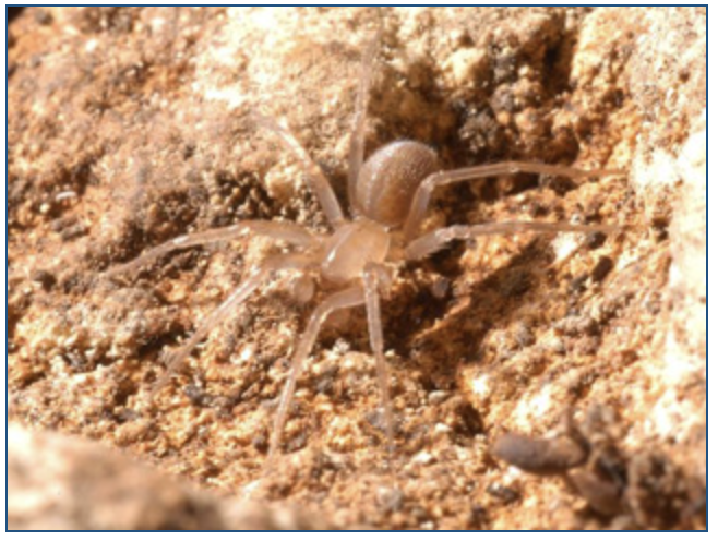
MADLA CAVE MESHWEAVER (Cicurina madla)
Photograph by Dr. Jean Krejca
MADLA CAVE MESHWEAVER (Cicurina madla)
Photograph by Dr. Jean Krejca
Description:
A small, essentially eyeless spider with reduced pigment.
Habitat:
Karstic (cavelike) formations of Bexar county, Texas.
Historic Range:
Historic Range is unknown, but likely similar to Current Distribution, with the exception of caves that have been destroyed or adversely impacted by development, other human activities, and non-native species like fire ants.
Current Distribution:
Known from eight caves in or near Government Canyon, Helotes, and UTSA.
GOVERNMENT CANYON BAT CAVE MESHWEAVER (Cicurina vespera)
Description:
A small, essentially eyeless spider with reduced pigment.
Habitat:
Karstic (cavelike) formations of Bexar county, Texas.
Historic Range:
Historic Range is unknown, but likely similar to Current Distribution, with the exception of caves that have been destroyed or adversely impacted by development, other human activities, and non-native species like fire ants.
Current Distribution:
Known from Government Canyon Bat Cave in the Government Canyon State Natural Area. As of 2004, only one specimen has ever been collected. At one time, a second cave northeast of Helotes was thought to contain the species but it was later found the individual in the Helotes cave represented a new species.
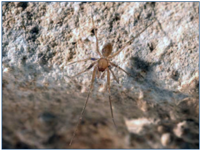
GOVERNMENT CANYON BAT CAVE SPIDER (neoleptoneta microps)
Photograph by Dr. Jean Krejca of Neoleptoneta myopica, to illustrate general external morphology.
GOVERNMENT CANYON BAT CAVE SPIDER (neoleptoneta microps)
Photograph by Dr. Jean Krejca of Neoleptoneta myopica, to illustrate general external morphology.
Description:
A small, yellowish, essentially eyeless spider.
Habitat:
Karstic (cavelike) formations of Bexar county, Texas.
Historic Range:
Historic Range is unknown, but likely similar to Current Distribution, with the exception of caves that have been destroyed or adversely impacted by development, other human activities, and non-native species like fire ants.
Current Distribution:
Known from two caves in Government Canyon State Natural Area.

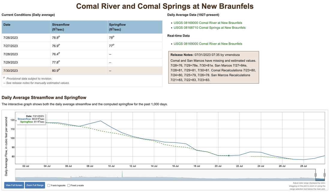

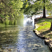
Comal Springs in 2012. Photo courtesy of photographer John Moler.
Comal Springs is in the National Register of Historic Places
By Rosemarie L. Gregory and Arlene K. Seales
September 22, 2019
September 22, 2019
When next you walk or drive through Landa Park the following are some interesting things you might keep in mind. New Braunfels’ Landa Park was named an initial Legacy Park of Texas. The William and Dolores Schumann Arboretum within Landa Park is considered a world class arboretum. The ancient oak within the arboretum was approximately 150 years old when New Braunfels was founded in 1845. It’s stated that Ferdinand Lindheimer — later known as the Botanist of Texas — took Prince Carl to view the majestic oak. During our local celebration of the Texas Sesquicentennial in 1986 the oak was named “Founders’ Oak” and it became the Living Memorial of the Sesquicentennial. In 2012 the ancient oak, now known as Founders’ Oak, was further honored by officially being recognized as a Famous Tree of Texas at a morning celebration of prayer, speeches, story — telling, music, dancing and singing under its outstretched branches in Landa Park. On May 30th of this year there was further honor brought to the area when Comal Springs (Main Springs), Landa Park, New Braunfels, Comal County, Texas was listed by the National Park Service in the National Register of Historic Places.
Here are interesting facts that led to the National Park Service listing Comal Springs (Main Springs), Landa Park, New Braunfels, Comal County, Texas in the National Register of Historic Places:
Comal Springs is comprised of a series of approximately 15 major and minor springs within Landa Park on the northwestern edge of New Braunfels in southeastern Comal County, Texas. The springs are the source of the 3.25-mile-long Comal River that flows southeast into the Guadalupe River. While the springs are found along a 4,300-foot stretch of the river, the nominated portion of Comal Springs is the secluded major spring west of Landa Park Drive, which best reflects the rural setting (as opposed to parklike setting) that was experienced by travelers along El Camino Real de los Tejas between 1691 and 1821. The nominated area includes the spring source and small portion (approximately 30 feet) of a channelized creek that flows south beyond the boundary, turns east to the Landa Park Drive Bridge, then northeast to meet the Comal River.
The Comal Springs site is on the Balcones Escarpment, which runs from southwest to northeast from Del Rio to Waco and marks the transition between the rugged limestone Hill Country of the Edwards Plateau and the flat expanses of the Blackland Prairies to the east. Impervious rocks on the southeast and limestone on the northwest form an underground barrier. Beneath the escarpment is the Edwards aquifer, a major water source that supplies water that is forced up through fault fissures that form springs at the surface. Comal Springs is the largest of those springs along the escarpment, with seven major springs and dozens of smaller ones occurring over a distance of about 4,300 feet (0.8 mile) at the base of a steep limestone bluff in Landa Park. Since Comal Springs was first recorded, the water has been noted for its clarity, a characteristic that is apparent today. The water temperature averages 73.6 to 75.0 degrees Fahrenheit. Ground water temperature increases with depth, and the water is believed to flow as much as 150 meters below the surface before reaching the springs.
Comal Springs has long been a dependable source of fresh water that has supported a unique ecological niche with a wide diversity and abundance of plants and animals. Today, the Edwards aquifer and its associated springs are vital to the provision of water for agriculture and municipal water supplies for San Antonio and other cities in the area. In New Braunfels, the Comal Springs also supports a regional recreation and tourism industry. Most importantly the Comal Springs provides critical habitat for the Fountain Darter, and other endangered species, as well as countless other flora and fauna. The Comal Springs are the principal source of water for the Comal River, which flows through Landa Park and New Braunfels before merging with the Guadalupe River. Comal Springs has been the site of prolonged and intensive use since the prehistoric period. Native American tribes camped around the springs for millennia. During the mid-nineteenth century, the springs were used to power a variety of industrial concerns, including a grist mill, saw mill, cotton gin and textile factories. The springs provided hydroelectric power from the late nineteenth through the midtwentieth century. All the industrial activity took place downstream of the spring outlets. The spring site also was, and remains a popular picnic and recreation spot.
Comal Springs served as a camping site for Native American tribes from the Paleoindian period (approximately 10,000 years before present) through the mid-nineteenth century. Spanish explorers discovered Comal Springs in 1691. The native tribes they found living there referred to it as Conaqueyadesta, translated as “where the river has its source.” A Spanish expedition, led by Domingo Ramon, reached Comal Springs in 1716. A short-lived Spanish mission, Nuestra Senora de Guadalupe, was located near the springs in 1756-1758. In 1764, the springs were visited by French explorer Louis Juchereau de St. Denis. Natural landmarks such as Comal Springs served to guide travelers, as natural defensive positions, as sources for food and water and as markers of political boundaries or property ownership. The location is also identified as a paraje, as Spanish entradas and other travelers noted stopping at the location before crossing the Guadalupe River. The springs, which emerge from faults in the Balcones Escarpment, offered Native Americans, Spanish explorers and travelers along El Camino Real de los Tejas a camp site that provided both water and food. The Spanish travelers called the springs “Las Fontanas.” During the nineteenth century, the spring flows were used to provide water power for a variety of industrial concerns. In 1898, Harry Landa opened a private park around the spring outflow sites, which the city of New Braunfels purchased in 1936 and has maintained as a municipal park. Comal Springs is nominated under Criterion A in the area of Exploration/Settlement at the state level of significance for its role in facilitating Spanish exploration during the seventeenth and eighteenth century under the Historic Resources of El Camino Real de los Tejas multiple property form. The period of significance spans from 1691 when springs were first encountered and recorded by Spanish explorers, through 1821, marking the end of Spanish Colonial Period in Texas.
The earliest historic-period Native American tribes in the vicinity were collectively referred to as Coahuiltecans. In addition to inhabiting the Comal Springs area, they lived throughout south-central Texas. During the eighteenth century, the Coahuiltecans were threatened, and eventually extinguished, by disruptions that began with the intrusions of several Native American groups, including the Jumano, Tonkawa, Lipan Apache, and Comanche tribes. The Jumano initiated extensive trading activities with the Caddo in East Texas and the Trans Pecos groups to the west. The Tonkawa, Lipan Apache, and Comanche entered the area from the Great Plains. Archeological investigations in the immediate vicinity of Comal Springs have uncovered sites associated with a variety of historic-period Native American tribes.
Comal Springs is a historically stable water source in an area where water supplies can be scarce, an asset that made it attractive for settlement by native people for millennia. These tribal groups created a network of trails for commerce, travel, cultural exchange, and raids, and they used the spring locations and major streams as campsites and as permanent settlement sites. As Spanish explorers entered the area during the seventeenth century, they used the existing trail network as a basis for their own explorations and thus created El Camino Real de los Tejas, a major travel corridor across Texas during the Spanish colonial period. The road and its many tributaries served as a conduit of trade, a strategic military route, and a supply line for the numerous missions established by the Spanish during the seventeenth and eighteenth centuries, including the short-lived Mission Nuestra Senora de Guadelupe. A network of evolving routes, El Camino Real developed over many years, with the earliest routes emerging from the trail blazing efforts of explorers Alonso De Leon (1690), Domingo Teran de los Rios (1691), and Gregoria de Salinas Varona (1693). By the early nineteenth century, El Camino Real also was an important route for immigrants traveling into Texas from Louisiana Territory. Proximity to El Camino Real was crucial to the success of early Spanish settlements as it served as a lifeline to market centers, military protection, and religious and civic institutions.
El Camino Real remained the basis of a major transportation route through the mid-nineteenth century. Military troops used El Camino Real repeatedly as a supply line and transportation route during the Mexican and Texas revolutions and the Mexican-American War. Sections of El Camino Real also were used during the Civil War, when East Texas cotton growers began shipping their crops to San Antonio, Laredo, and Mexico. Following the end of the war, however, newer shorter roads replaced large segments of El Camino Real. New markets shifted trade patterns from an east/west line of travel to one that extended from the south to the north. Railroad construction during the late nineteenth century further altered transportation routes throughout Texas, rendering many historic road alignments obsolete. Portions of older roads remained in use for local use, but most historic corridors diminished with each passing year, leaving little more than faint vestiges of their once well-worn alignments.
In 1937, a former regular stop on El Camino Real, the principal Comal Spring and those located to the west were modified as part of a larger park development project carried out by the Works Progress Administration. WPA workers altered the spring outlets by rearranging rocks to make the springs more visible. The rock retaining walls have been repaired as needed over the years, but no major alterations to the springs have been undertaken since 1937. A gravel path parallels the rock-lined channel that leads toward Landa Lake. No non-contributing resources are associated with the Comal Springs site. In 1936, the City of New Braunfels acquired the park and hasmaintained it since that time as a popular recreation and tourist destination. As such, the Comal Springs site is protected from unsympathetic development.

COMAL SPRINGS PHOTO GALLERY
Comal River, looking downstream
A view looking downstream from the large springs west of Landa Park Drive. This is called Spring Run 1.
Comal River, looking upstream
Looking upstream at Spring Run 1 toward the concrete steps and the large springs west of Landa Park drive. As you can see, water clarity is exceptional.
Comal Springs, view from above
A view of Spring Run 1 from the bluff just above the large springs.
Prehistoric food preparation site
The stone next to the large spring opening has traces of a thick shiny coating that archaeologists tell us is mostly animal fat built up over thousands of years of use in food preparation.
Spring-fed channel where wading is allowed
Most of Landa Lake is off-limits for swimming and wading because endangered species are present. Wading is allowed in this spring-fed channel that feeds the swimming hole in the photo below.
Public swimming section
New Braunfels residents and tourists flock to this swimming hole on hot summer days.
Landa Lake paddle boats
For $3 per person, you get 30 minutes of paddle boat time, but they are not real strict about it if you show up back at the dock a little late. It's a great way to see the Lake and also get some exercise!
Some large fish in Landa Lake
A school of large fish in Landa Lake. Endangered fountain darters are also present.
Spring fed swimming pool in Landa Park
Another attraction in Landa Park is this large spring-fed swimming pool, complete with bathouses and lifeguard protection.
Landa Park miniature train
Taking a ride on the miniature train is a good way to get a feel for the layout of the Park.
Founder's Oak in Landa Park
This tree in Landa Park is called the Founder's Oak. Legend has it that founders of New Braunfels held their first council meeting under the tree in 1845. Core samples taken in 1985 concluded that it sprouted in the year 1700.
Engraving of Founder's Oak
This image appeared in the Magazine of American History Illustrated in October 1888. Author Lee C. Harby wrote:
The first meeting of the council was held under a large oak in the lovely park of the Comal Springs. The tree was then crowned with verdure, and the gushing, sparkling water sang its song to the luxuriant caladiums which grew along its margin. Here the German girls came to fill their buckets, which they carried suspended from each end of a yoke which lay across the neck. These they still use, and very picturesque and un-American do the girls look in their straight skirts and short bodices.
Plaque erected by the Edwards Underground Water District at Comal Springs
Part of it says:
Visited in 1764 by French explorer St. Denis. Later a stop on El Camino Real. In 1845, the area was settled by German immigrants under Prince Carl Solms-Braunfels and called Las Fontanas. 1300 surrounding acres were purchased for $1,111.
Historical plaque for Nuestra Senora de Guadalupe Mission
Part of it says:
Good features at this site included five springs, fertile fields, timber, meadows and the nearby river. Two friars ran the small mission, with a citizen guard, so as to avoid friction. Four Spanish families and 47 Indians (27 of them baptized) comprised the inhabitants of this mission as of January 1757.
COMAL SPRINGS POSTCARD COLLECTION
Clemens Dam, 1900
The earliest postcard I have found of the Comal River. Mailed in 1900. This is Clemens Dam, just downstream from the Springs, which later became known as Stinky Falls. Published by B. E. Voelcker
This postcard was technically illegal, because it has a "divided back", with one side for the address and the other side for writing your note. Divided back postcards were not made legal in the U.S. until 1907, but apparently some manufacturers simply ignored this requirement.
Clemens Dam, 1900
Postcard manufacturers of the day would often share images. This card appears to use the same photo as above, but it was published by E. C. Kropp Co. in Milwaukee. Like the card above, it has a divided back and was illegal.
Clemens Dam, 1906
A 1906 view of Clemens Dam. This card was completely legal - the back says "Nothing but address on this side." Note how the manufacturer has left a small space on the front side for the note.
Comal River, circa 1906
Another legal card, with plenty of space on the front side for the note.
Scene in Landa's Park, 1906
The earliest postcard I have found of Landa Park - not mailed but has a penciled date of June 2, 1906.
Dam Across Comal River, 1907
A nicely colored view of Clemens Dam mailed in 1907. Made in Germany by B. E. Voelcker.
Lake Landa Park, 1907
A view of Lake Landa Park, postmarked September 9, 1907. Made in Germany by B. E. Voelcker.
Rustic Bridge and Water Wheel in Landa Park, 1907
In August of 1907 Miss Maynort wrote to Miss Elma Bright: You left too soon. Am still having a good time. See where I am.
Scene in Landa's Park, 1907
Mailed on August 10, 1907 to Miss Stella Masters in Swanville, Indiana. On the back, an apparent suitor lamented that she had gone far away and wrote: I am afraid we will not get to cross this bridge.
Landa Mills, 1907
In the early 20th century a variety of mills and factories were using Spring water for power and in their processes. At Landa Mills, products included oil, ice, and light.
View in Landa's Park, 1907
Produced by I. A. Hoffman in New Braunfels and mailed Dec. 28, 1907.
Water Wheel, Landa Park, 1907
A nice view of the water wheel in Landa Park, mailed in August of 1907.
View in Landa's Park, 1908
Postmarked Jan. 25, 1908. In those days postcards were like the text message of today, and it was expensive to send a lot of them. Ella Wise wrote to Miss Pauline Pepper: Thank you very much for your postal. You don't know how much pleasure it gave me. But I am sorry to say that I cannot correspond with all for I am not able to. So I hope you are satisfied with this postal because that is all I can send you and no more.
Scene in Landa's Park, circa 1908
An early view of the steamboat in Landa Park, mailed in August of 1908.
Water Fall, Landa Mills, 1908
Printed in Germany by B. E. Voelcker and postmarked August 1, 1908.
Falls near Landa's Mills, 1908
Postmarked Dec. 7, 1908.
Curt Teich card, 1900-1908
From the first series of cards produced by famous postcard producer Curt Teich. He always numbered his cards with a unique identifier, but in the beginning did not record production dates. From the copyrights on other images card collectors have deduced that Teich cards numbered in this range were produced between 1900 and 1908.
Swimming pool, Landa park, 1900-1908
Another card from the first series produced by Curt Teich, this one showing the swimming pool sometime between 1900 and 1908.
Minnehaha Bridge, 1909
A Real Photo card published by B. E. Voelcker and Son, made in Germany. Postmarked from New Braunfels on May 16, 1909.
Comal Springs, circa 1909
About 1909 B. E. Voelcker and Son produced a series of hand-colored Real Photo cards of Comal Springs and Landa Park. This one is postmarked from New Braunfels on April 14, 1909. There are a number of additional examples from this series among the cards below.
Water Power Flour Mill, 1909
A variety of industries used water power from the Springs, including grist, flour, and sawmills, cotton and woolen factories, a paper mill, an ice plant, and a brewery.
Water Wheel and Caladiums, 1910
A water wheel in one of the upper spring runs. Miss Lucille Stappes father wrote to her: How are you getting along. I am in the park writing this. - Papa
Postcard circa 1910
Not mailed or dated, but from the stamp box on the back the postcard dealer believed it was produced circa 1910.
Cotton yards, 1910
Cotton yard adjacent to the spring-water powered factory, 1910.
Landa Park, 1911
Postcard mailed in 1911 shows a scene in Landa Park.
Comal Springs hand-colored hard, 1911
A vey rare early hand-colored view of Comal Springs, produced by B. E. Voelcker & Son. Mail from New Braunfels on June 18, 1911. Mrs. Louise Davis had news for relatives: Dear Aunt Carrie - No doubt this will be a surpirse to all of you. I was quietly married last Wednesday and we are spending a few days in this pretty town.
Comal Springs sepia tone card, 1911
A sepia tone version of the card above by the Albertype Company. This card is unusual because the back is an advertisement for Albertype's services in producing sepia tone cards. One thousand cards cost $7.50.
Comal Springs hand-colored card, circa 1911
Another hand-colored card by B. E. Voelcker & Son, not mailed or dated but produced about the same time as the dated card above.
Comal Springs, circa 1915
An early 20th century view of the large spring next to Landa Park Drive before the concrete steps were built. Not mailed or dated, but produced between about 1907 and 1915.
Comal Springs lithograph colored card, 1915
Another early 20th century view. On the back, Leonard wrote: We made our hike all right and have sure got a nice place to stay. I think we will be here for a week or so but still send my mail to my old address. I'll get it alright.
Comal Springs hand-colored lithograph card, circa 1915
Produced by Bradford and Company, St. Joseph, Michigan.
Boat house and lake, Landa's Park, circa 1915
A view of Landa Lake circa 1915. Produced by B. E. Voelcker & Son in their typical hand-colorized style.
Philippine Pavilion, circa 1915
The gazebo was built in 1898 and was called the Philippine Pavilon. An article on the Sophienberg Museum website says the story is this gazebo was fashioned in the Oriental style so popular in the late 1800s when the United States was involved in the Spanish-American War, in which the first battles occurred in the Philippines (sophienberg.com, 2007).
Landa Industries Water Fall
Not mailed or dated, but appears to be circa 1910 - 1920.
Bridge in Landa's Park
An unusual sepia tone card with a hand-tinted blue sky. Also unusual because it was produced in New Braunfels; most cards of the day were produced in Germany or in printing houses back east.
Bridge in Landa's Park
Another version of the card above, also produced in New Braunfels by B. E. Voelcker & Son.
Steam boat in Landa Park
Not many people remember that steam boats used to ply the waters of Landa Lake. The card was not mailed or dated, but the style dates it as probably being produced between 1910 and 1915.
Boat house and steam boat
A view of a Landa Lake steam boat parked at its dock.
Landa Park, circa 1915
A view of the Lake circa 1910 - 1915.
Boaters on Landa Lake, circa 1915
Another view of the Lake in the postcard style that suggests a production date between 1910 and 1915.
Boating and fishing in Landa Park, circa 1915
The back says: Boating and fishing on Lake in Landa Park, in the heart of New Braunfels, Texas, where Nature did its masterpiece of beauty.
Landa Park swimming pool, circa 1915
A view of the swimming pool from the time when black and white striped bathing suits were in style!
Camp Placid, circa 1915
This area of Landa Park was known as "Camp Placid" around this time. A view of the swimming pool, bath house, and sleeping porches.
1916 view of Landa Lake
Mailed on August 16, 1916 to Mrs. Louis Hazelton in Chicago. Eunice wrote: Dear Aunt Lou. Arrived here in good health and all's well. Expect to stay a week. Albert is feeling well. Regards to all and my Muriel. With love, Eunice.
1918 scene in Landa Park
Mailed in August of 1918.
Bridge scene in Landa Park
A similar scene to the one above, but the tree next to the bridge appears to have suffered some storm or ice damage, so this one was probably produced slightly later. The cactus also appears larger.
Camp Placid, circa 1919
A view of the Camp Placid swimming pool, bath house, and sleeping porches. The Curt Teich production number indicates it was produced in 1919.
Landa's Park, circa 1920
The Curt Teich production number indicates this card was produced in approximately 1920.
Comal Springs, circa 1920
Another Curt Teich card produced in approximately 1920 showing oneof the main spring runs.
Japanese Pavilion and Rustic Bridge, 1924
A Curt Teich card with a production number that places the scene in 1924. The Philippine Pavilion is identified here as the Japanese Pavilion.
Lovers Retreat in Landa Park, 1924
Another Curt Teich card with a 1924 production number.
Comal River Bridge, 1924
Apparently Curt Teich imaged New Braunfels heavily in 1924; this one also has a production number from that year.
Planters and Merchants Mill, 1924
Yet another Curt Teich card with a 1924 production number.
Comal Springs, Landa Park, circa 1925
Not mailed or dated, but is from the "White Border Period" of postcards that lasted from 1915 to 1930. Probably produced mid 1920s.
1927 postcard
A handwritten date on the back is "July 4, 1927." Perhaps a memento of someone's holiday visit to Landa Park.
Comal Power Plant, 1927
Hydroelectric power was generated using springflows as early as 1890. This power plant in Landa Park was built in the 1920s and operated until 1972. It sat vacant and decrepit for many years, until 2004, when a project began to re-develop the site into loft apartments.
Another view of the Comal Power Plant
Another view after an expansion that doubled the plant's size.
View of Landa Lake, late 1920s
A view of the northwest end of the Lake. Never mailed. Produced by the same manufacturer and about the same time as the card above. The gazebo pictured is still there.
Greetings from New Braunfels, circa 1935
Not mailed or dated, but dated to roughly 1935 as it straddles the "White Border" period of postcards and the "Linen Card Era" that began about 1930. It appears highly yellowed but really is not - the border is printed with the reddish tinge.
Landa Park, circa 1939
A Real Photo card mailed in October of 1939.
Comal Springs, circa 1940
A Real Photo view of the Springs, mailed in August of 1940.
Landa Park bath house, 1941
On August 17, 1941 Sally wrote J.R. and Claire: I am having a good time on my vacation. There are lots of pretty parks, pools, and mountain drives and we have a big rock cottage up on a mountain - it overlooks the Comal Springs and Guadalupe River. Daddy is coming today. Love, Sally.
Landa Park waterfall, circa 1942
From the same Seidel Studio production run as the card below, which was mailed in 1942, so I am dating it to approximately that time.
Postcard mailed August 6, 1942
By 1945 there was a highly colorized version of this scene, an example is several cards below.
On the back of this one, Roberta wrote: Dear Polly - Had an all day picnic in this beautiful park.
Postcard mailed June 12, 1943
On the back of the card, Frances wrote to Miss Lucille Brown of Borger, Texas: Hi Pal - Surely bet you'd like this cool place - lots of fishing, swimming, boating. Better come on down. I came on Friday - will return Sunday. Be good. Love, Frances.
View of springs, 1945
This postcard mailed on July 4, 1945 shows the rock walls and steps that still surround the largest of the Comal Springs have remained basically unchanged for over 60 years.
Landa Park swimming pool, 1945
Mailed in August of 1945, the back caption says: This is the largest swimming pool in the South. Five million gallons of water flow through it daily; modern bath house accommodates 500 bathers. Landa Park is famed as the beauty spot of Texas.
Circa 1940s view of Landa Park swimming pool
A view of the swimming pool circa late 1940s. The back caption says: Landa Park Swimming Pool, where thousands swim weekly. 70 degrees year round temperature. Millions of gallons of Spring Water continuously flow through this pool.
Circa 1940s view of Landa Park swimming pool
Another view of the swimming pool circa late 1940s. The back caption says: This is the largest swimming pool in the South. Five million gallons of water flow through it daily; modern bath house accommodating 500 bathers. Landa Park is famed as the beauty spot of Texas.
Landa Park motorboat trips, circa 1955
The drought of record in the 1950s appears to have seriously impacted postcard production in those years. This is the only one of Landa Park I have seen, postmarked April 11, 1955. The springs were almost dry from June to November of 1956.
Evelyn Lois Peterson at Landa Lake, early 1960s
This is Evelyn Lois Peterson, who had been a model, actress, and Copa girl in New York before returning to New Braunfels to marry a local physician. She was featured in Life magazine twice. Her experience in modeling and publications probably explains why she was asked by local publisher Seidel Studio to appear in the card. The photographer was Joe Faust.
Very seldom is it possible to attach a name and a story to any of the people depicted in these vintage cards, so it was great to receive this information on Ms. Peterson from her granddaughter.
The postcard was mailed on July 20, 1962.
Landa Park swimming pool, circa 1960s
A view of the Landa Park swimming pool that appears to be circa 1960s
Spring Run 1, circa 1960s
A view of the main spring from Seidel Studios in New Braunfels. Appears to be circa 1960s.
Children's Pool, Landa Park, 1971
A section of Landa Lake used to be sectioned off as a children's pool.
Report on New Braunfels in Scientific American, 1849
It didn't take the industrious German settlers long to begin harnessing the power of the Springs. This article from the March 31, 1849 edition of Scientific American extolled the new little town's promising prospects.
By 1860, seven grist, flour, and sawmills were using the Spring waters for power. There were also cotton and woolen factories, a paper mill, an ice plant, and a brewery. Hydroelectric power was generated using springflows from 1890 until about 1950 (Brune, 1981). New Braunfels merchant Joseph Landa purchased the site in 1860, and by the 1890s it had become known as Landa's Pasture and was a popular picnic and recreation spot.
Scene on Comal River
This engraving appeared in Homer S. Thrall's 1879 travelogue called A Pictorial History of Texas, From the Earliest Visits of European Adventurers, to A. D. 1879.
Ferry on Comal River
Another engraving from Thrall's 1879 travelogue.
Comal River
A third engraving from Thrall's 1879 travelogue of a scene on the Comal River near New Braunfels.
Roeder's Mill on the Comal River
This image appeared in the Magazine of American History Illustrated, November 1888.
New Braunfels 50 year anniversary, 1895
An RSVP envelope for New Braunfels' 50th anniversary in 1895 highlighted the little city's abundant water, declaring it had "The Finest Water Power in the State of Texas" and "The Most Complete Water Works in the South, supplied with pure Spring Water."
LANDA PARK
Landa's Park, 1899
In 1897, Helen Gould, daughter of railroad financier Jay Gould, visited Landa's Pasture and was impressed by its beauty. She suggested that the International and Great Northern build a spur into the property. The Missouri, Kansas and Texas railroad also built a track into the park. By 1899, the railroads were offering 'very low excursion rates' to attract tourists from San Antonio and Austin, and they sponsored special music events, such as concerts by Carl Beck's Military Band. The Pasture became known as Landa's Park and grew into one of the most popular resorts in the Southwest.
Comal Baths, circa 1900
The city of New Braunfels opened the Comal Baths in 1900, where children and adults learned how to swim. Today, the city still conducts thousands of swimming lessons each year.
A Texas Eden, Landa Park, circa 1900 - in 3D
Get out your 3D glasses to view this vintage stereoview published in 1900 by the Keystone View Company. Click to enlarge, it's just like being there.
Shady Nook, Landa Park, circa 1900, Keystone Views stereoview
3D glasses also required for this one. The back says:
"Must I carry a revolver in Texas for protection; must I, really must I?" earnestly asked the conscientious tourist. "Stranger," replied the Texas; "you might not need a revolver in Texas at all; and then you might need it awful bad, and need it awful quick."
But those rough frontier days are gone. Order and security, wealth and luxury, culture and bounty have taken their place. The largest state in the Union is bent on making its excellence equal to its vastness. The future home of twenty-five millions of people is being set in order and adorned. Landa's Park, beautiful by nature, will be made more inspiring by art. It is at New Braunfels, a city founded by Prince Braunfels in 1845, at the confluence of the Comal and Guadalupe rivers, 50 miles southwest of Austin and 30 miles northeast of San Antonio. This prosperous and public-spiritited town is a type of many that are transforming the old Texas into a name of greatness and honor.
The Oasis of Texas, 1904 (pdf download is 91 mb)
In 1904 the Landa Estate produced its second edition of The Oasis of Texas, a 30 page treatise on the area's history, its industries, and the park. After gushing about New Braunfels for 28 pages, Harry Landa finally concedes:
This scribe feels the poverty of his vocabulary, for one may bankrupt all the lexicons of all the languages and not flatter this heavenly spot.
Radium at Comal Springs, 1921
An advertisement from the San Antonio Express-News, June 29, 1921. Nowadays the notion of radium in water tends to cause concern; the truth is that almost all water on Earth contains small amounts of naturally occurring radioactivity.
By 1922, Landa Park was drawing over 100,000 visitors per year. In 1926, the park was sold along with much of the Landa estate to J. E. Jarratt of San Antonio. On Easter Sunday in 1931 the Park officially opened for its 37th year, but within a few years, as the Depression took hold, the owners were forced to close the Park and surround it with a barbed-wire fence. Local residents organized a petition drive to hold a bond election aimed at providing funds for a city purchase. In 1936 the city purchased 128 acres including the headwaters and adjoining springs, and two additional tracts totaling 72 acres were purchased later (Landa, 1945 and Haas, 1968).
Landa Park picnic, February 8, 1928
An early photographic view of the large spring west of Landa Park Drive. Another photograph from the same roll identifies the ladies as Mrs. Gough, Isabell Stark, Mrs. Frey, APJ, and Viora Frey. On the back, one of them wrote: "Section of Comal River. In one place it is 12 feet deep and the bottom is seen as clear as though there was no water."
With the purchase and consolidation of the headwaters properties by the city, and with the establishment of nearby resort parks like Camps Giesecke, Ulbricht's, and Warnecke (more on those farther down this page), New Braunfels grew into the epicenter of regional water recreation. When new interstate highways opened in the late 1950s, all the elements were in place for a regional synergy. Since San Antonio and the Alamo are only 30 miles away, families in station wagons from far and wide could spend a few days exploring the historic missions and battlegrounds of old San Antonio, and then spend a few days basking in the natural aquatic wonders of New Braunfels.
New Braunfels Vacationland, circa 1942
Even today, it is difficult to overstate the importance of water recreation to the economy of New Braunfels. This tourist brochure from about 1942 featured, what else, water.
OTHER PHOTOS
Stinky Falls in 2009
In the old days, before the sidewalks were built, there was a lot of risky diving from the raised platform on the right. The New Braunfels Tube Chute is seen entering the River on the left.
New Braunfels Tube Chute
If you don't have the $40 bucks to get into Schlitterbahn, the city-owned New Braunfels tube chute is almost as good and lots cheaper.
Clemens Dam and the Comal River
Just below Clemens Dam, the Comal River teems with people on a hot summer morning in 2009.
Schlitterbahn Waterpark
The Schlitterbahn Waterpark, on the site where Camp Warnecke was located, is consistently ranked as the best water park in America.
Camp Landa, circa 1940s
Not mailed or dated, but from the linen post card era that lasted from about 1930 to 1945. At this address today is The Resort at Schlitterbahn, adjacent to the park itself and offering a wide variety of accommodations from hotel rooms to vacation homes and condos. The caption on the back of the card says: This spring fed pool, plus Camp Landa's new modern, one and two bedroom cottages, and our recreational facilities make Camp Landa an ideal place for YOUR family vacation.
Bedroom at Camp Landa, circa 1940s
A few of you probably remember what your summer cottage bedroom looked like. The back caption says: New motel accommodations, quiet surroundings, vented heat, air conditioning, swimming pool. Also units with kitchens.
Water wheel at the Rapids, circa 1926
This card and the one below are the earliest I have found of Camp Warnecke. Produced by Curt Teich of Chicago, the production numbers on the bottom right indicate both were produced in 1926.
Low water bridge, circa 1926
A group of Camp Warnecke canoes are seen tied to the bank at left.
Camp Warnecke, 1940
Canoes on the Comal River at Camp Warnecke. Not lithographed but an actual photo, produced by the Seidel Studio in New Braunfels and mailed in October of 1940.
Camp Warnecke, 1940
Another photographic card by the Seidel Studio in New Braunfels from about 1940.
Camp Warnecke cabin, 1940s
A view of one of the cabins about 1940.
Camp Warnecke entrance, 1940s
A view of the entrance to Camp Warnecke in the 1940s.
Camp Warnecke, 1941
A Real Photo card mailed in 1941.
Warnecke's Camp, 1943
Mailed from New Braunfels in September of 1943. The back says: New Braunfels camp of distinction, where swimming, boating, and fishing is the byword on the Crystal Clear Comal.
Camp Warnecke, 1944
Mailed in July of 1944. Marie wrote to the Mittag family in Eunice, Mexico: Here we are at Camp Warnecke having fun. Sure wish you were here. Will try to see you this summer. Mom said she will drink a beer on Uncle Max. Love, Marie.
1940s postcard
A group of tubers that look like they are preparing to form a train and shoot the rapids. Not mailed or dated, but the linen stock suggests it was produced in the 1940s. The caption on the back says: Warnecke's Camp, New Braunfels camp of distinction, where swimming, boating and fishing is the byword on the Crystal Clear Comal.
The Rapids, Warnecke's Camp
This one includes an unusual water wheel whose function is unclear.
Camp Warnecke Life magazine story, 1951
Camp Warnecke made it into Life magazine in 1951 as part of a photo essay on how Americans deal with the summer heat.
Camp Warnecke, 1950s
A 1950s era postcard from Camp Warnecke. The Camp had little cabins all along the shady banks of the Comal River. In 2009 Jim Walters recalled they were true cabins, with no refrigerator, just an icebox. In the 1950s, summertime stays at Camp Warnecke were a tradition for his family. He declared that: Heaven is bound to have such a river, where you can just float along on a hot afternoon, without a care in the world, exerting no energy and feeling no stress. (Walters, 2009)
Camp Warnecke, "Home of the Rapids", 1950s
A "Bursheen" finished Color-Litho card, made only by the MWM Company of Aurora, Missouri: Beautifully shaded acres on the crystal-clear Comal River. Both summer cottages and modern apartments at reasonable prices. Finest swimming in the State of Texas.
Camp Warnecke, 1960s
Shooting the rapids in a long train was a popular tradition until Camp Warnecke closed.
CAMP ULBRICHT AND CAMP GIESCKE
Ulbricht's Summer Resort, 1930s
Other resorts on the Comal River included Ulbricht's and Giesecke's. This card was not mailed or dated, but the linen stock suggests it was produced between 1930 and 1944.
Ulbricht's Summer Resort, circa 1935
A Real Photo postcard showing an aerial view of Ulbricht's Summer Resort. It was produced by the EKKP company, a major national producer of Real Photo cards in the 1930s and 40s. This one was not mailed or dated, but the narrow white margin is characteristic of other EKKP cards produced in the mid 1930s.
Ulbricht's Summer Resort, circa 1940s
A Phototone card by the Federal Printing Company of Chicago. Not mailed or dated, but the deckled edge was popular in the 1930s and 40s.
Ulbricht's Summer Resort, 1940s
Mailed in August of 1945. The back caption says: On the banks of the Comal River, within the city limits, are Camp Warnecke, Camp Ulbricht, and Camp Giesecke. Accommodations are modern here, where cooling gulf breezes fan the city, which is located just below the escarpment of the Edwards Plateau at the entrance to the scenic Southwest Texas "Hill Country."
Ulbricht's Summer Resort, 1947
The artistic license that lithographers took in creating colored postcards is evident by comparison with the card above. This Real Photo card mailed in 1947 apparently served as the base image for the highly colorized version above.
Ulbricht's Summer Resort, 1962
Another view of Ulbricht's Summer Resort, mailed in 1962.
Camp Giesecke, circa 1915
So far, the card at left and the one below are the only two images of Camp Giesecke that I have seen.
Camp Giesecke, circa 1960s
This card was included in a collection of 18 images that were featured in a postcard mailer marketed to tourists. Unlike other collections, they were not intended to be separated and mailed as individual cards - the entire booklet was mailed with all the accordion-folded images intact.
Enlarge the image below to figure out where the cabin you had as a kid would be today on the Schlitterbahn site.
Plat of Camp Warnecke, 1956
Same approximate area, 2014


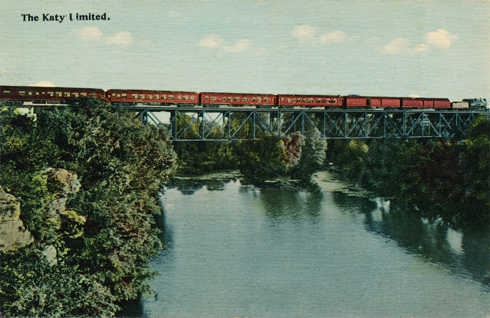
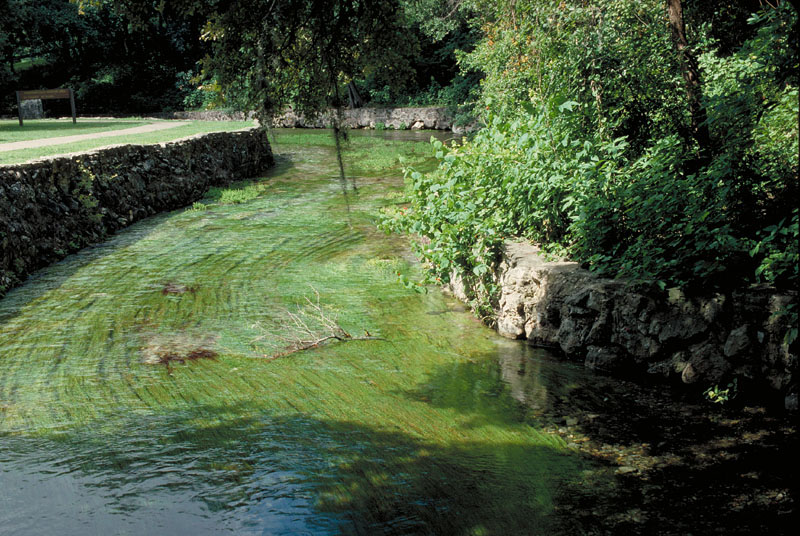
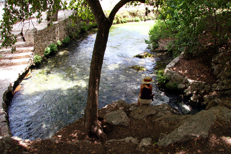
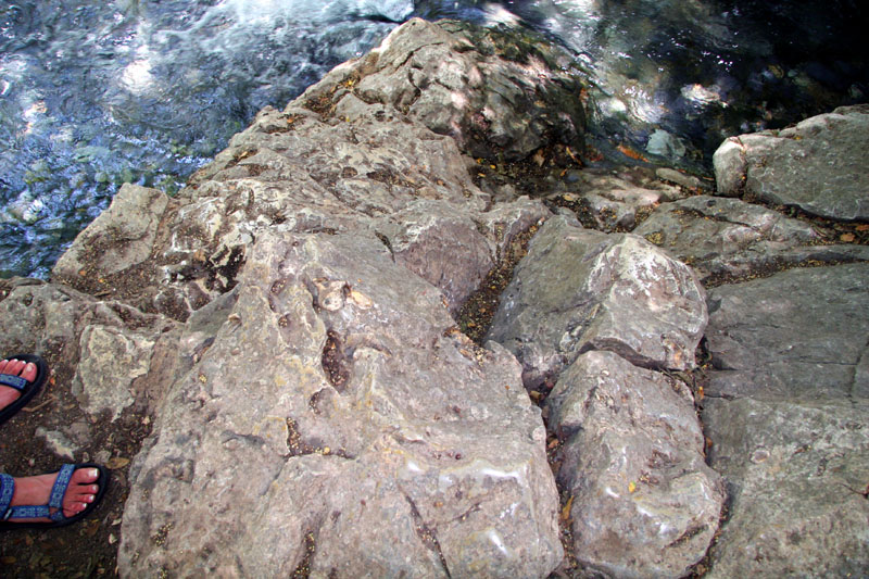
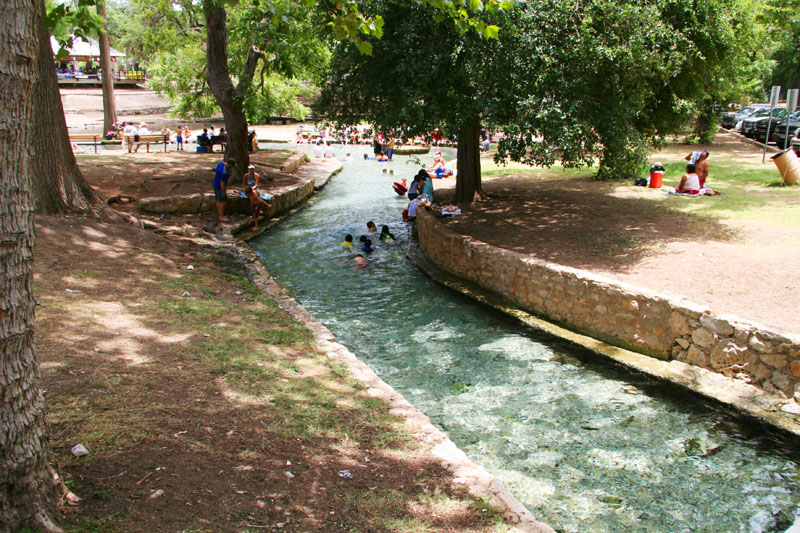
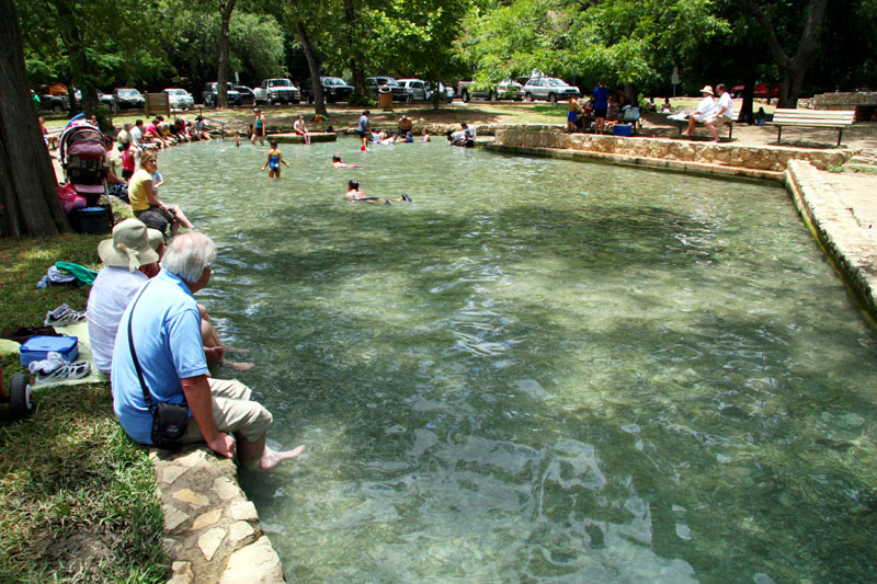
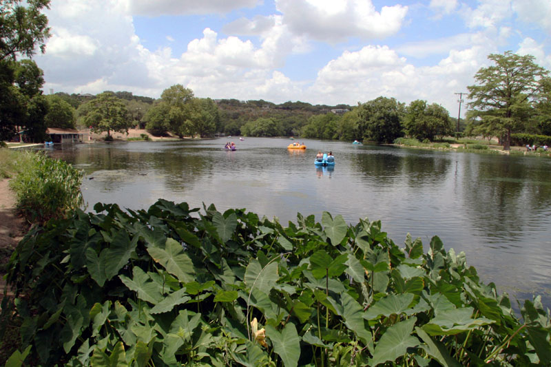
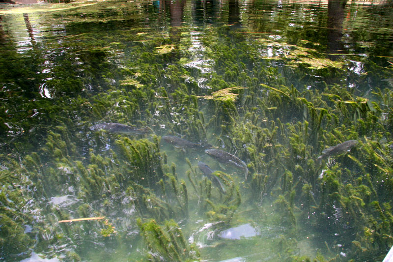
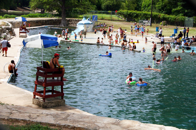
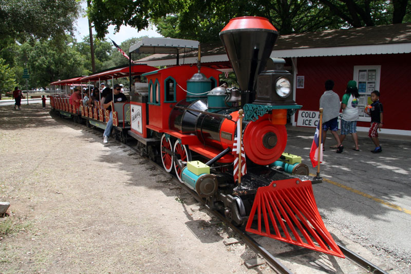
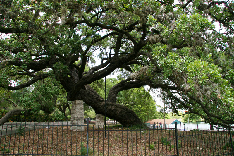
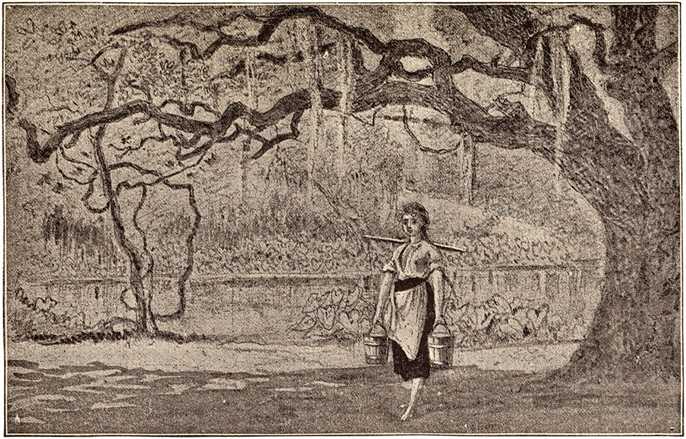
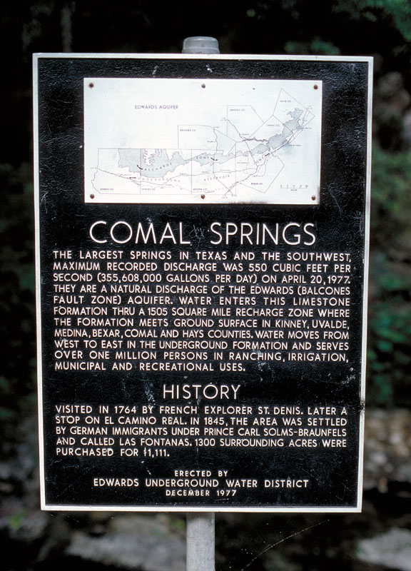
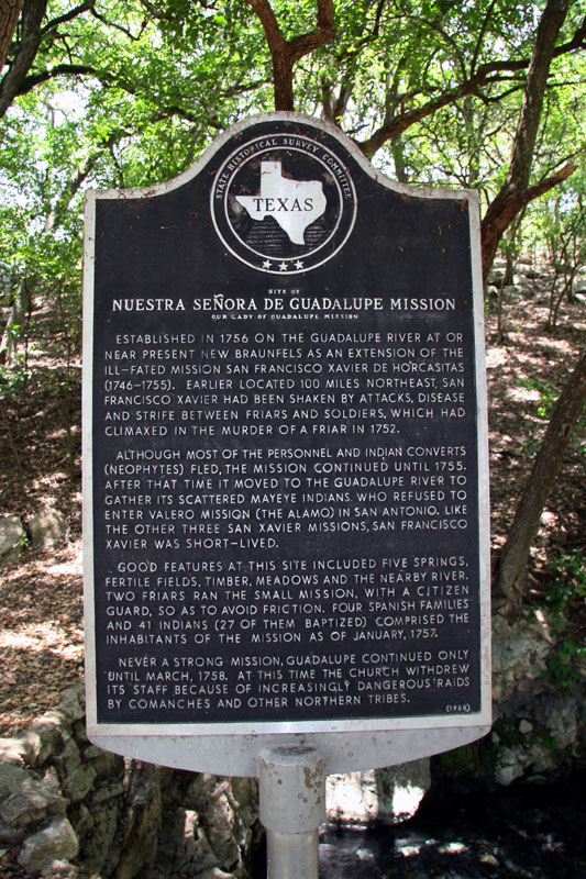
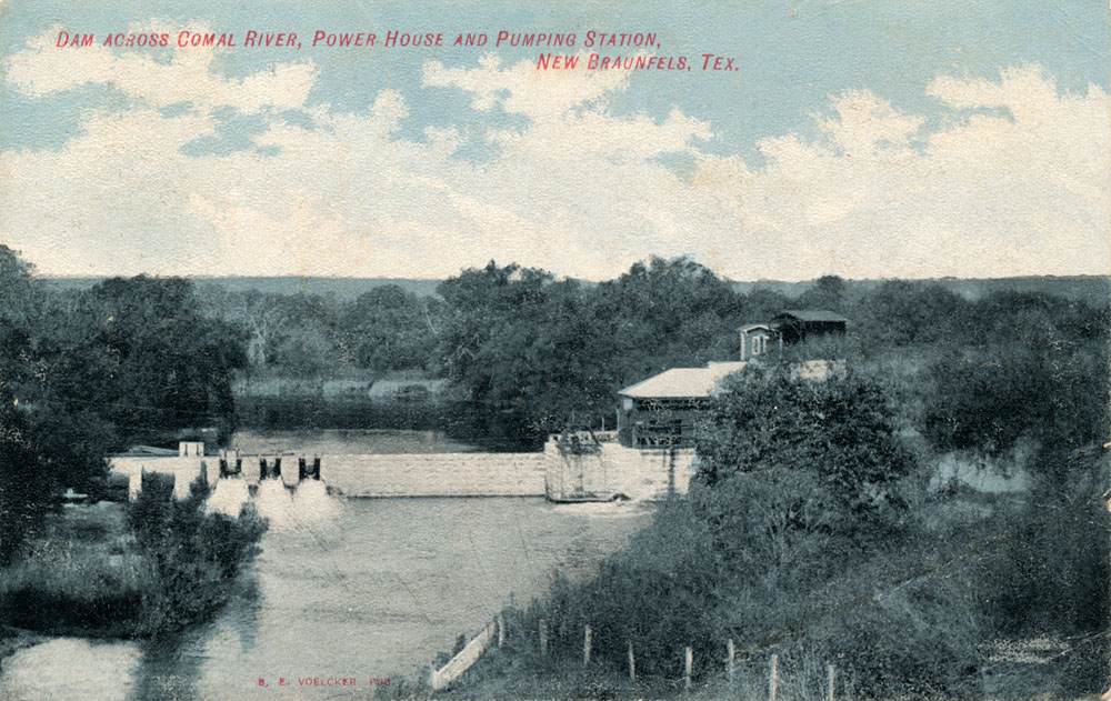
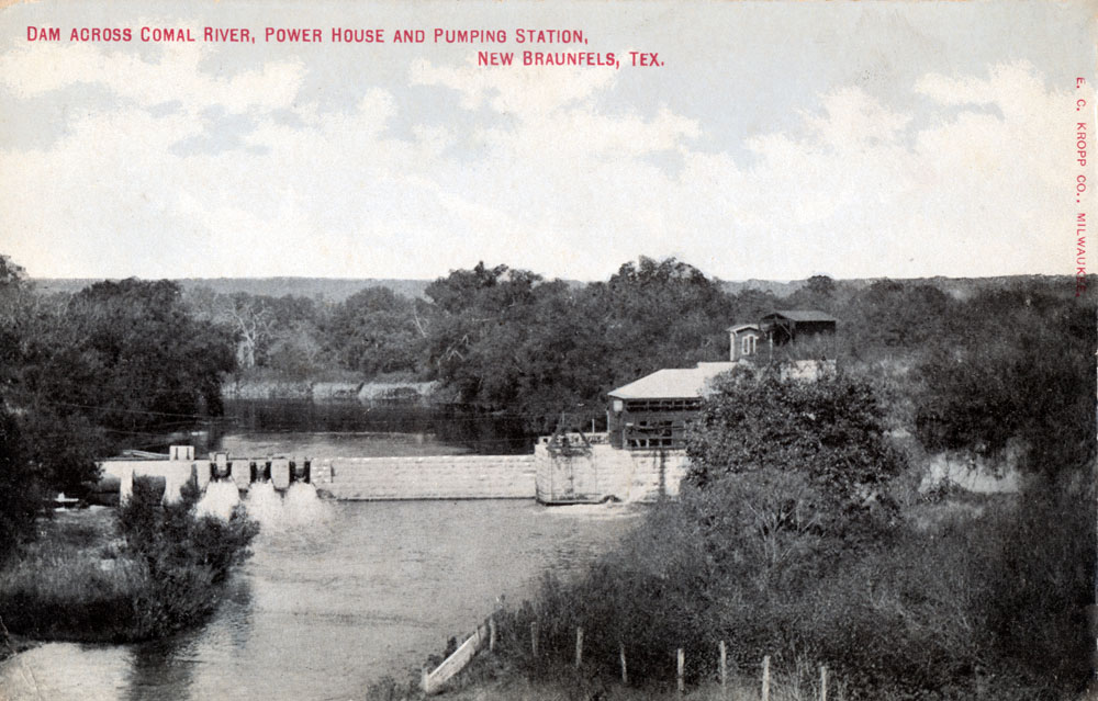
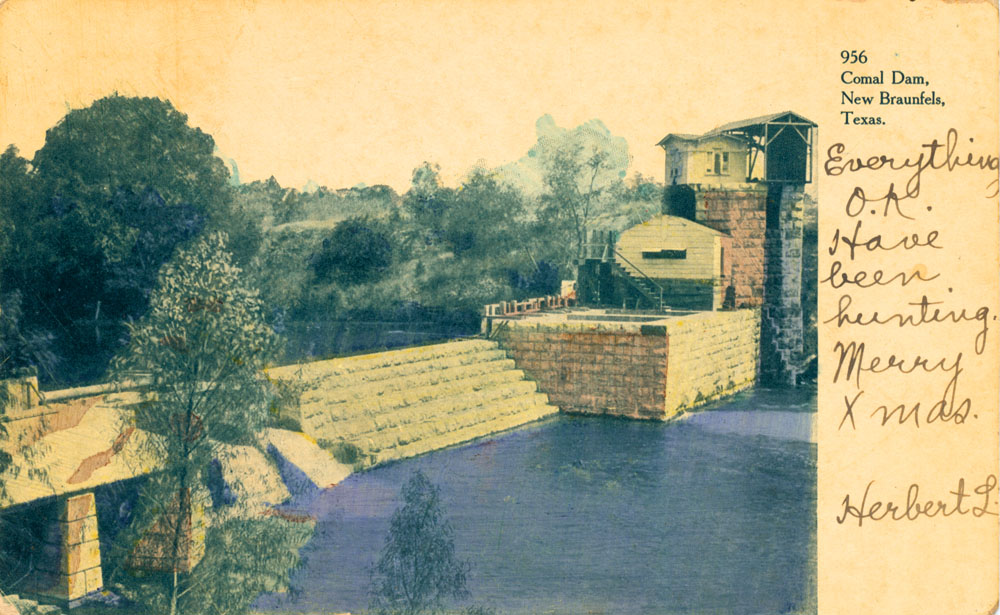
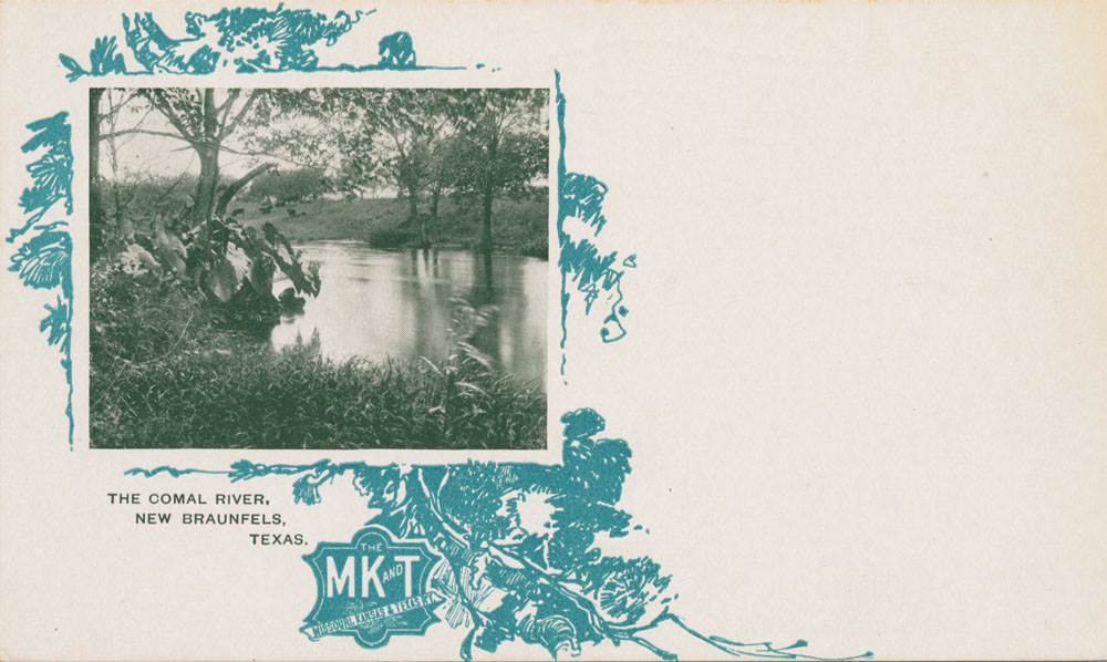
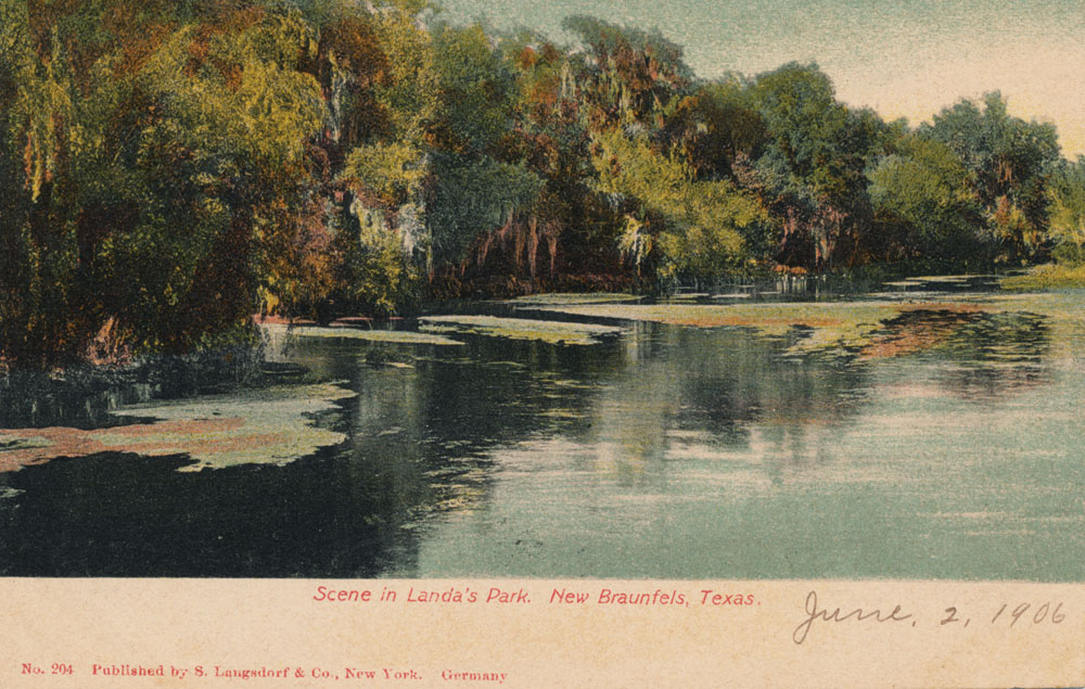
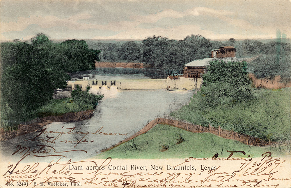
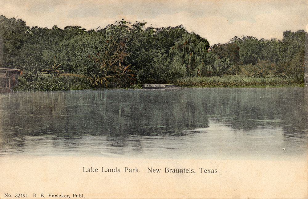
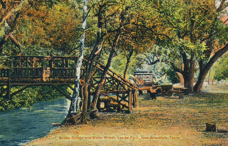
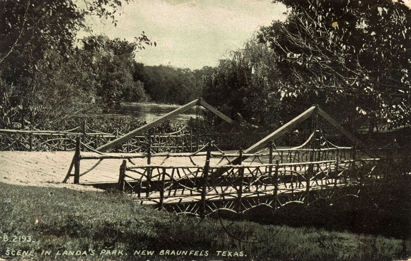
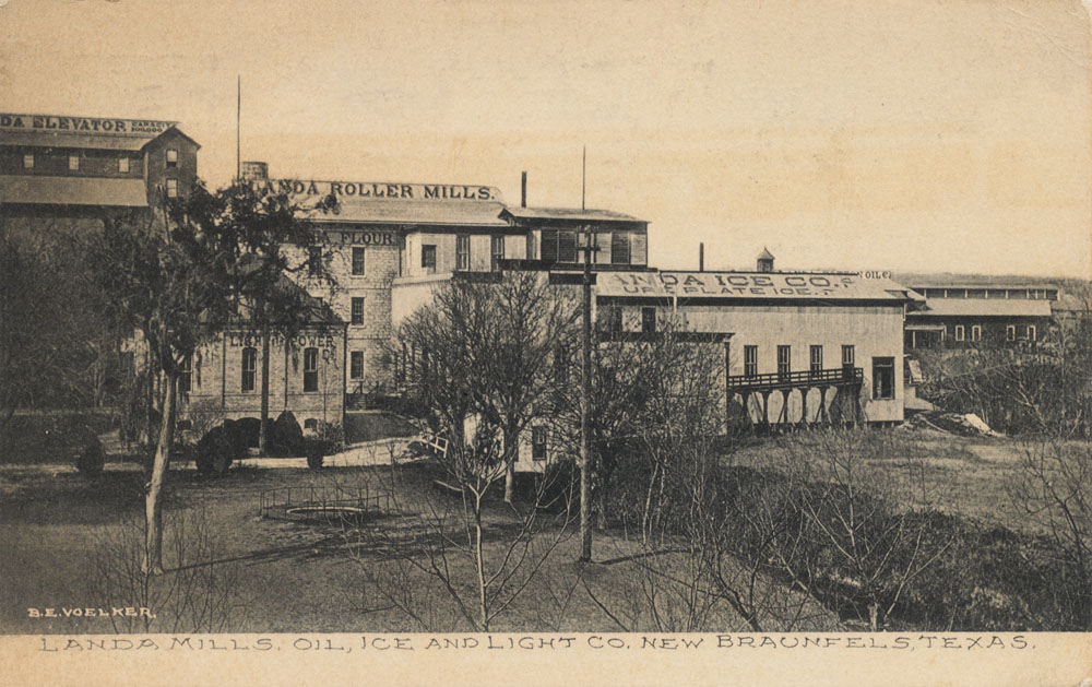
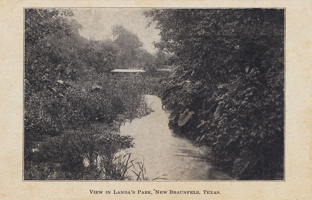
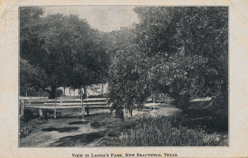
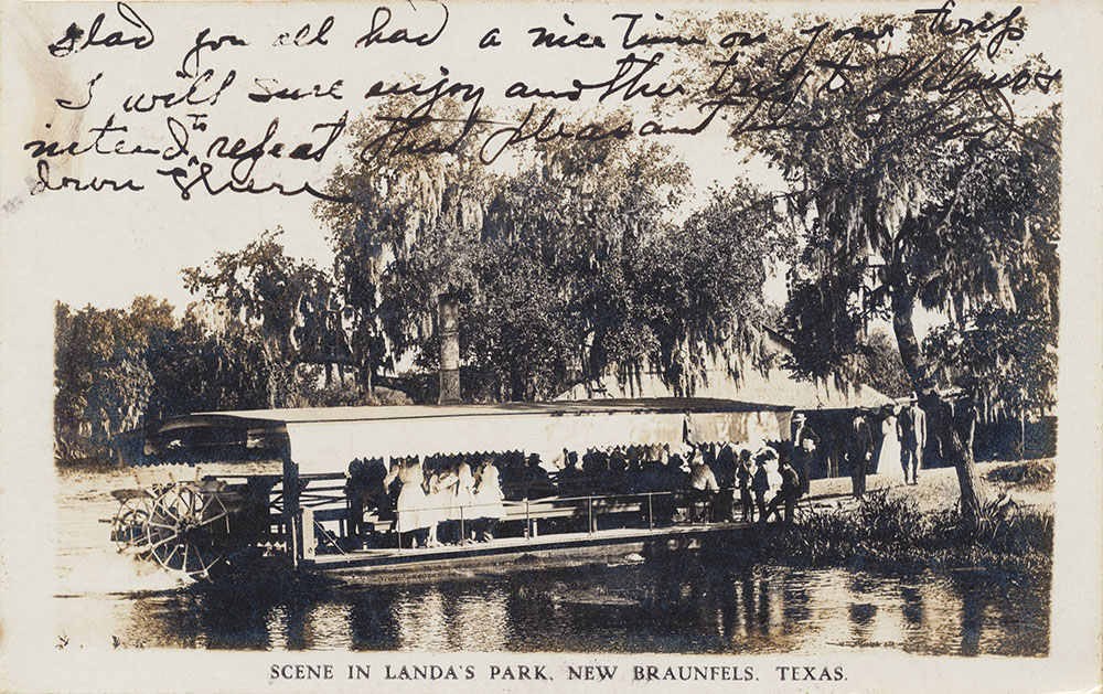
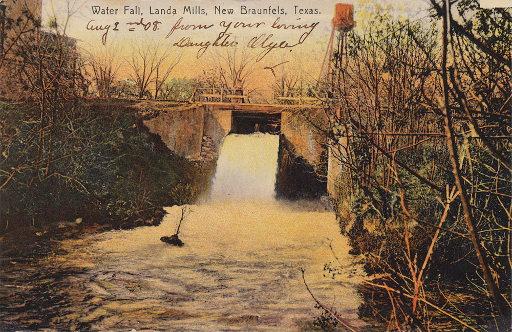
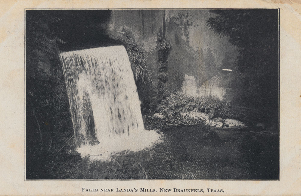
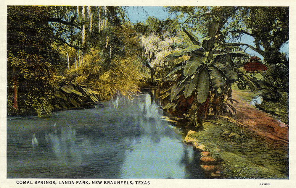
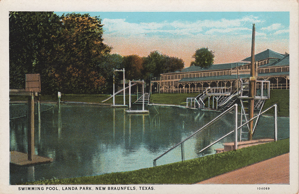
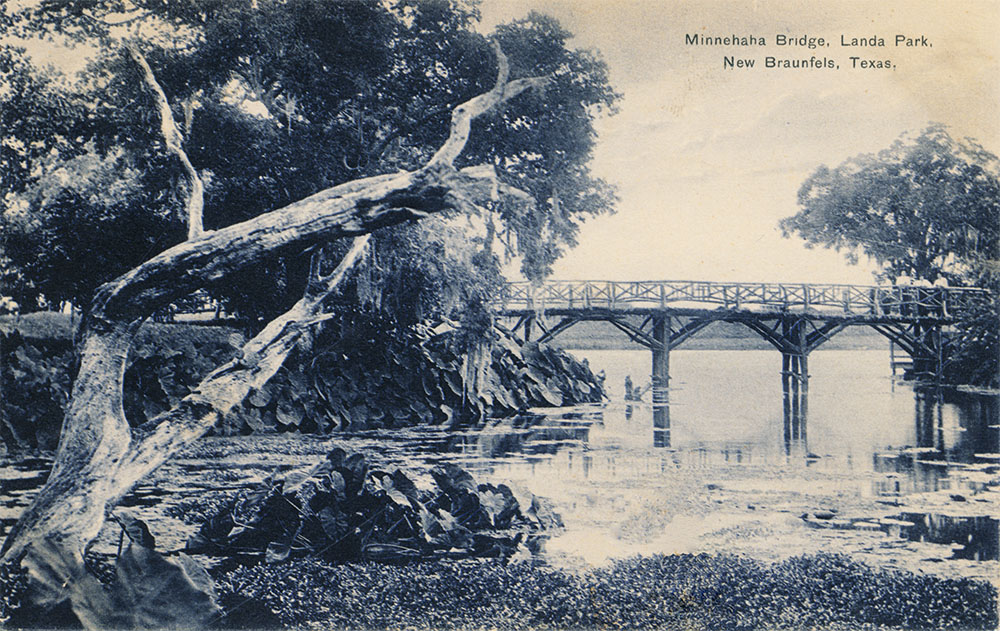
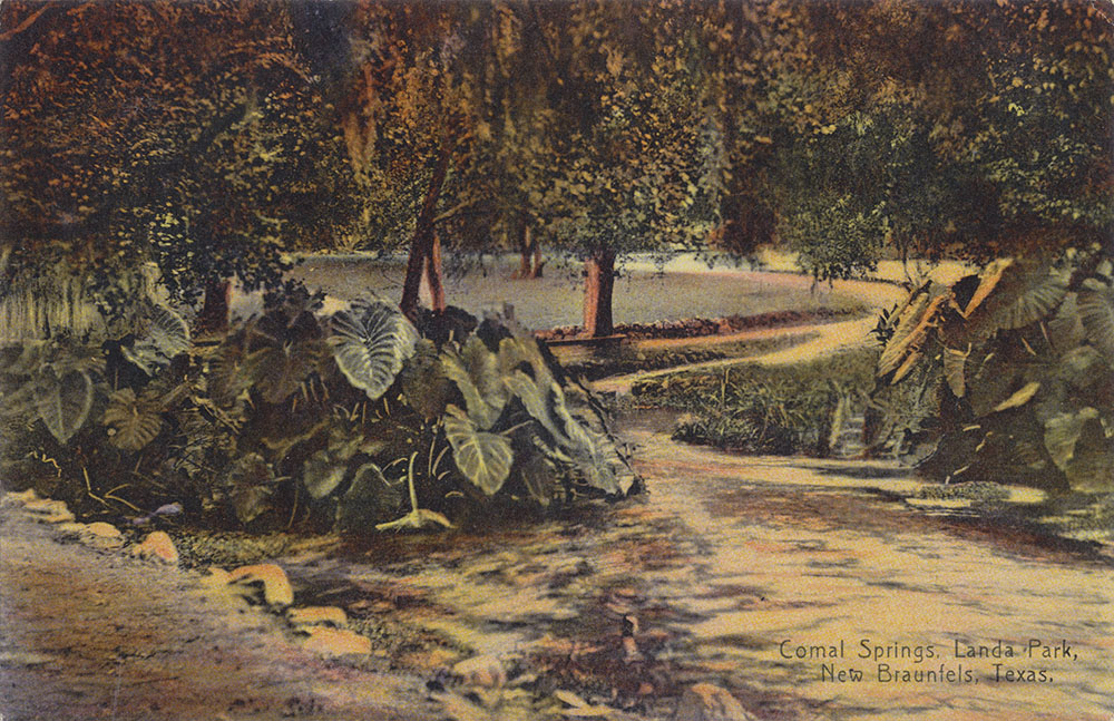
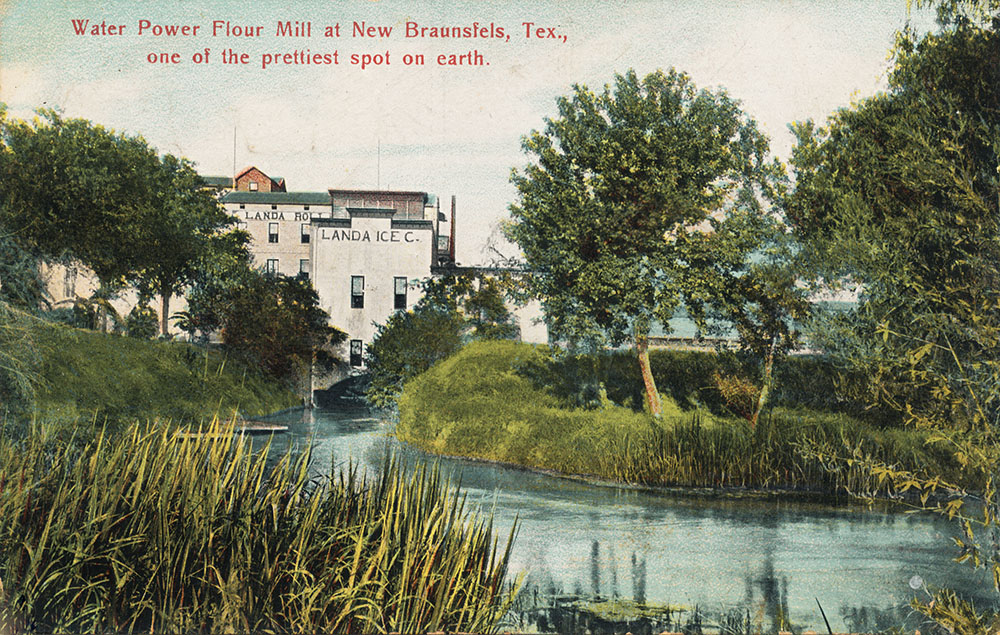
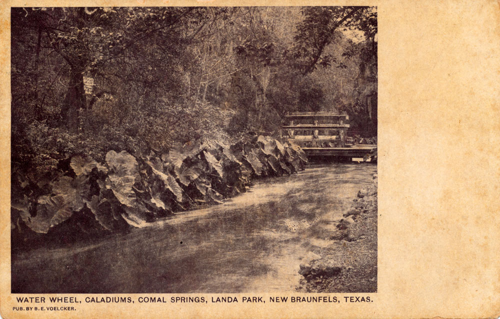
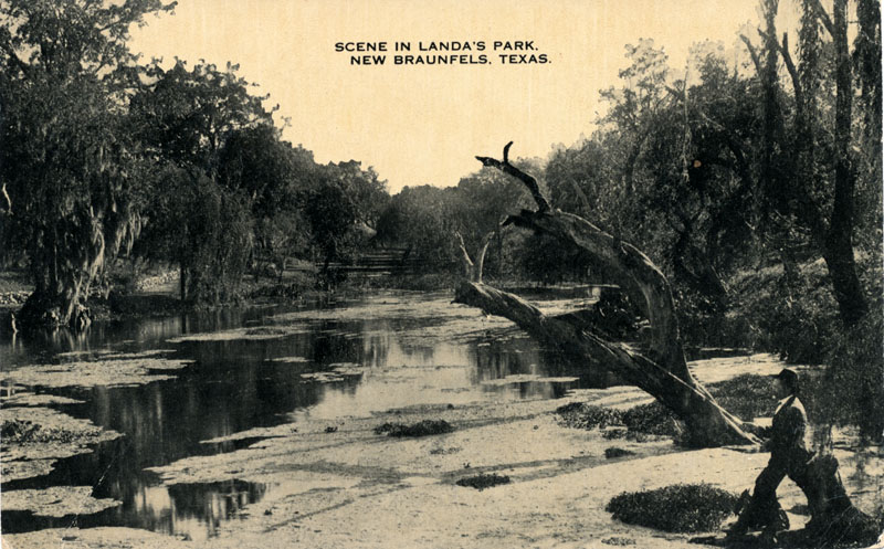
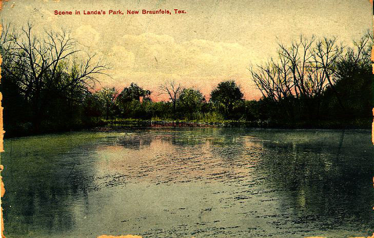
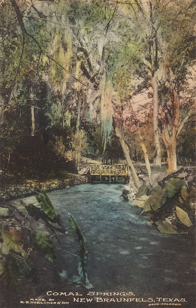
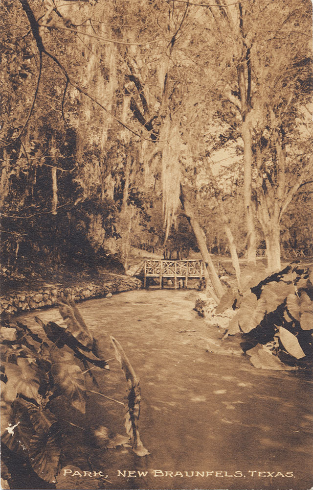
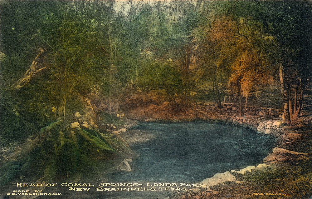
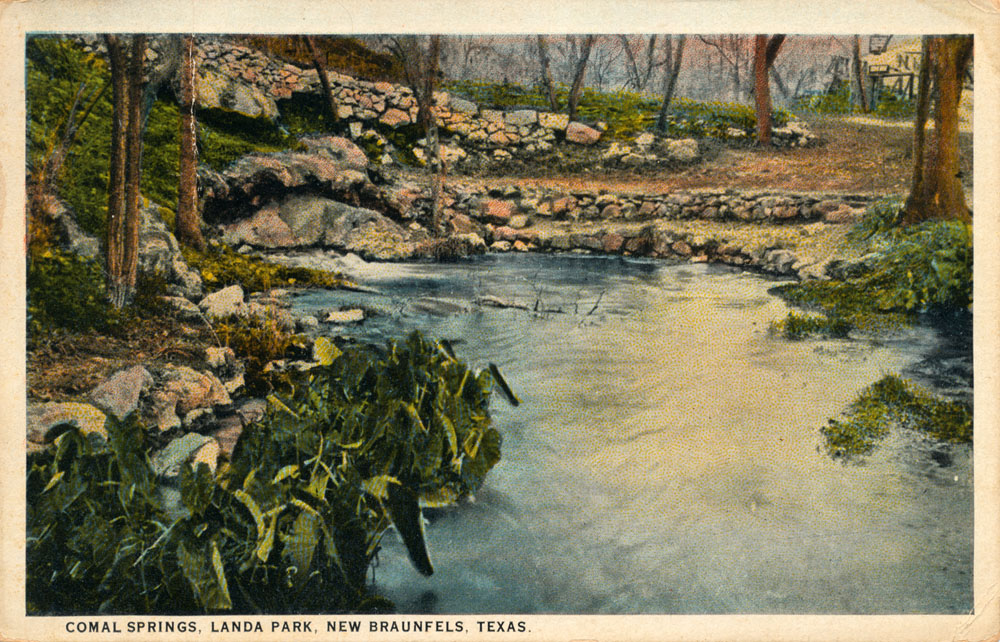
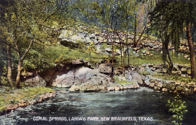
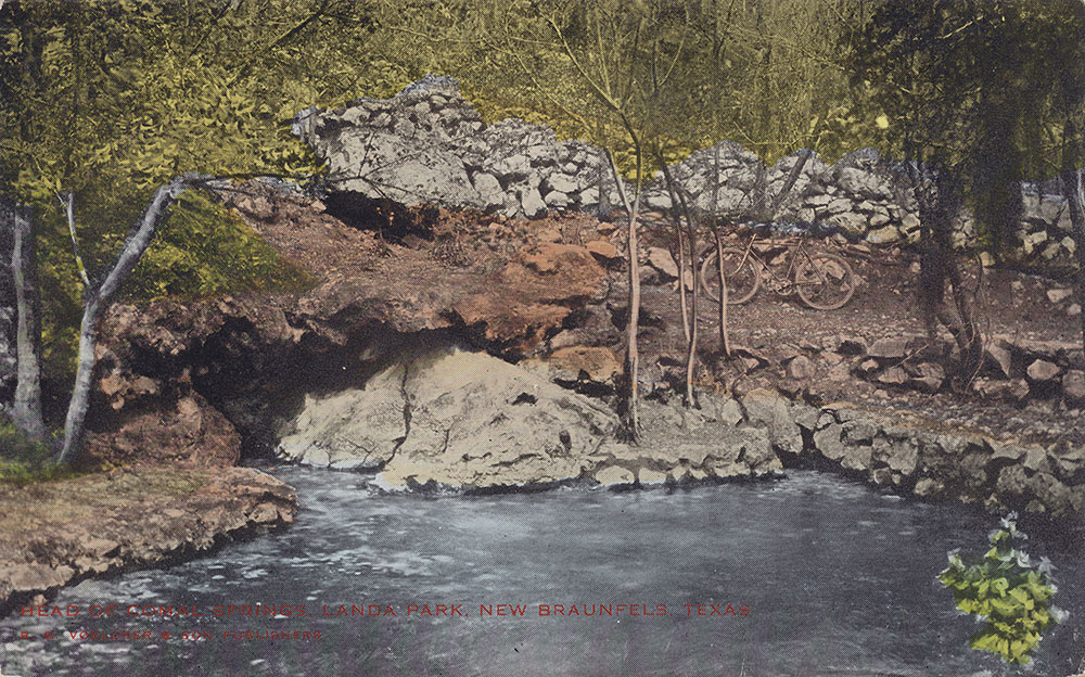
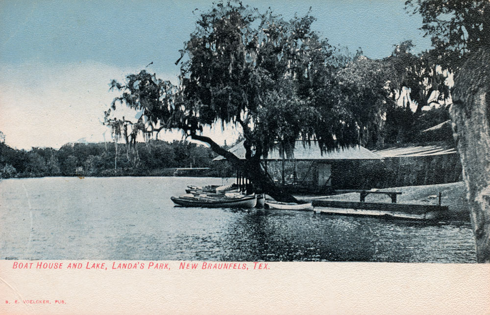
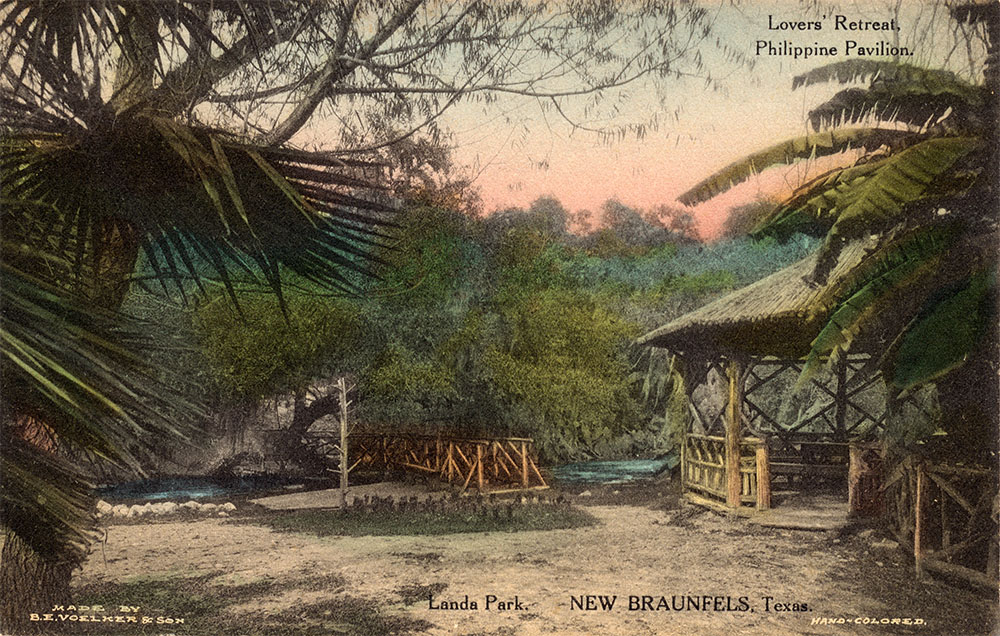
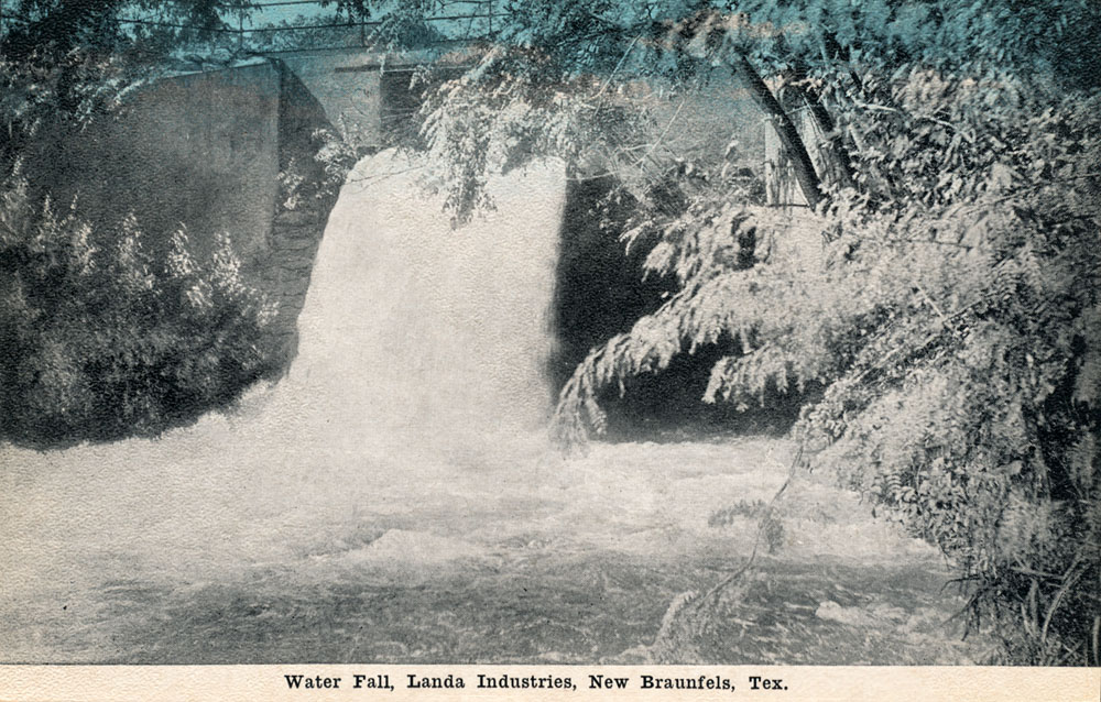
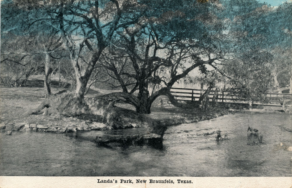
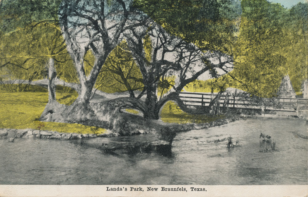
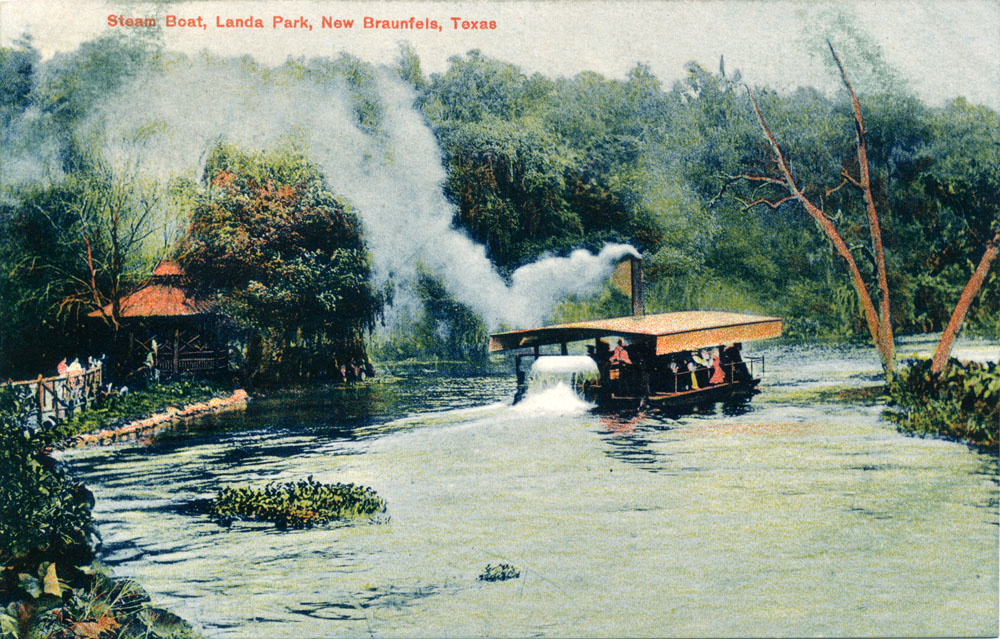
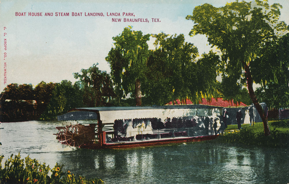
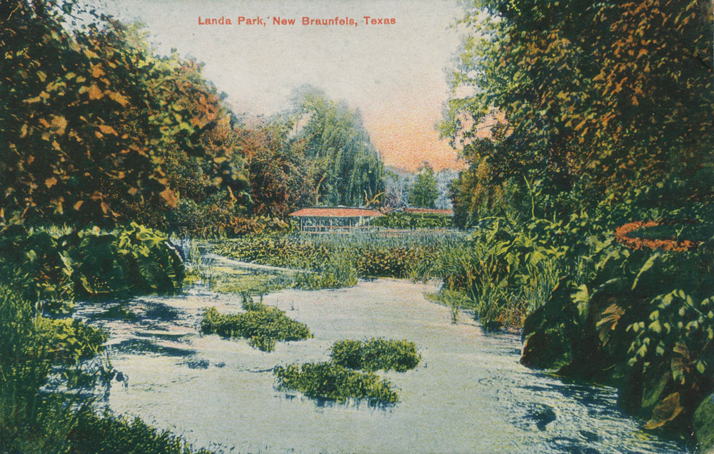
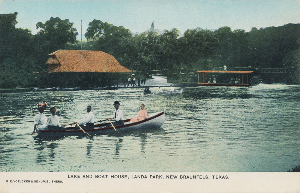
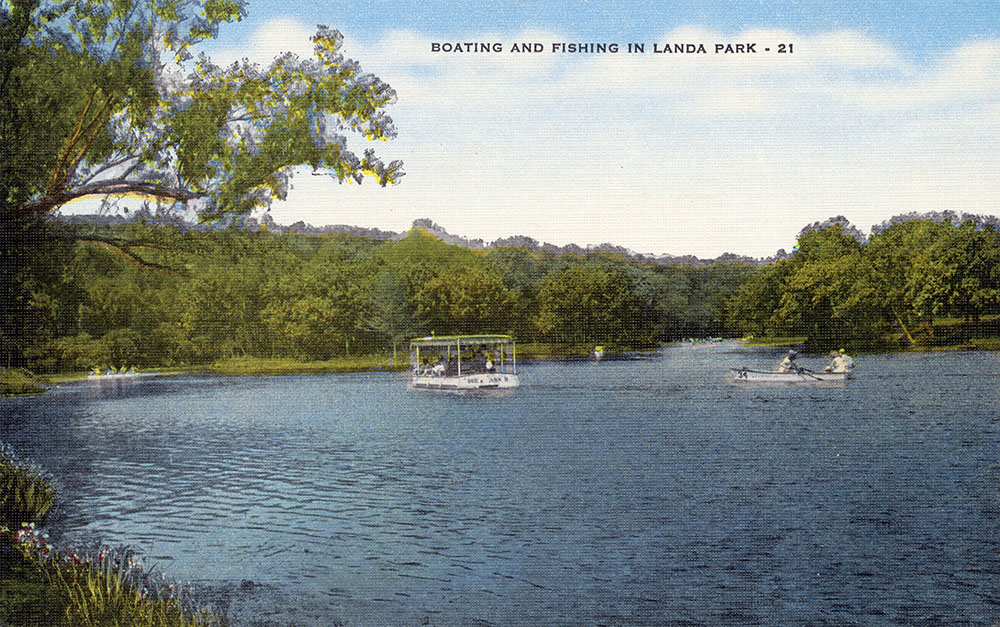
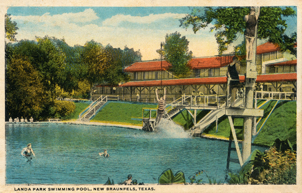
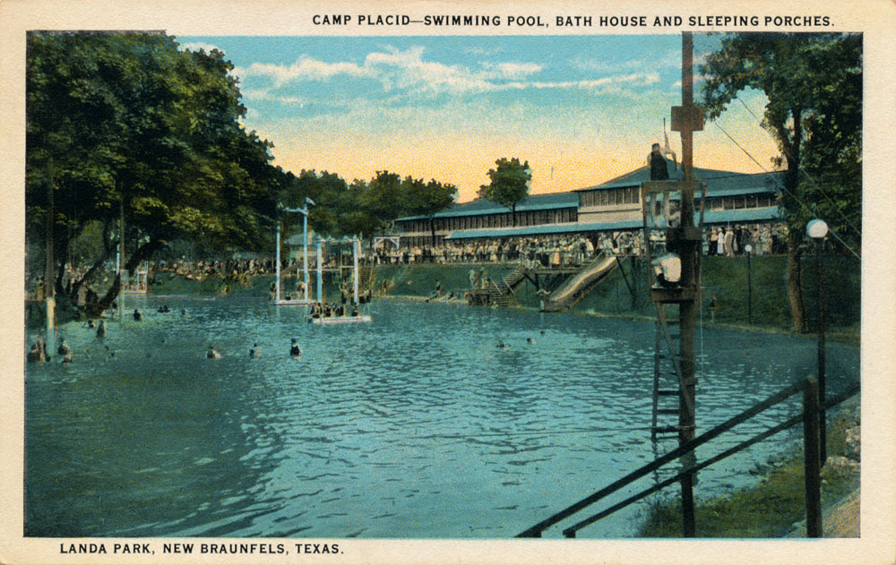
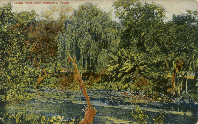
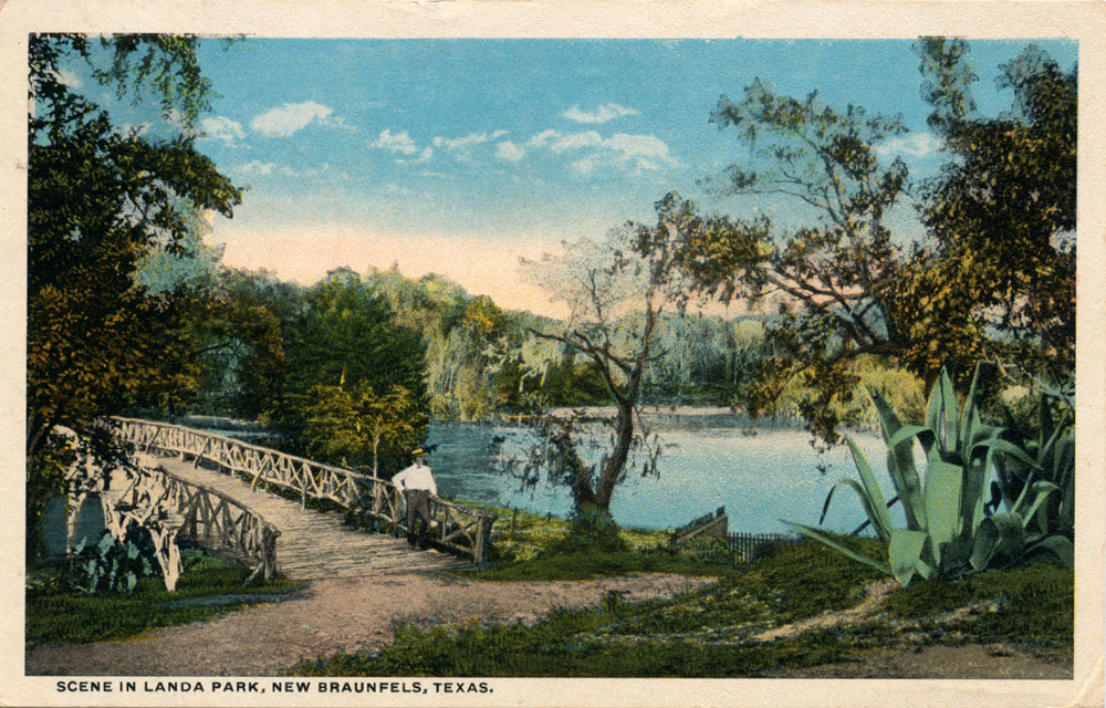
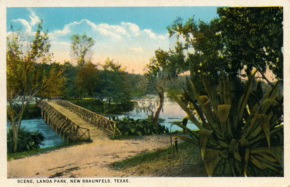
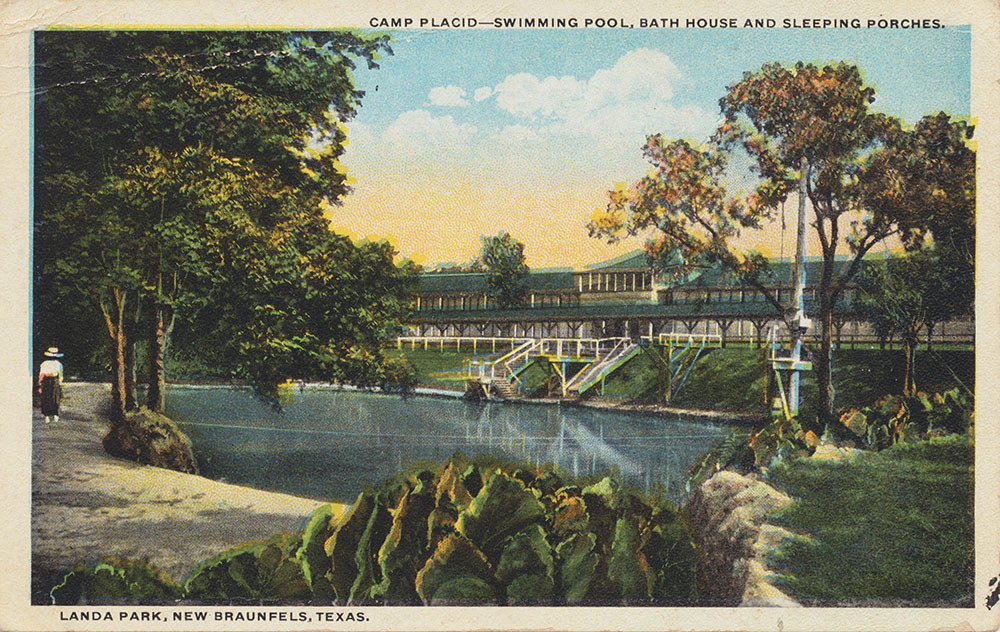
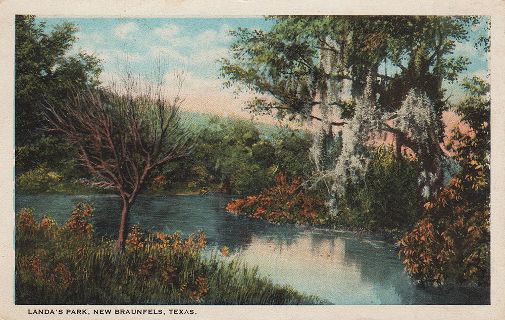
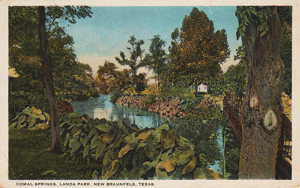
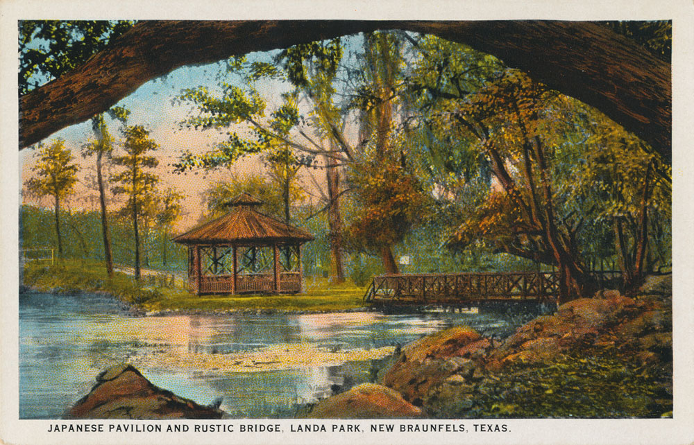
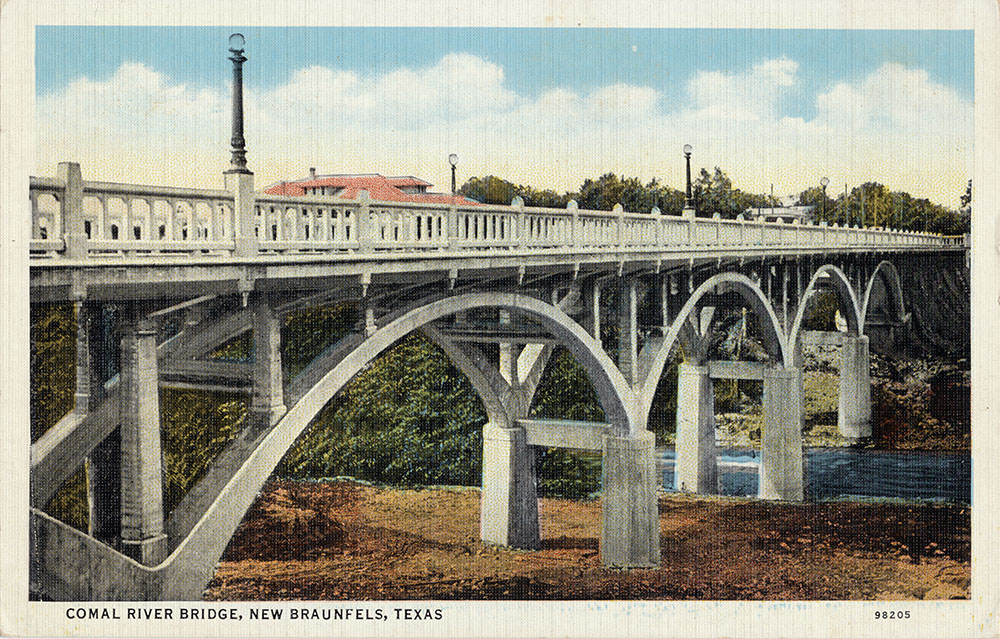
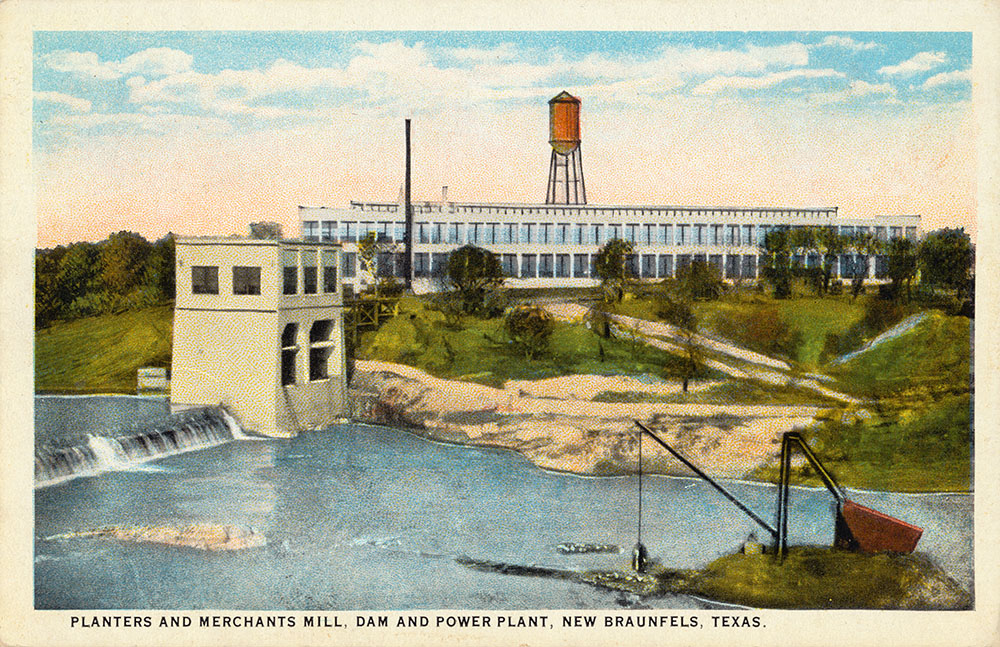
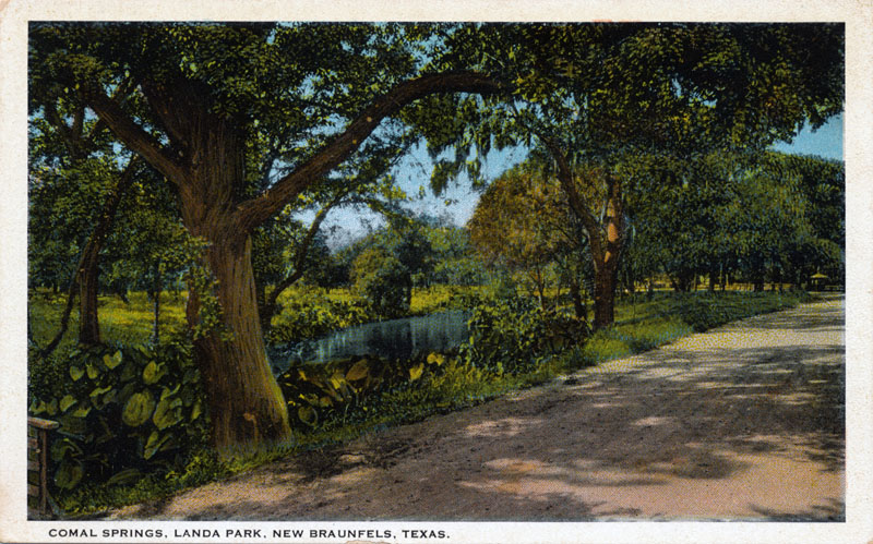
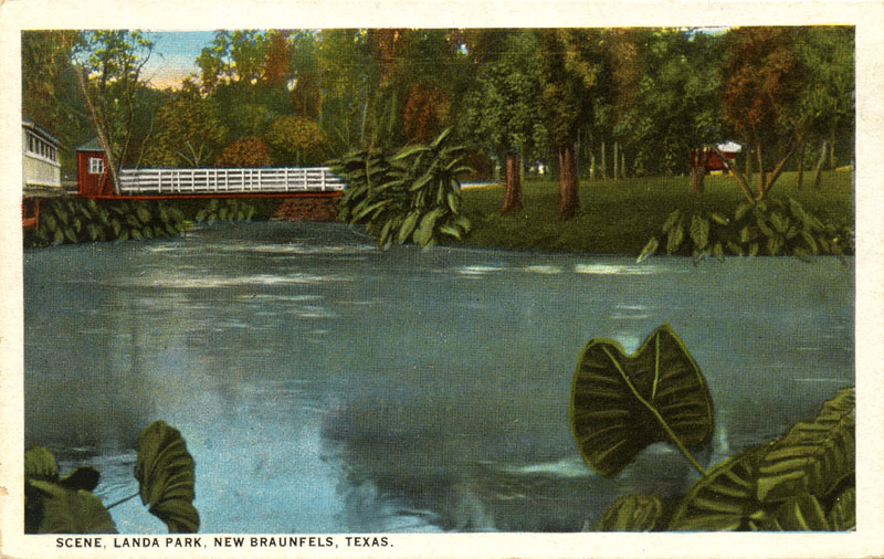
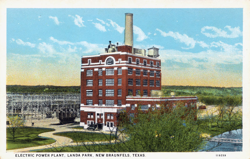
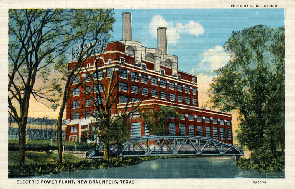
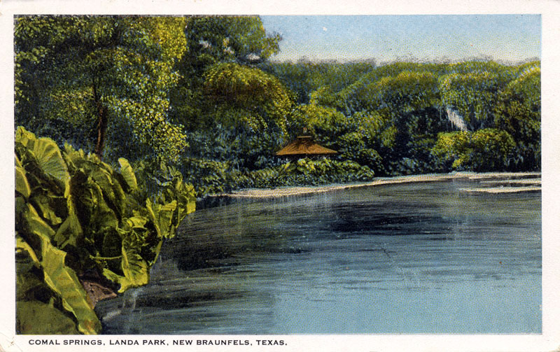
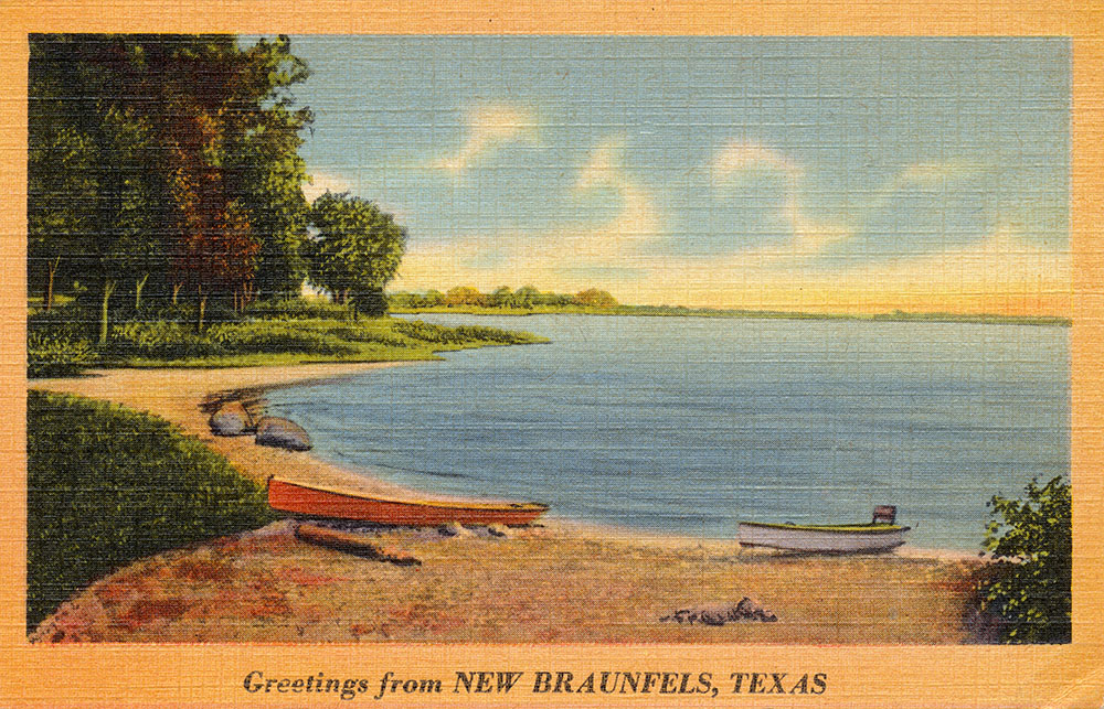
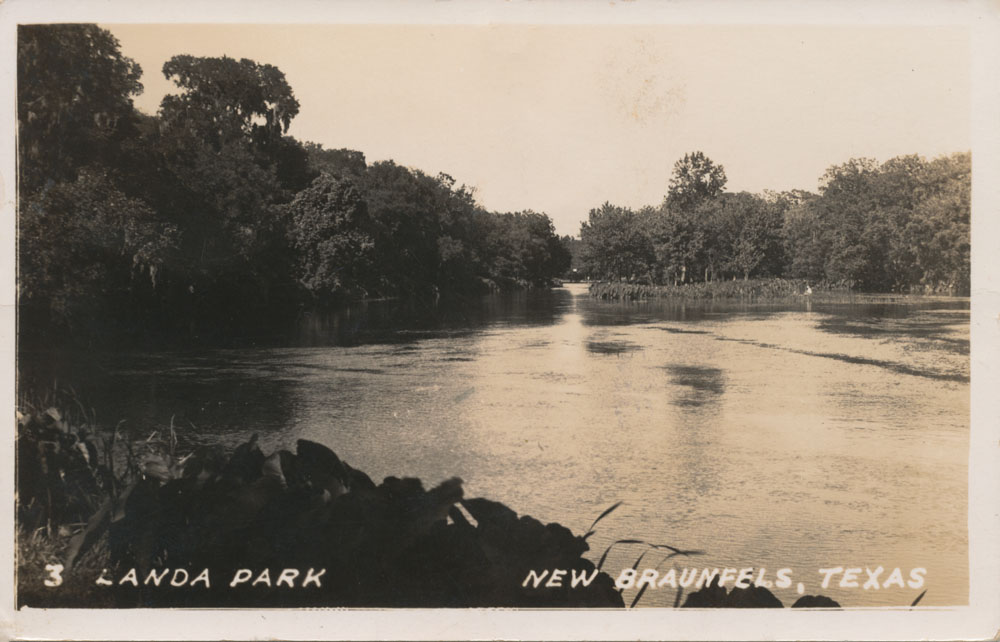
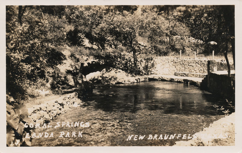
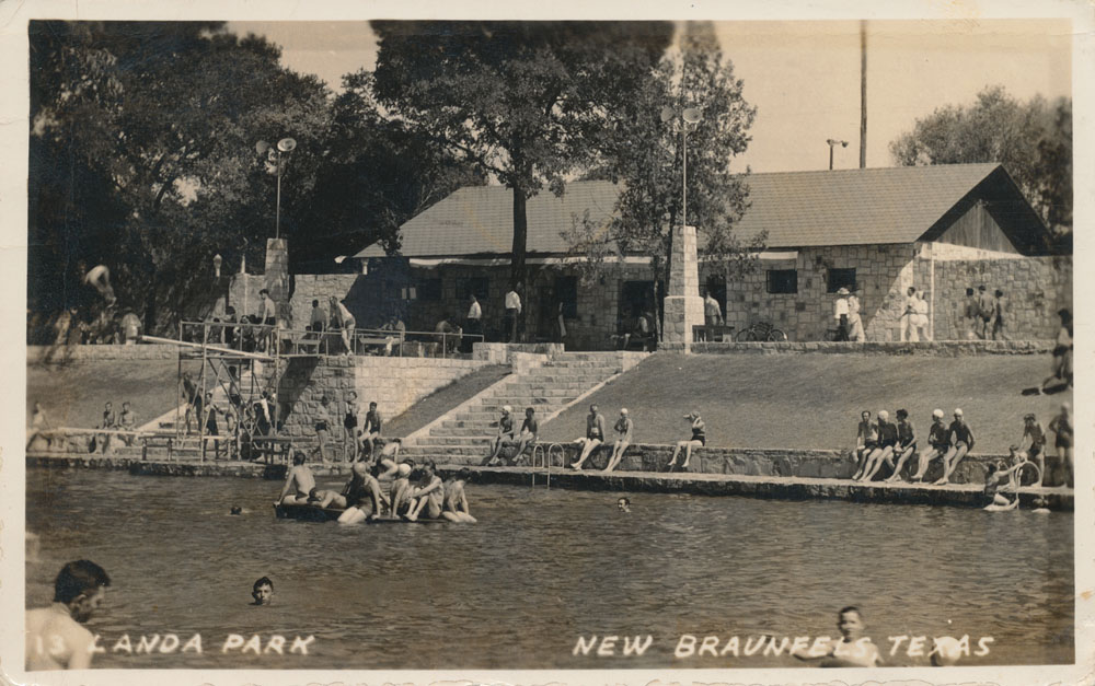
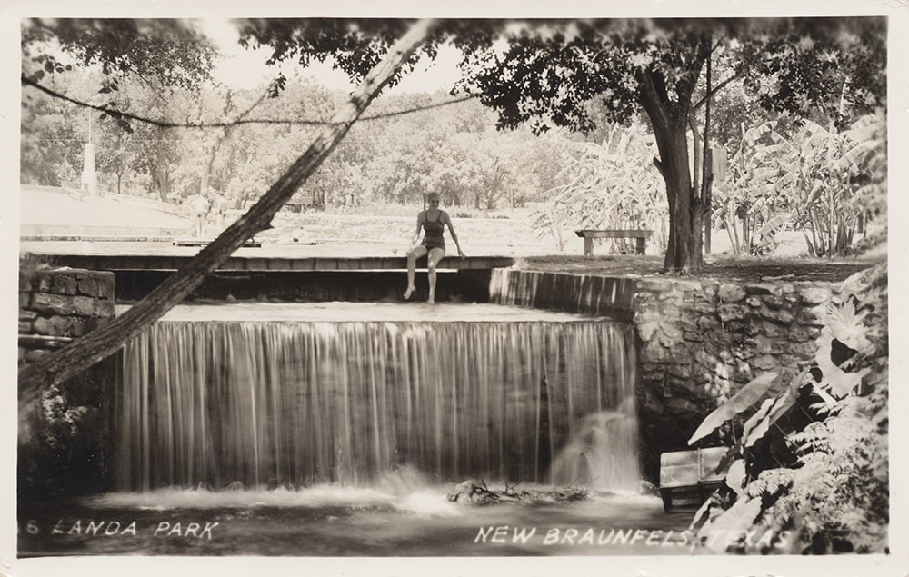
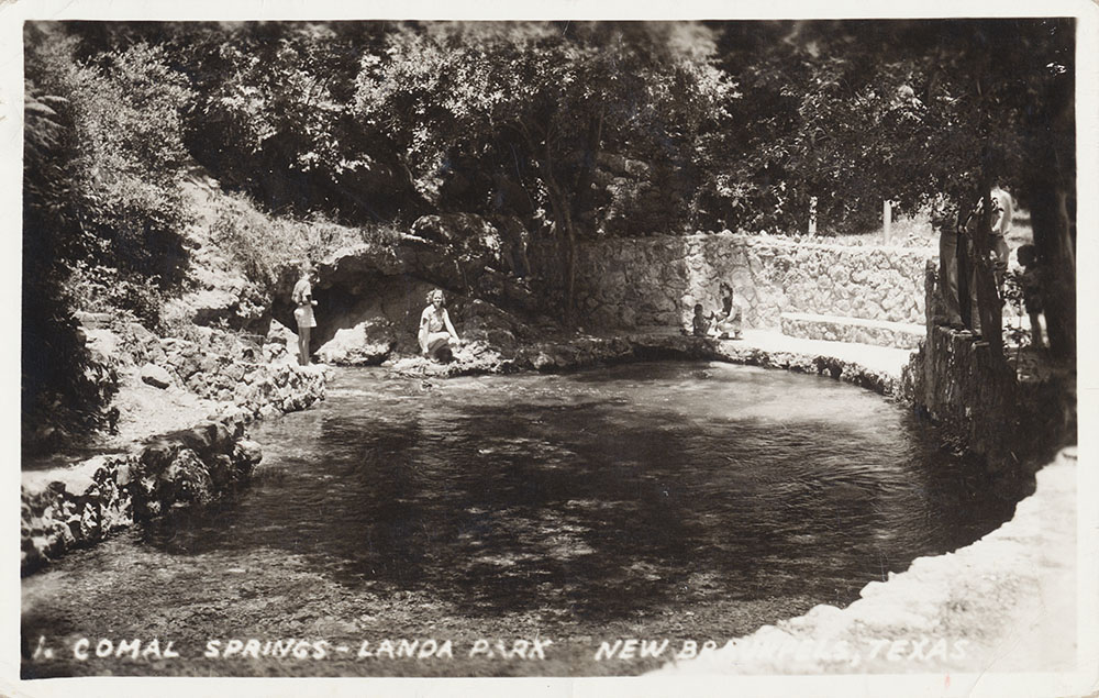
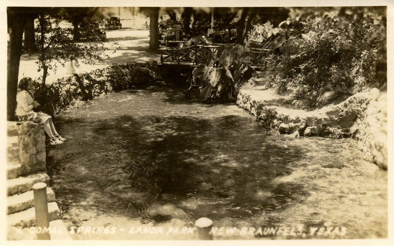
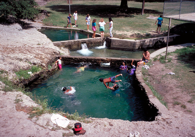
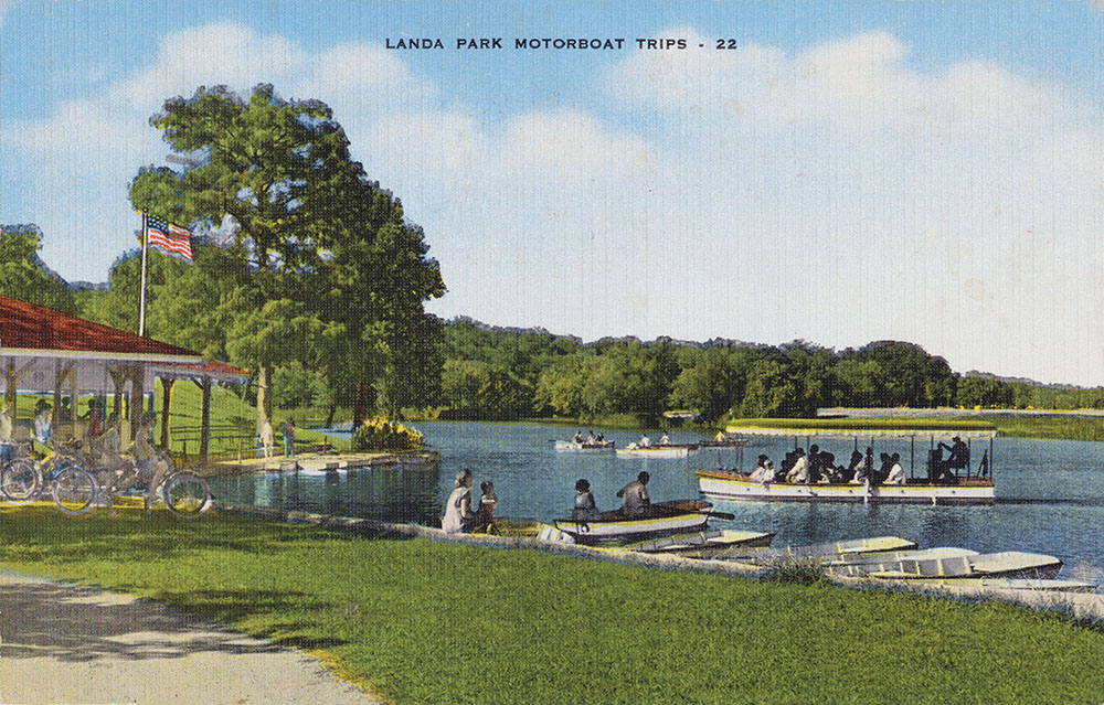
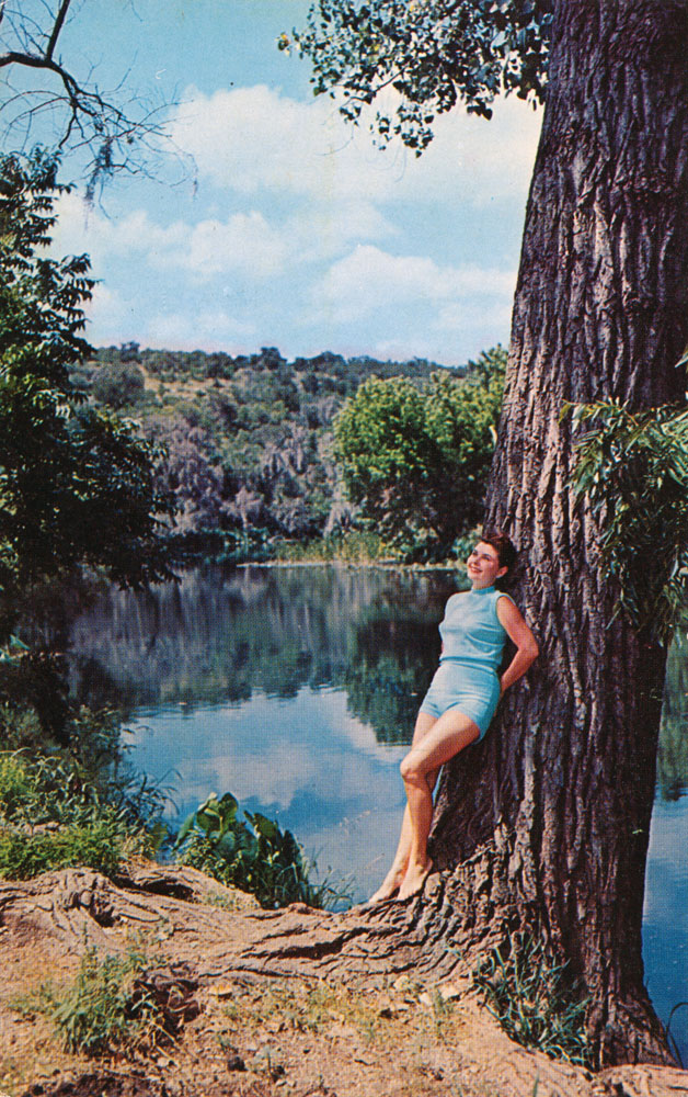
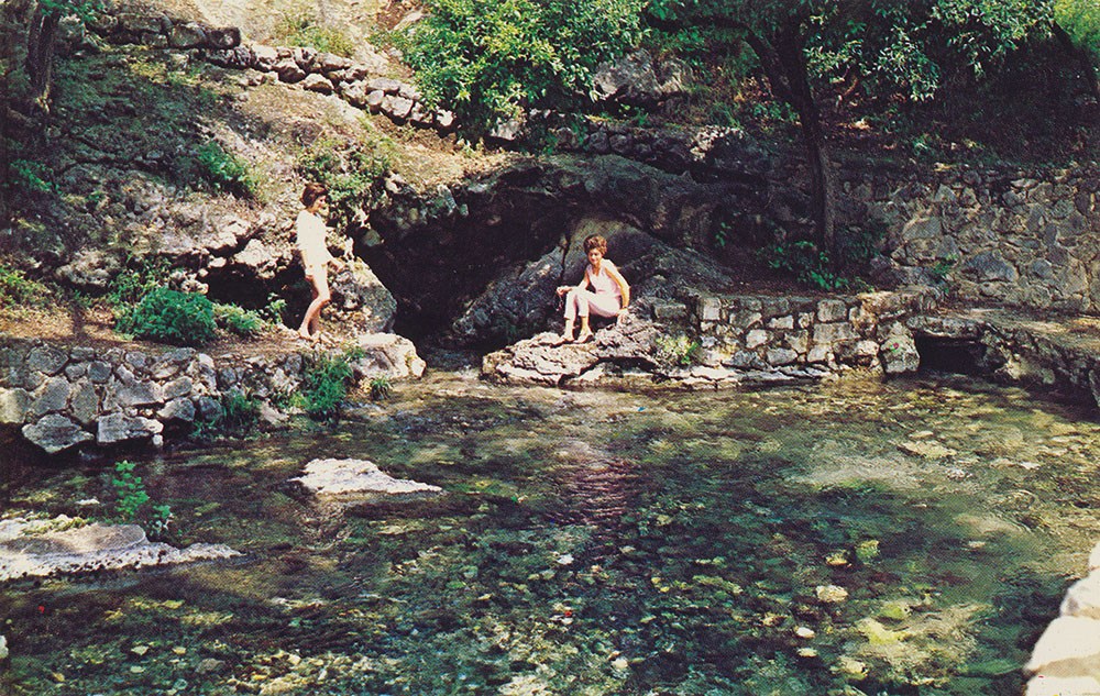
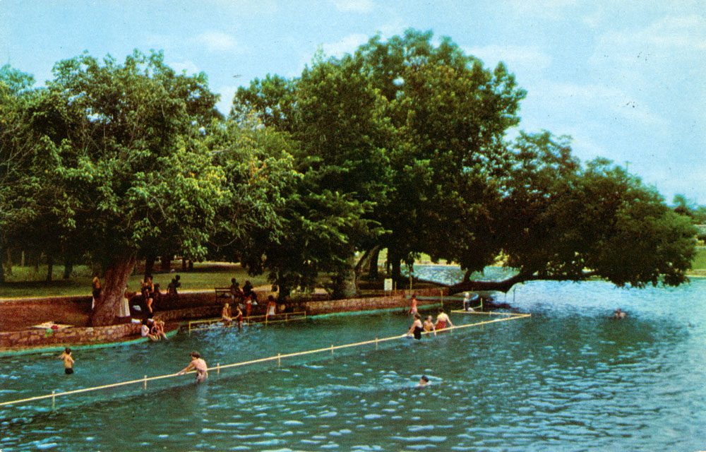
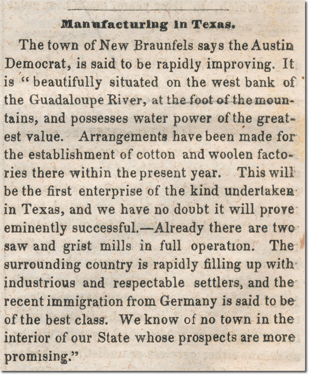
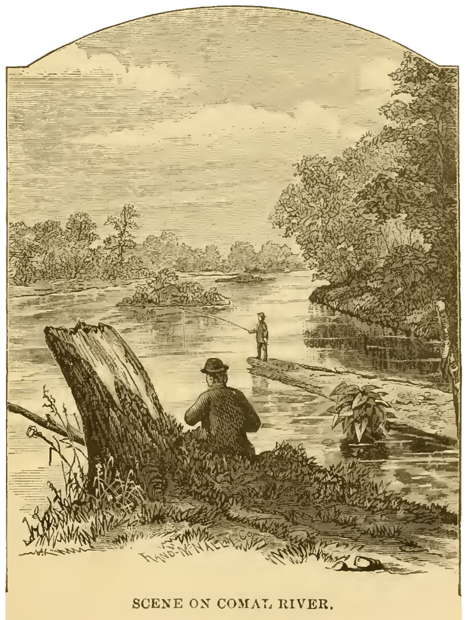
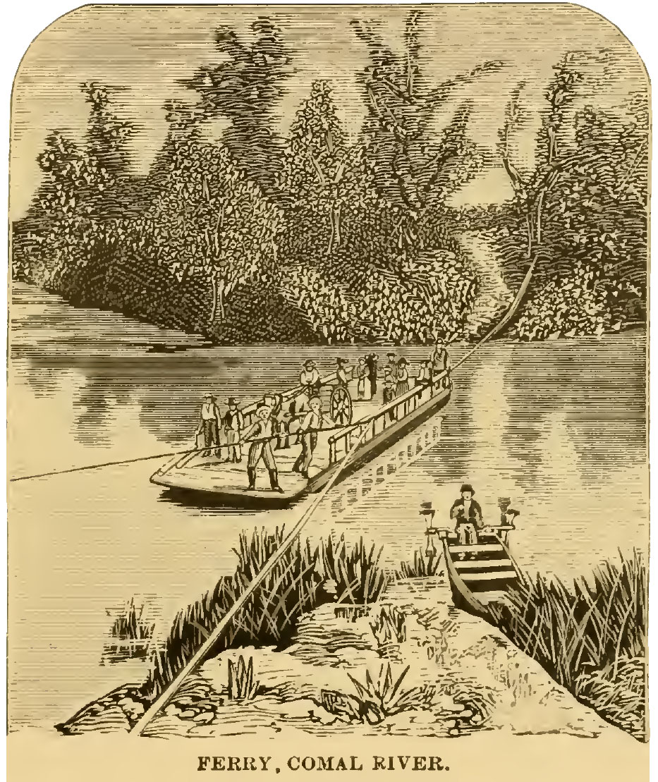
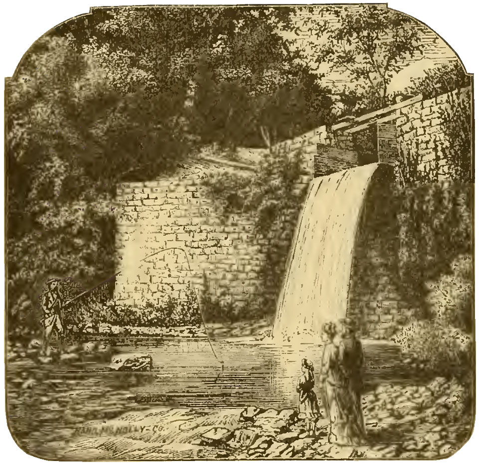
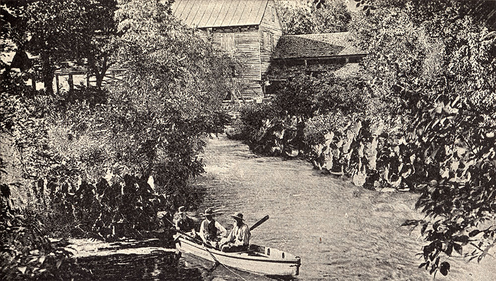
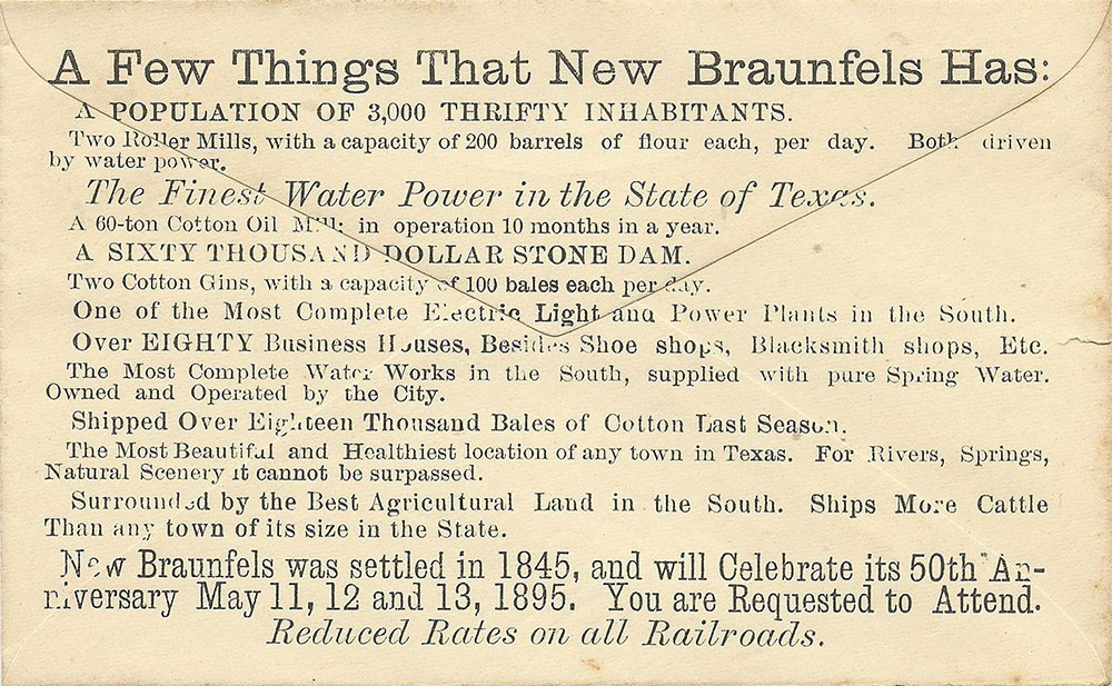
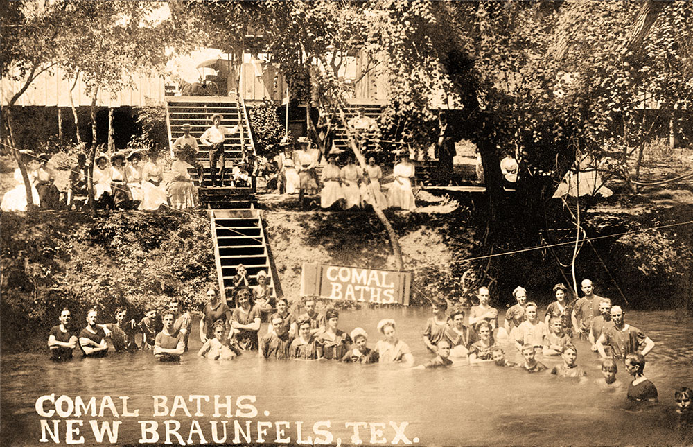
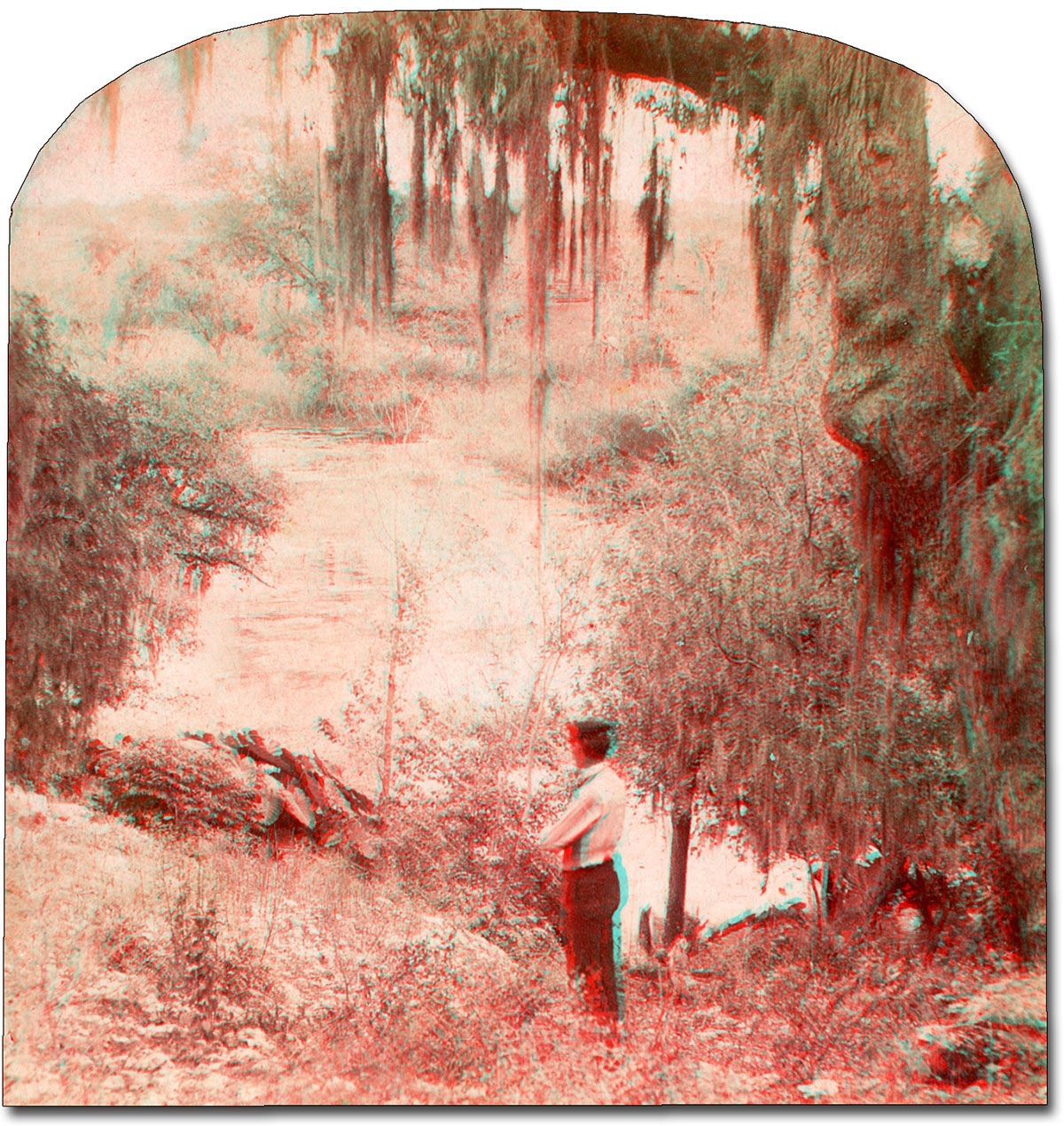
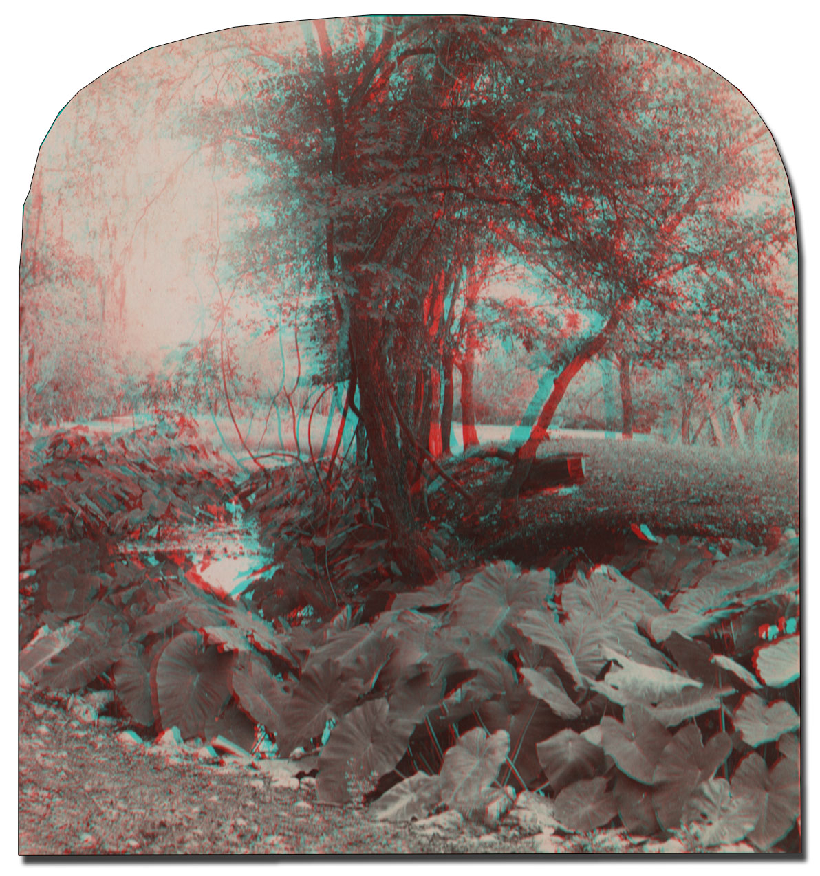
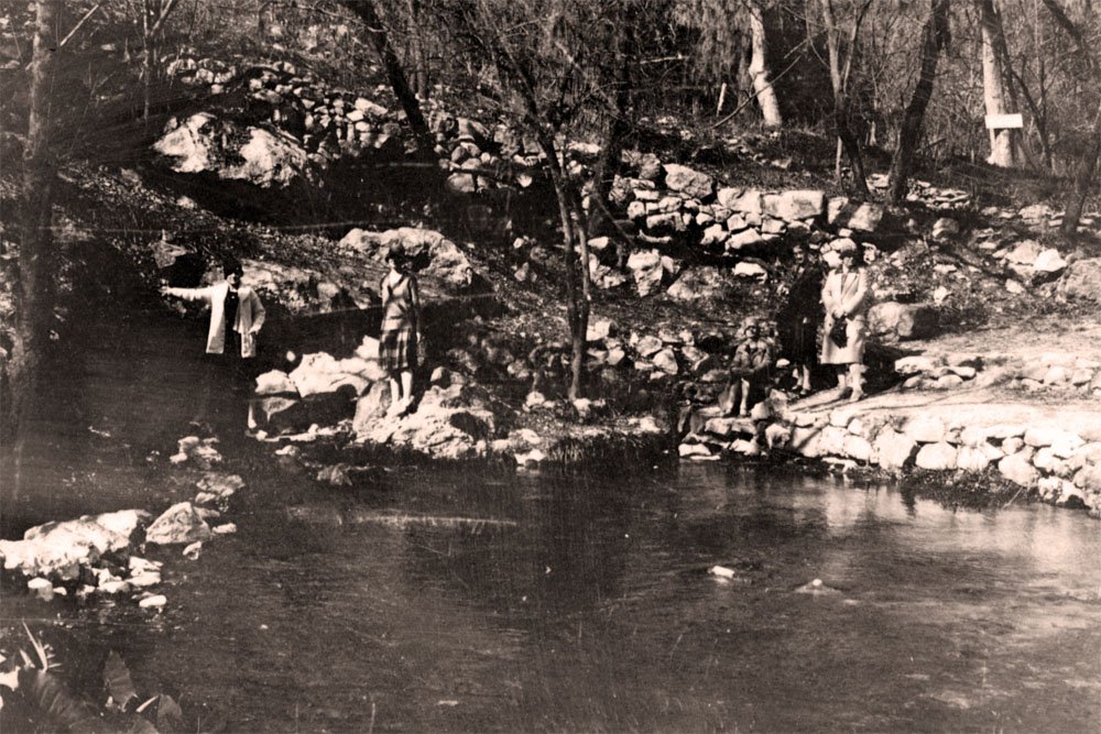
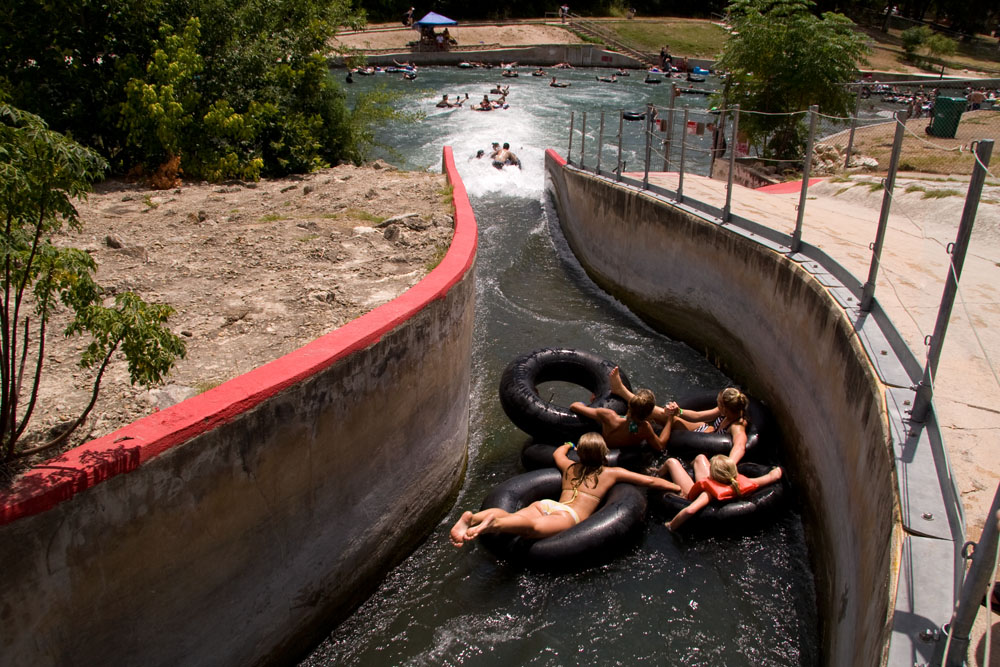
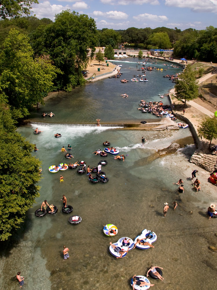
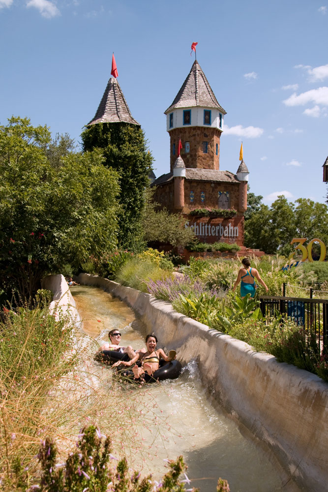
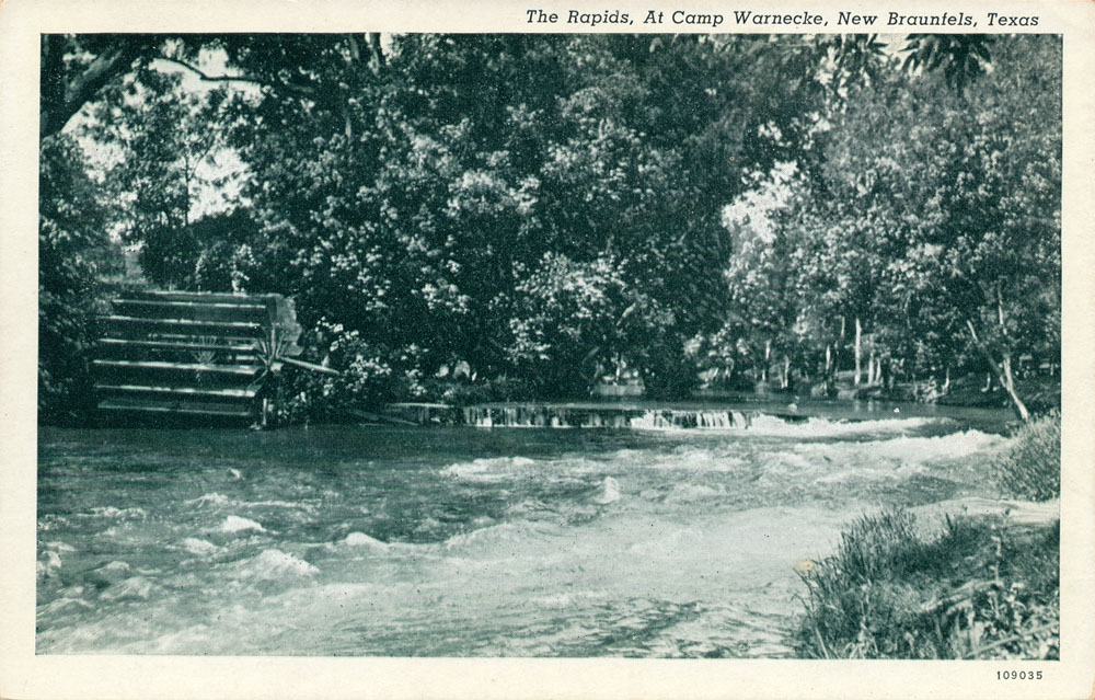
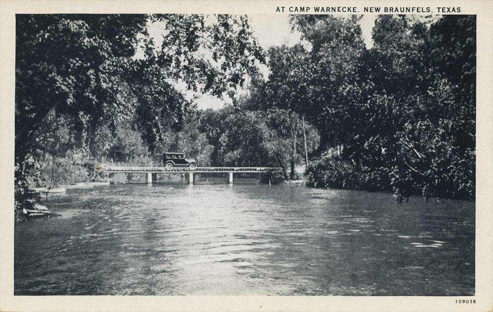
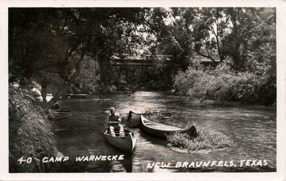
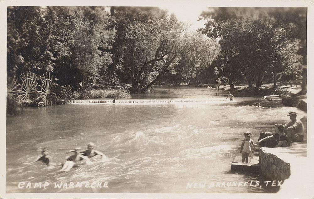
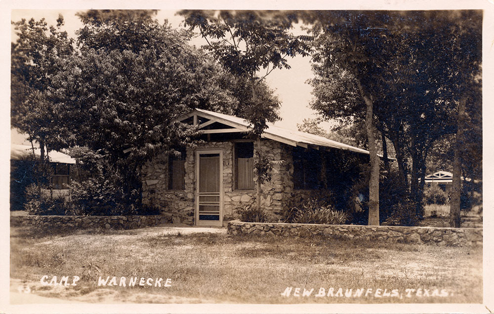
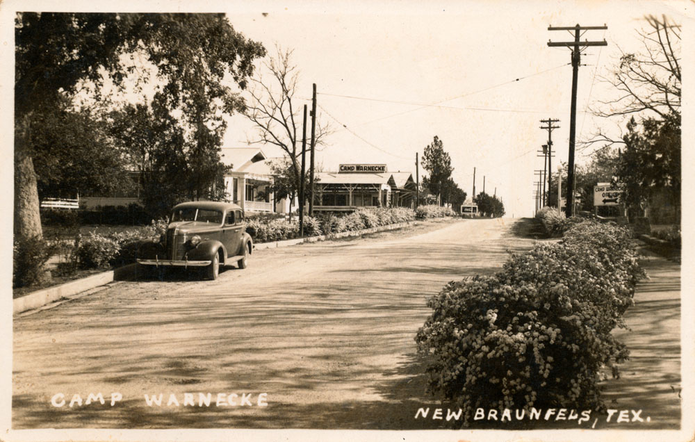
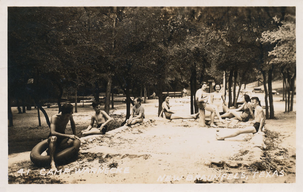
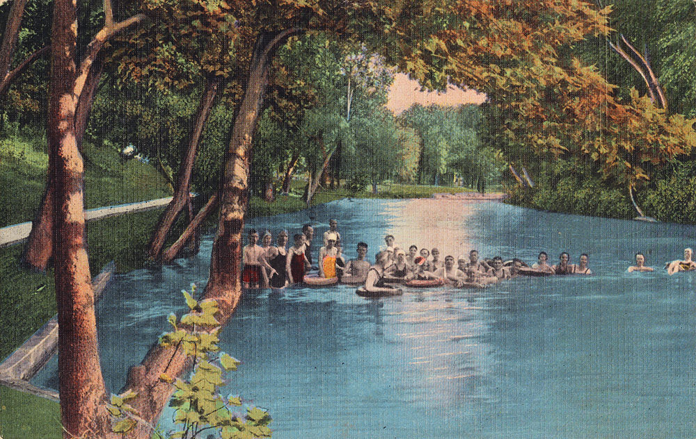
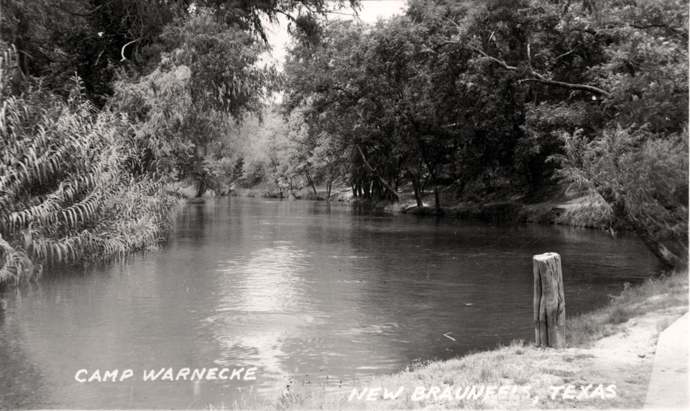
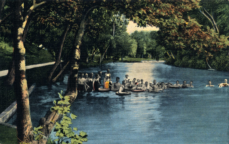
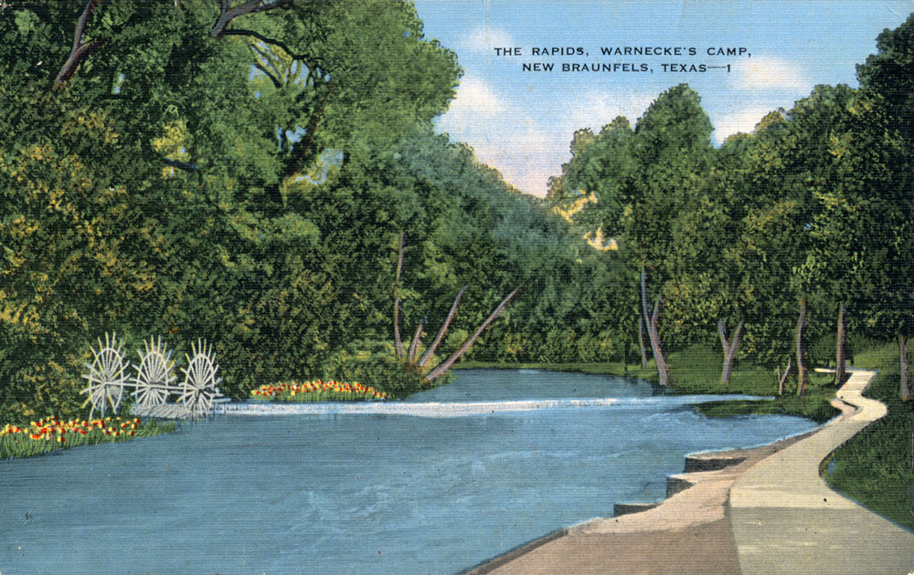
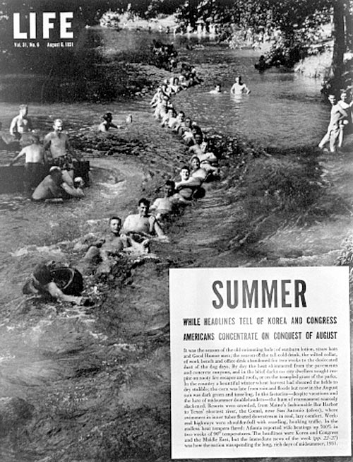
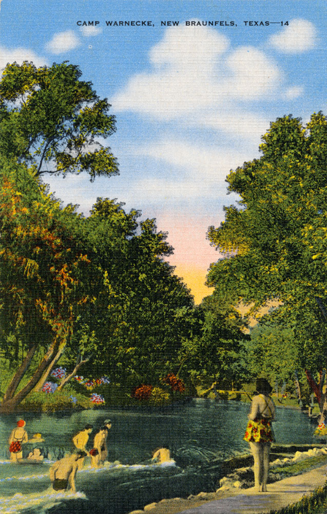
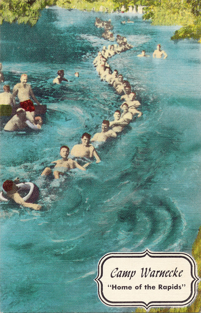
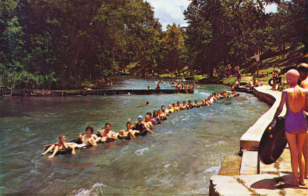
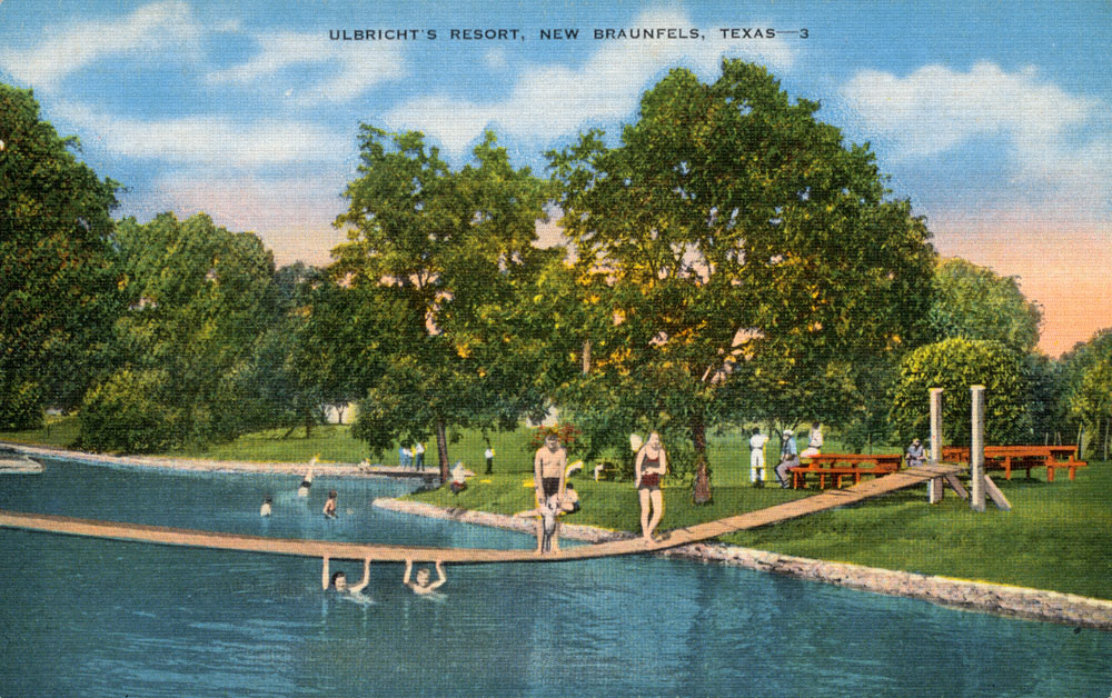
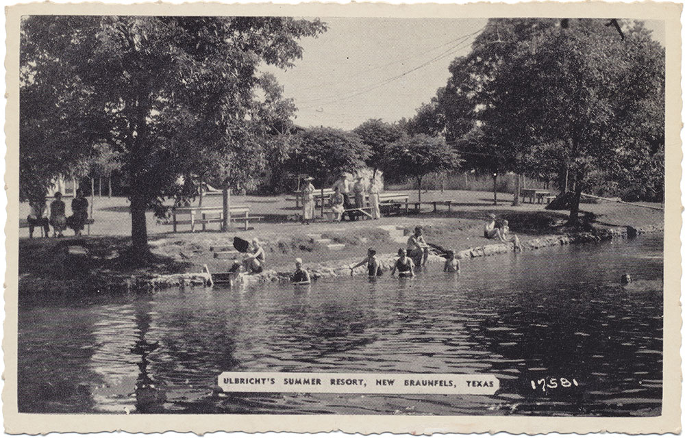
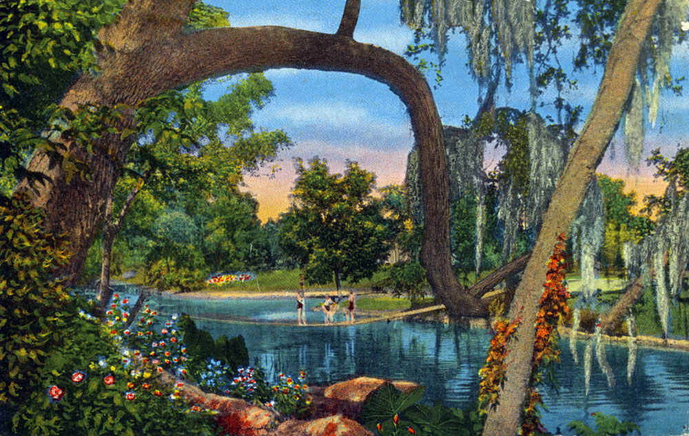
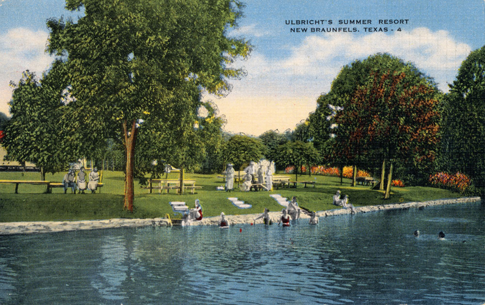
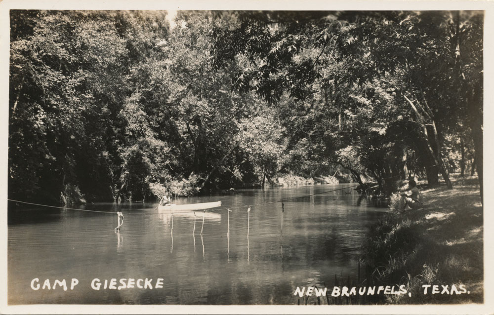
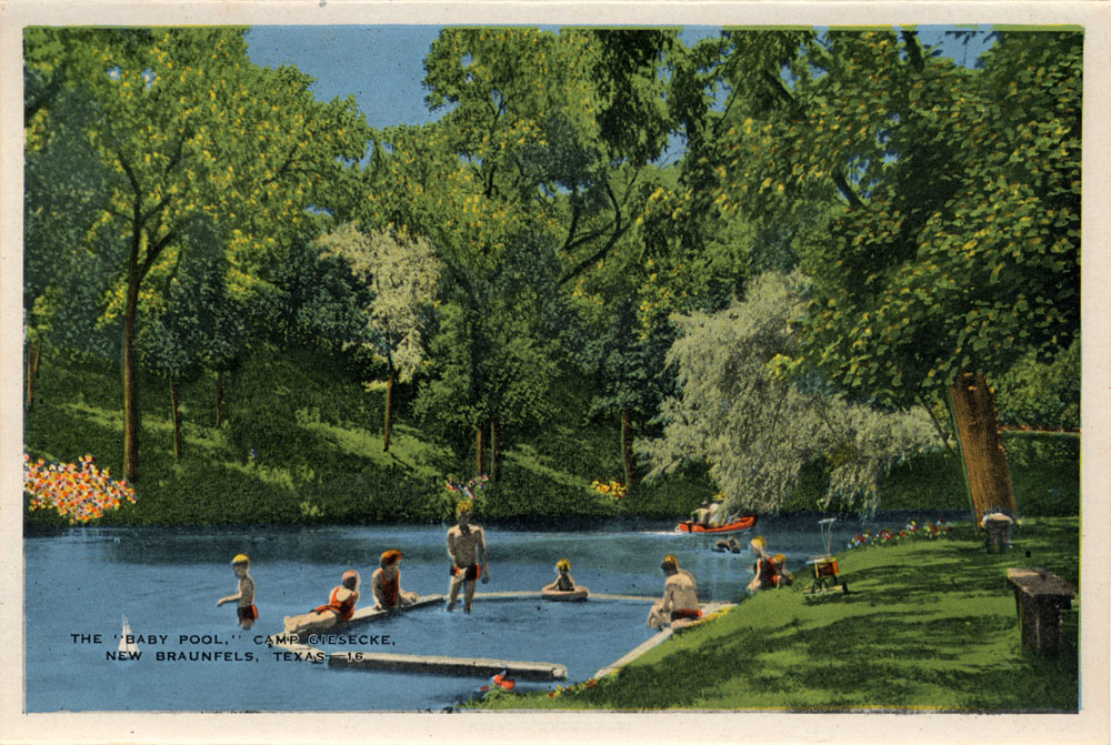
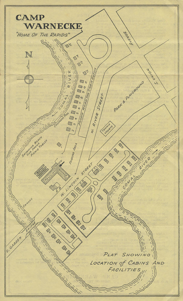
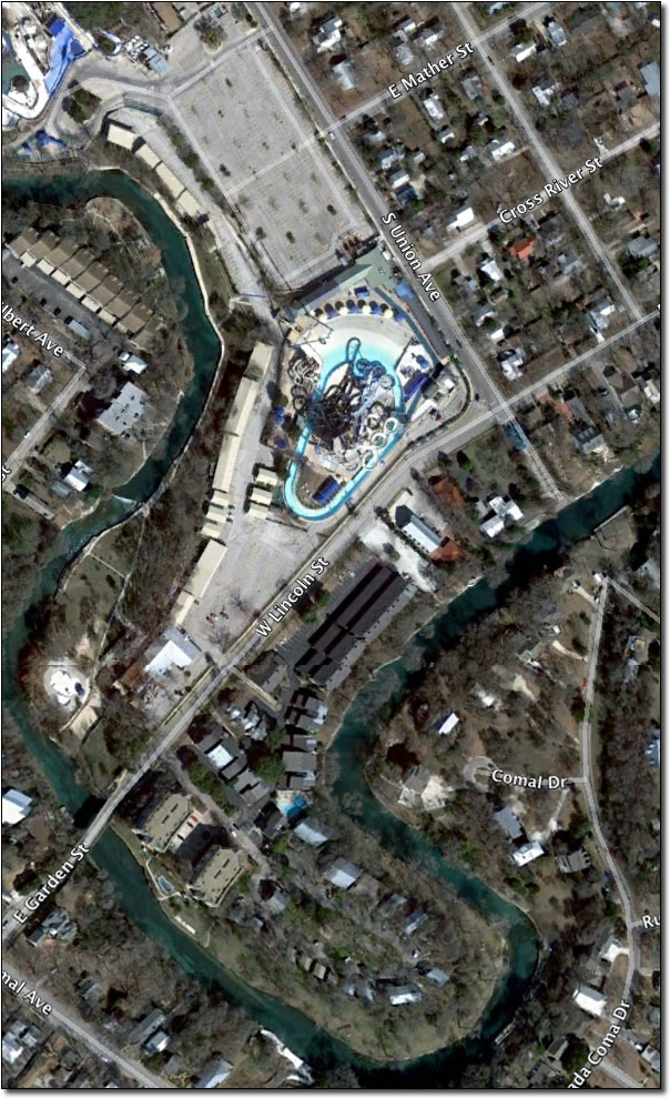